| Prel. Rep. | Date | Time(UTC) | Time(Local) | Lat. | Lon. | Depth | Mag. | Region | Waveform |
|
|
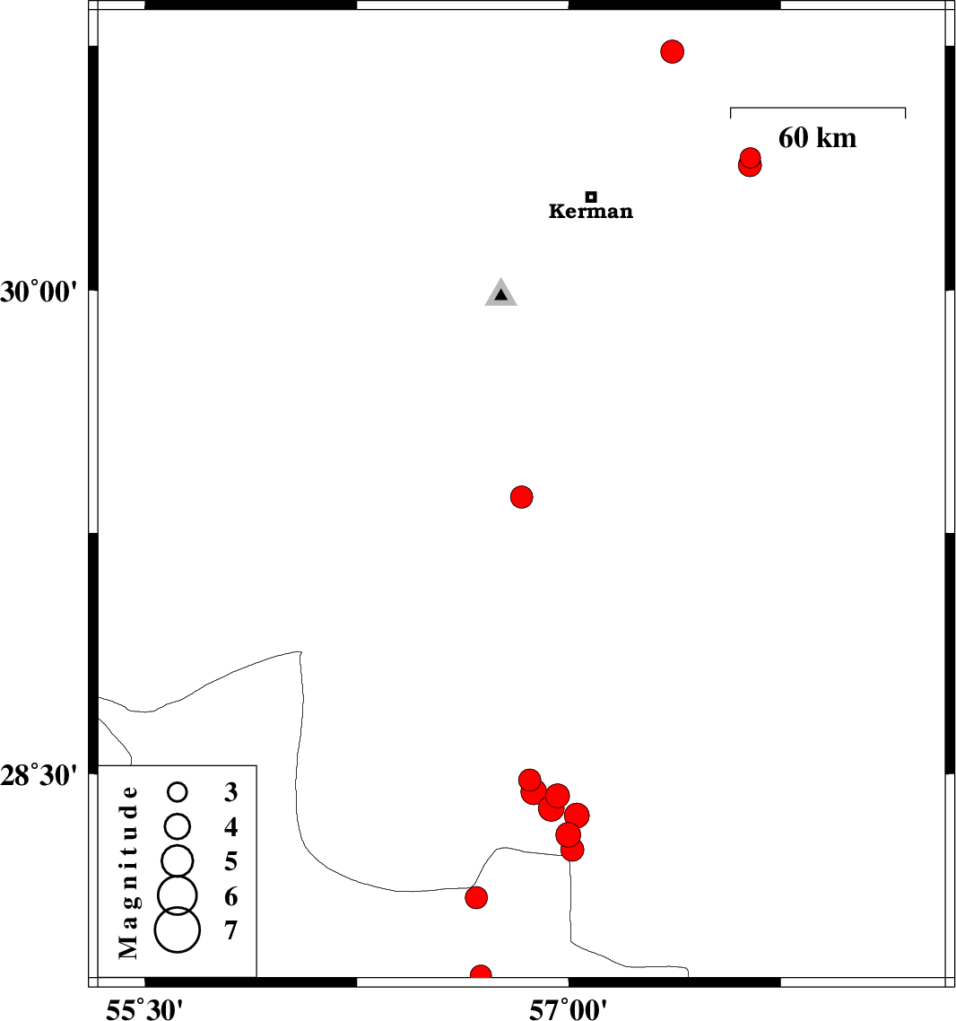
2023/03/02
|
03:06:37.0
|
06:36:37.0
| 29.361 | 56.833 | 31 |
ML:3.5
|
Kerman Province, 26 km North-East of Baft | |
|
|
2023/02/26
|
08:23:32.2
|
11:53:32.2
| 28.112 | 56.673 | 10 |
ML:3.5
|
Hormozgan Province, 79 km South-East of Hajiabad | |
|
|
2023/02/23
|
10:54:02.5
|
14:24:02.5
| 30.407 | 57.643 | 12 |
ML:3.2
|
Kerman Province, 56 km North-East of Kerman | |
|
|
2023/02/21
|
15:33:43.5
|
19:03:43.5
| 27.974 | 55.718 | 16 |
ML:3.4
|
Hormozgan Province, 41 km South-West of Hajiabad | |
|
|
2023/02/16
|
18:44:34.0
|
22:14:34.0
| 30.385 | 57.642 | 12 |
ML:3.6
|
Kerman Province, 55 km -East of Kerman | |
|
|
2023/02/15
|
07:50:50.5
|
11:20:50.5
| 28.431 | 56.96 | 12 |
ML:3.8
|
Kerman Province, 81 km South-West of Jiroft | |
|
|
2023/02/11
|
03:12:45.0
|
06:42:45.0
| 28.391 | 56.938 | 12 |
ML:4.1
|
Kerman Province, 84 km South-West of Jiroft | |
|
|
2023/02/10
|
08:43:26.4
|
12:13:26.4
| 28.309 | 56.998 | 10 |
ML:3.9
|
Kerman Province, 79 km North-West of Kahnuj | |
|
|
2023/02/09
|
13:07:51.5
|
16:37:51.5
| 27.866 | 56.688 | 7 |
ML:3.4
|
Hormozgan Province, 73 km North-West of Dehbarez | |
|
|
2023/02/09
|
12:29:54.8
|
15:59:54.8
| 28.369 | 57.029 | 12 |
ML:3.9
|
Kerman Province, 77 km South-West of Jiroft | |
|
|
2023/02/09
|
12:09:52.1
|
15:39:52.1
| 28.48 | 56.861 | 12 |
ML:3.5
|
Kerman Province, 87 km South-East of Baft | |
|
|
2023/02/09
|
09:19:23.9
|
12:49:23.9
| 28.262 | 57.013 | 12 |
ML:3.6
|
Kerman Province, 75 km North-West of Kahnuj | |
|
|
2023/02/09
|
00:52:34.5
|
04:22:34.5
| 30.732 | 57.366 | 12 |
ML:3.6
|
Kerman Province, 57 km North-East of Kerman | |
|
|
2023/02/08
|
23:25:21.9
|
02:55:21.9
| 28.444 | 56.876 | 12 |
ML:4.1
|
Kerman Province, 92 km South-East of Baft | |
