
| Prel. Rep. | Date | Time(UTC) | Time(Local) | Lat. | Lon. | Depth | Mag. | Region | Waveform |
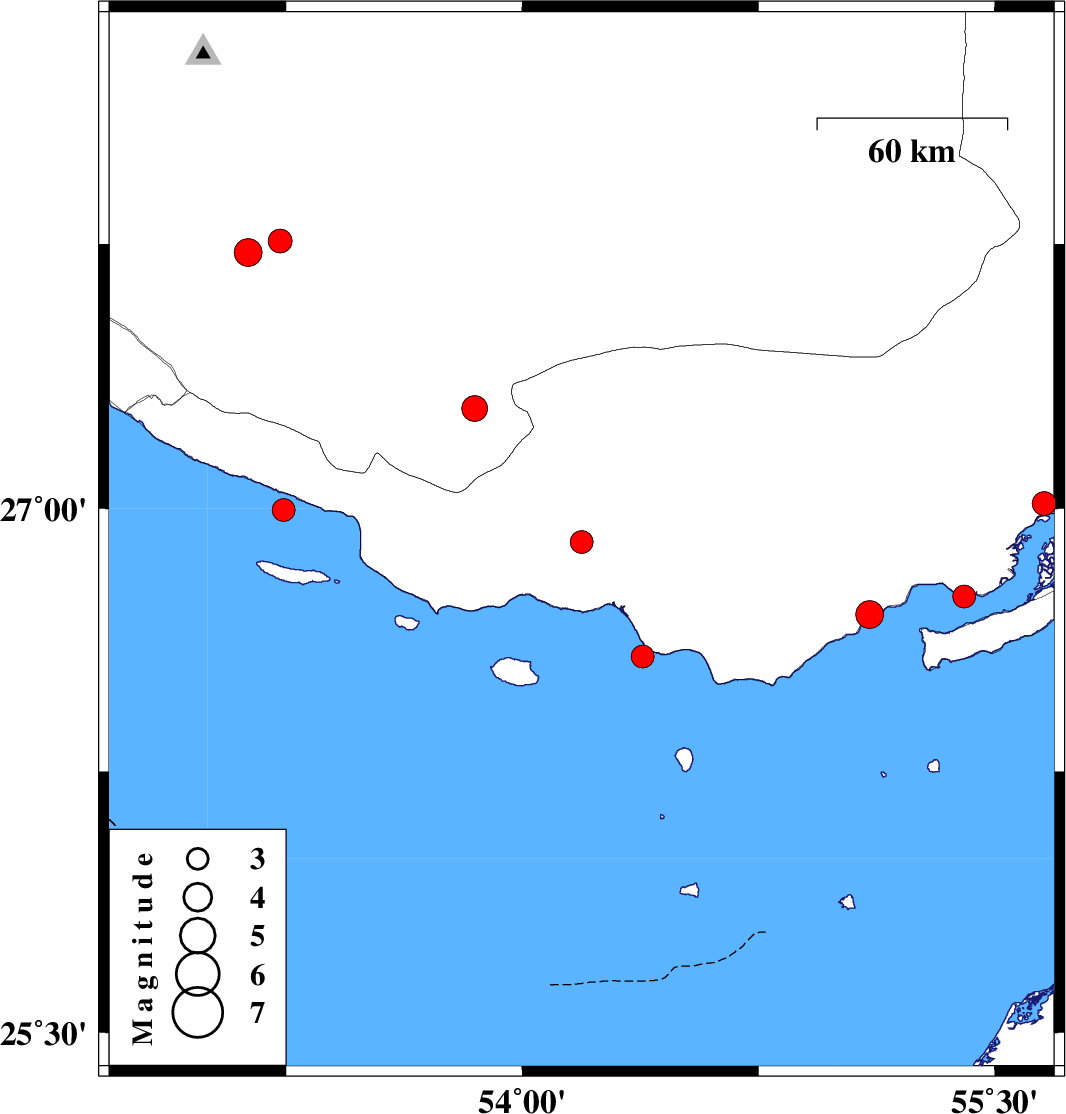
| 2023/01/02 | 19:28:45.3 | 22:58:45.3 | 26.905 | 54.188 | 12 | ML:3.2 | Hormozgan Province, 37 km South-West of Bastak | ||
| 2022/12/26 | 12:41:36.2 | 16:11:36.2 | 27.759 | 53.231 | 12 | ML:3.4 | Fars Province, 48 km North of Lamerd | ||
| 2022/12/22 | 19:42:58.3 | 23:12:58.3 | 27.015 | 55.657 | 12 | ML:3.4 | Hormozgan Province, 61 km -West of Qeshm | ||
| 2022/12/16 | 23:06:23.8 | 02:36:23.8 | 26.578 | 54.382 | 12 | ML:3.3 | Persian Gulf, 47 km -West of Bandar-e lengeh | ||
| 2022/12/15 | 00:43:12.0 | 04:13:12.0 | 26.996 | 53.242 | 7 | ML:3.3 | Persian Gulf, 38 km South of Lamerd | ||
| 2022/12/12 | 03:57:59.5 | 07:27:59.5 | 26.698 | 55.102 | 16 | ML:3.9 | , 32 km North-East of Bandar-e lengeh | ||
| 2022/12/09 | 19:18:37.0 | 22:48:37.0 | 26.75 | 55.403 | 12 | ML:3.2 | Persian Gulf, 60 km North-East of Bandar-e lengeh | ||
| 2022/12/08 | 05:13:07.5 | 08:43:07.5 | 27.726 | 53.129 | 10 | ML:4 | Fars Province, 31 km North-East of Mehr | ||
| 2022/12/03 | 10:17:36.7 | 13:47:36.7 | 27.285 | 53.848 | 16 | ML:3.6 | Fars Province, 52 km -West of Bastak |