
| Prel. Rep. | Date | Time(UTC) | Time(Local) | Lat. | Lon. | Depth | Mag. | Region | Waveform |
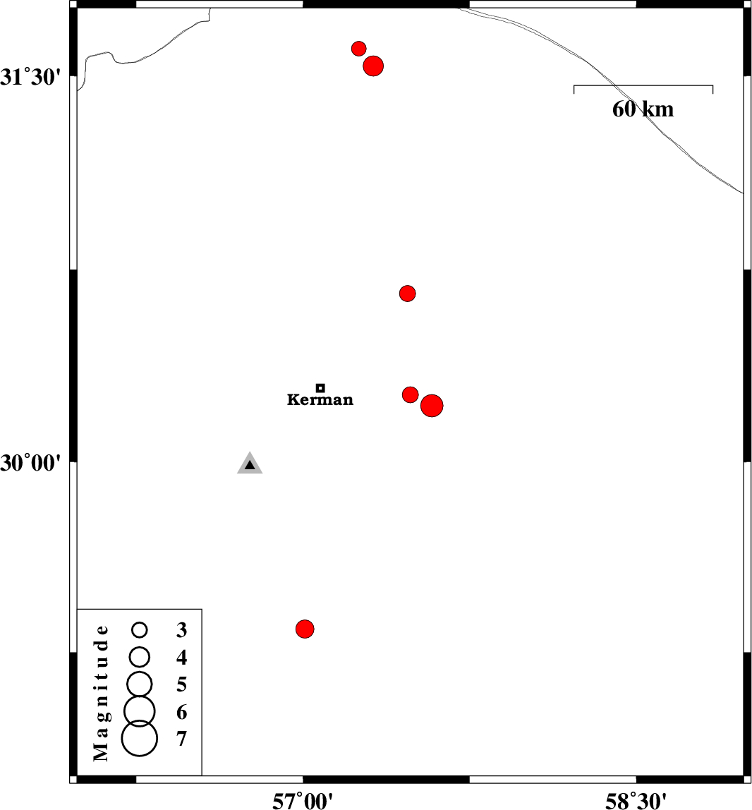
| 2022/12/11 | 00:54:16.6 | 04:24:16.6 | 30.262 | 57.483 | 12 | ML:3.2 | Kerman Province, 39 km -East of Kerman | ||
| 2022/12/09 | 12:55:50.4 | 16:25:50.4 | 29.342 | 57.008 | 12 | ML:3.6 | Kerman Province, 41 km North-East of Baft | ||
| 2022/11/25 | 09:39:22.1 | 13:09:22.1 | 31.604 | 57.252 | 12 | ML:3 | Kerman Province, 56 km North-East of Ravar | ||
| 2022/11/25 | 09:29:26.0 | 12:59:26.0 | 31.538 | 57.316 | 12 | ML:4.1 | Kerman Province, 57 km North-East of Ravar | ||
| 2022/11/13 | 20:57:11.4 | 00:27:11.4 | 30.656 | 57.471 | 12 | ML:3.3 | Kerman Province, 56 km North-East of Kerman | ||
| 2022/11/12 | 22:48:02.7 | 02:18:02.7 | 30.219 | 57.58 | 12 | ML:4.5 | Kerman Province, 49 km -East of Kerman |