| Prel. Rep. | Date | Time(UTC) | Time(Local) | Lat. | Lon. | Depth | Mag. | Region | Waveform |
|
|
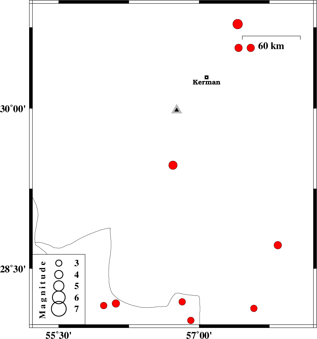
2020/08/01
|
16:07:08.9
|
20:37:08.9
| 29.47 | 56.72 | 10 |
ML:4.1
|
Kerman Province, 28 km North-East of Baft | |
|
|
2020/07/31
|
09:55:42.9
|
14:25:42.9
| 28.15 | 55.98 | 10 |
ML:3.2
|
Hormozgan Province, 19 km South of Hajiabad | |
|
|
2020/07/28
|
06:06:39.9
|
10:36:39.9
| 30.78 | 57.41 | 10 |
ML:4.6
|
Kerman Province, 63 km North-East of Kerman | |
|
|
2020/07/26
|
06:06:32.7
|
10:36:32.7
| 28.17 | 56.11 | 10 |
ML:3.6
|
Hormozgan Province, 26 km South-East of Hajiabad | |
|
|
2020/07/19
|
17:40:35.9
|
22:10:35.9
| 28.01 | 56.91 | 10 |
ML:3.2
|
Hormozgan Province, 77 km -West of Kahnuj | |
|
|
2020/07/17
|
10:57:33.9
|
15:27:33.9
| 30.56 | 57.42 | 10 |
ML:3.6
|
Kerman Province, 45 km North-East of Kerman | |
|
|
2020/07/13
|
01:20:36.6
|
05:50:36.6
| 28.124 | 57.584 | 12 |
ML:3.3
|
Kerman Province, 22 km North-West of Kahnuj | |
|
|
2020/07/11
|
18:53:35.4
|
23:23:35.4
| 28.186 | 56.818 | 12 |
ML:3.3
|
Hormozgan Province, 91 km South-East of Hajiabad | |
|
|
2020/07/08
|
06:33:06.2
|
11:03:06.2
| 28.72 | 57.84 | 10 |
ML:3.7
|
Kerman Province, 11 km -East of Jiroft | |
|
|
2020/07/06
|
22:17:50.1
|
02:47:50.1
| 30.56 | 57.55 | 15 |
ML:3.6
|
Kerman Province, 54 km North-East of Kerman | |
