
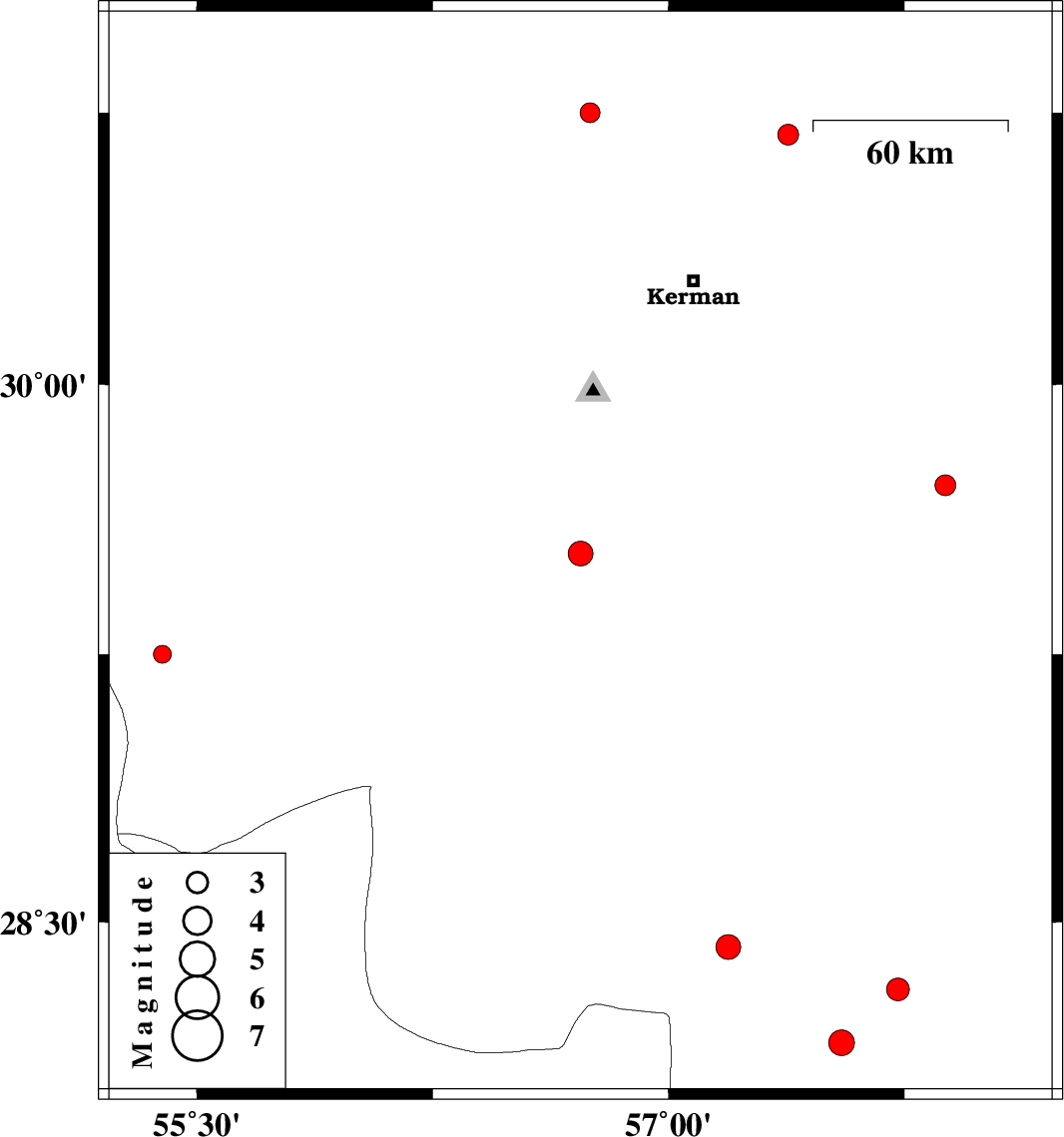
| Prel. Rep. | Date | Time(UTC) | Time(Local) | Lat. | Lon. | Depth | Mag. | Region | Waveform |
| 2019/11/30 | 03:47:29.3 | 07:17:29.3 | 29.53 | 56.72 | 14 | ML:3.5 | Kerman Province, 35 km North-East of Baft | ||
| 2019/11/29 | 22:50:27.6 | 02:20:27.6 | 28.31 | 57.73 | 46 | ML:3.2 | Kerman Province, 40 km South of Jiroft | ||
| 2019/11/24 | 02:11:50.0 | 05:41:50.0 | 29.72 | 57.88 | 14 | ML:2.9 | Kerman Province, 82 km North-West of Bam | ||
| 2019/11/22 | 11:25:10.9 | 14:55:10.9 | 29.25 | 55.39 | 10 | ML:2.5 | Kerman Province, 35 km South-West of Sirjan | ||
| 2019/11/18 | 08:08:59.6 | 11:38:59.6 | 28.16 | 57.55 | 14 | ML:3.6 | Kerman Province, 27 km North-West of Kahnuj | ||
| 2019/11/16 | 20:05:34.1 | 23:35:34.1 | 30.69 | 57.38 | 10 | ML:2.9 | Kerman Province, 53 km North-East of Kerman | ||
| 2019/11/15 | 10:47:44.0 | 14:17:44.0 | 30.75 | 56.75 | 14 | ML:2.8 | Kerman Province, 19 km -East of Zarand | ||
| 2019/11/04 | 16:59:23.5 | 20:29:23.5 | 28.43 | 57.19 | 10 | ML:3.5 | Kerman Province, 60 km South-West of Jiroft |