
| Prel. Rep. | Date | Time(UTC) | Time(Local) | Lat. | Lon. | Depth | Mag. | Region | Waveform |
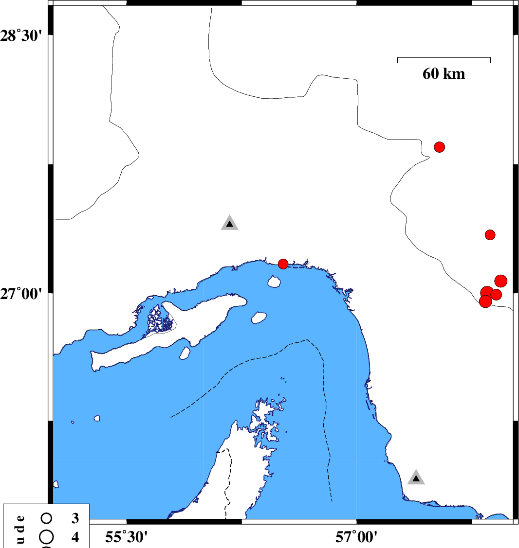
| 2019/11/26 | 19:55:50.0 | 23:25:50.0 | 27.17 | 56.52 | 10 | ML:2.9 | Hormozgan Province, 24 km -East of Bandar-e abbas | ||
| 2019/11/25 | 00:14:55.2 | 03:44:55.2 | 27.34 | 57.87 | 10 | ML:2.9 | Kerman Province, 38 km -East of Manujan | ||
| 2019/11/23 | 20:06:15.9 | 23:36:15.9 | 27.85 | 57.54 | 10 | ML:3.1 | Kerman Province, 19 km South-West of Kahnuj | ||
| 2019/11/19 | 22:36:14.8 | 02:06:14.8 | 26.99 | 57.91 | 14 | ML:3.3 | Kerman Province, 62 km South-East of Manujan | ||
| 2019/11/19 | 19:40:46.7 | 23:10:46.7 | 26.95 | 57.84 | 14 | ML:3.6 | Kerman Province, 61 km South-East of Manujan | ||
| 2019/11/19 | 18:49:49.2 | 22:19:49.2 | 27.07 | 57.94 | 14 | ML:3.7 | Kerman Province, 58 km South-East of Manujan | ||
| 2019/11/19 | 18:23:03.5 | 21:53:03.5 | 27 | 57.85 | 14 | ML:3.9 | Kerman Province, 58 km South-East of Manujan |