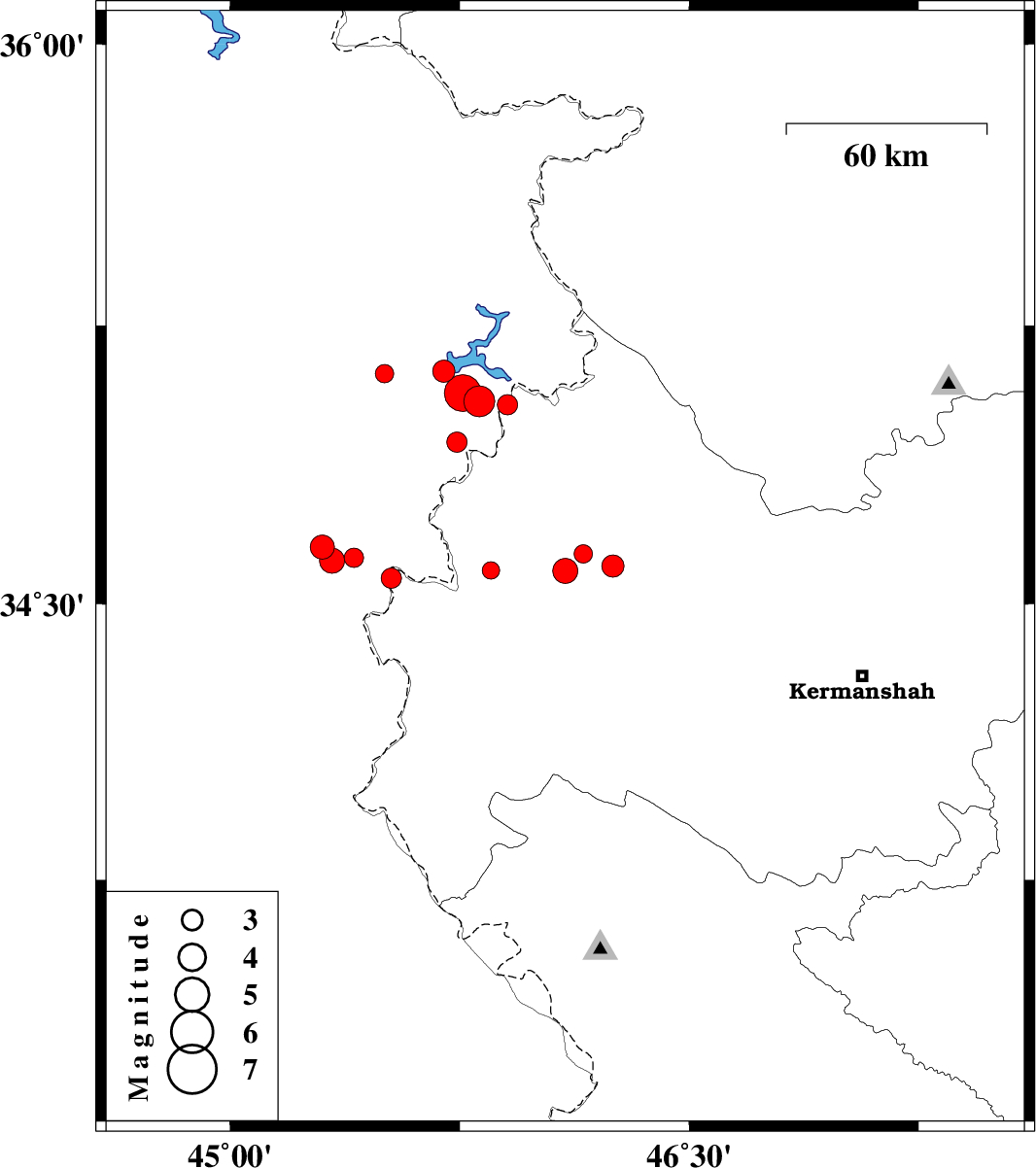
| Prel. Rep. | Date | Time(UTC) | Time(Local) | Lat. | Lon. | Depth | Mag. | Region | Waveform |
|
|
2017/12/18
|
19:20:25.3
|
22:50:25.3
| 34.654 | 45.301 | 14 |
ML:3.5
|
Iraq, 30 km North-West of Qasr-E-Shirin | |
|
|
2017/12/18
|
16:26:03.7
|
19:56:03.7
| 34.57 | 45.527 | 14 |
ML:3
|
Kermanshah Province, 8 km of Qasr-E-Shirin | |
|
|
2017/12/18
|
06:35:15.5
|
10:05:15.5
| 35.127 | 45.698 | 15 |
ML:3.3
|
Iraq, 42 km North-West of Tazehabad | |
|
|
2017/12/18
|
02:47:00.2
|
06:17:00.2
| 34.59 | 46.095 | 15 |
ML:3.7
|
Kermanshah Province, 24 km North-East of Sar-e pol-e zahab | |
|
|
2017/12/17
|
07:55:08.2
|
11:25:08.2
| 34.591 | 45.852 | 15 |
ML:2.6
|
Kermanshah Province, 15 km North of Sar-e pol-e zahab | |
|
|
2017/12/16
|
03:25:01.3
|
06:55:01.3
| 35.037 | 45.906 | 15 |
ML:3
|
Kermanshah Province, 31 km North of Tazehabad | |
|
|
2017/12/14
|
13:26:49.6
|
16:56:49.6
| 34.617 | 45.333 | 17 |
ML:3.7
|
Iraq, 26 km North-West of Qasr-E-Shirin | |
|
|
2017/12/13
|
07:09:08.0
|
10:39:08.0
| 34.603 | 46.251 | 7 |
ML:3.3
|
Kermanshah Province, 31 km South-West of Javanrud | |
|
|
2017/12/11
|
14:42:41.5
|
18:12:41.5
| 35.047 | 45.814 | 15 |
ML:4.5
|
Iraq, 32 km North of Tazehabad | |
|
|
2017/12/11
|
14:09:57.6
|
17:39:57.6
| 35.069 | 45.76 | 15 |
ML:5.3
|
Iraq, 35 km North of Tazehabad | |
|
|
2017/12/11
|
10:52:35.9
|
14:22:35.9
| 35.121 | 45.505 | 14 |
ML:2.7
|
Iraq, 49 km South of Sulaymaniyah | |
|
|
2017/12/11
|
07:30:44.1
|
11:00:44.1
| 34.937 | 45.741 | 14 |
ML:3
|
Iraq, 21 km North of Tazehabad | |
|
|
2017/12/11
|
05:54:51.0
|
09:24:51.0
| 34.625 | 45.405 | 17 |
ML:2.8
|
Iraq, 20 km North-West of Qasr-E-Shirin | |
|
|
2017/12/11
|
02:42:34.8
|
06:12:34.8
| 34.635 | 46.154 | 6 |
ML:2.7
|
Kermanshah Province, 31 km North-East of Sar-e pol-e zahab | |
