| Prel. Rep. | Date | Time(UTC) | Time(Local) | Lat. | Lon. | Depth | Mag. | Region | Waveform |
|
|
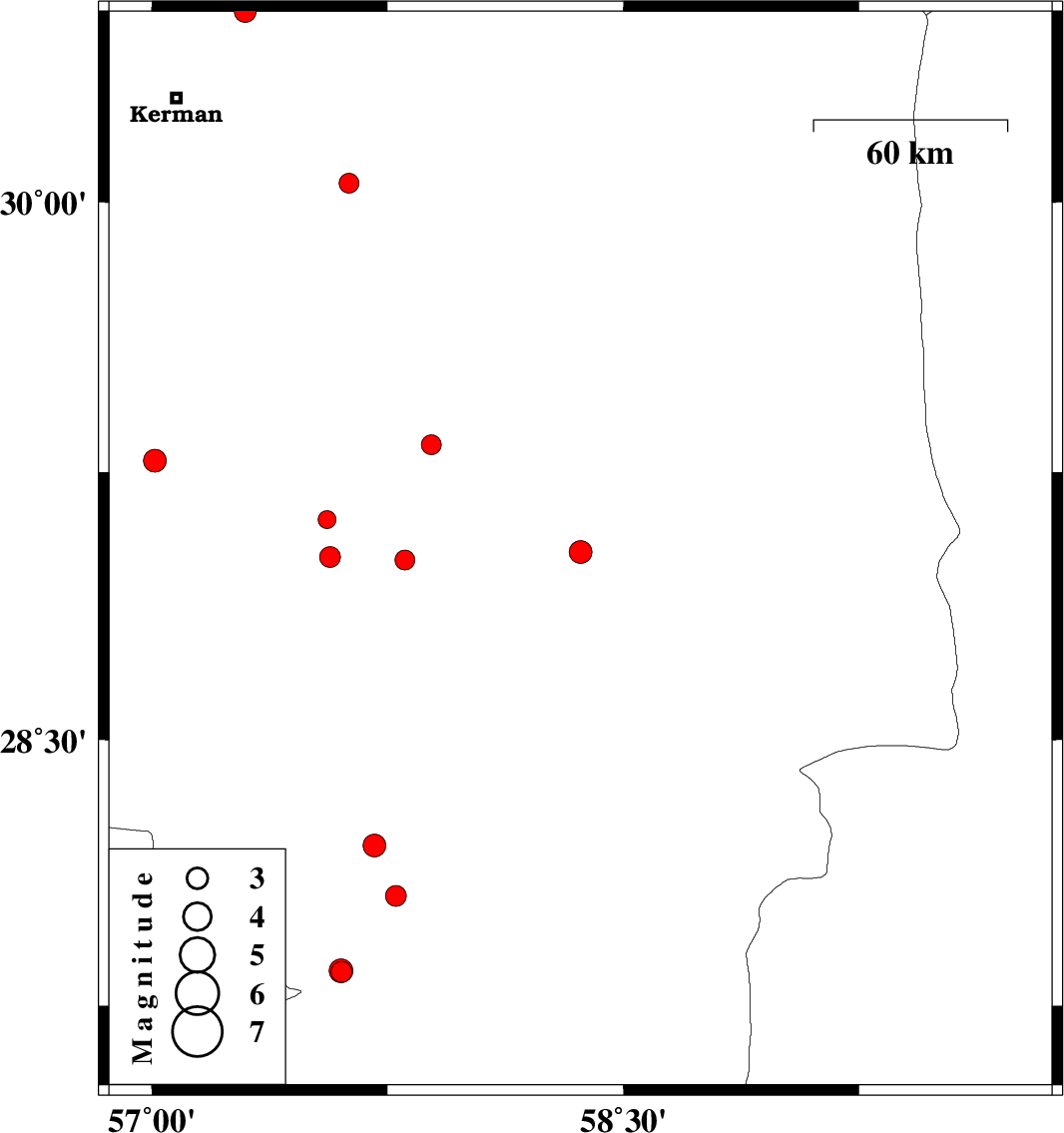
2017/06/01
|
11:42:48.6
|
16:12:48.6
| 29.027 | 58.364 | 14 |
ML:3.3
|
Kerman Province, 9 km of Bam | |
|
|
2017/05/31
|
11:51:21.7
|
16:21:21.7
| 29.326 | 57.89 | 7 |
ML:2.8
|
Kerman Province, 51 km North-West of Bam | |
|
|
2017/05/26
|
17:09:03.9
|
21:39:03.9
| 28.061 | 57.777 | 18 |
ML:2.9
|
Kerman Province, 15 km North of Kahnuj | |
|
|
2017/05/26
|
06:33:51.6
|
11:03:51.6
| 28.203 | 57.709 | 14 |
ML:3.3
|
Kerman Province, 28 km North of Kahnuj | |
|
|
2017/05/20
|
16:37:26.7
|
21:07:26.7
| 29.117 | 57.558 | 14 |
ML:2.5
|
Kerman Province, 53 km North-West of Jiroft | |
|
|
2017/05/19
|
05:29:10.7
|
09:59:10.7
| 27.846 | 57.604 | 14 |
ML:2.9
|
Kerman Province, 15 km South of Kahnuj | |
|
|
2017/05/19
|
03:42:31.8
|
08:12:31.8
| 27.849 | 57.602 | 14 |
ML:3.4
|
Kerman Province, 14 km South of Kahnuj | |
|
|
2017/05/17
|
18:04:22.0
|
22:34:22.0
| 30.052 | 57.627 | 18 |
ML:2.8
|
Kerman Province, 59 km South-East of Kerman | |
|
|
2017/05/15
|
05:43:08.1
|
10:13:08.1
| 29.281 | 57.01 | 15 |
ML:3.2
|
Kerman Province, 39 km -East of Baft | |
|
|
2017/05/08
|
16:35:32.2
|
21:05:32.2
| 30.526 | 57.298 | 14 |
ML:3.1
|
Kerman Province, 34 km North-East of Kerman | |
|
|
2017/05/03
|
17:28:49.2
|
21:58:49.2
| 29.013 | 57.567 | 27 |
ML:3
|
Kerman Province, 42 km North-West of Jiroft | |
|
|
2017/05/02
|
18:53:08.5
|
23:23:08.5
| 29.004 | 57.805 | 14 |
ML:2.8
|
Kerman Province, 38 km North of Jiroft | |
