| Prel. Rep. | Date | Time(UTC) | Time(Local) | Lat. | Lon. | Depth | Mag. | Region | Waveform |
|
|
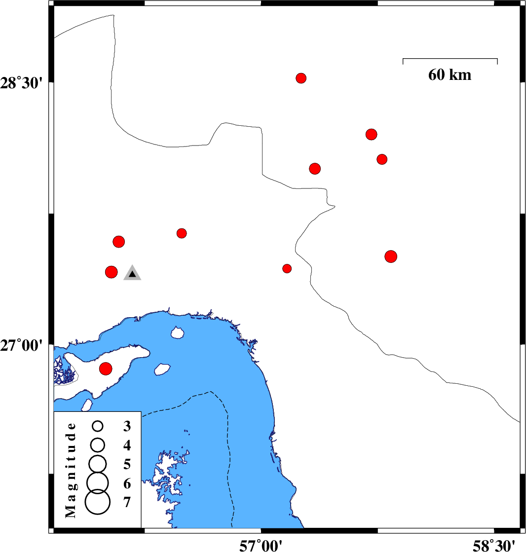
2017/06/19
|
04:16:50.5
|
08:46:50.5
| 27.435 | 57.166 | 17 |
ML:2.6
|
Hormozgan Province, 7 km of Dehbarez | |
|
|
2017/06/17
|
09:07:54.2
|
13:37:54.2
| 28.007 | 57.345 | 15 |
ML:3.2
|
Kerman Province, 35 km -West of Kahnuj | |
|
|
2017/06/16
|
13:21:58.7
|
17:51:58.7
| 28.523 | 57.256 | 14 |
ML:3
|
Kerman Province, 50 km South-West of Jiroft | |
|
|
2017/06/14
|
10:14:46.0
|
14:44:46.0
| 26.859 | 56 | 7 |
ML:3.7
|
Persian Gulf, 28 km -West of Qeshm | |
|
|
2017/06/04
|
10:01:00.7
|
14:31:00.7
| 27.505 | 57.835 | 14 |
ML:3.5
|
Kerman Province, 35 km -East of Manujan | |
|
|
2017/06/02
|
18:57:21.5
|
23:27:21.5
| 27.638 | 56.488 | 14 |
ML:2.8
|
Hormozgan Province, 54 km North-East of Bandar-e abbas | |
|
|
2017/05/26
|
17:09:03.9
|
21:39:03.9
| 28.061 | 57.777 | 18 |
ML:2.9
|
Kerman Province, 15 km North of Kahnuj | |
|
|
2017/05/26
|
06:33:51.6
|
11:03:51.6
| 28.203 | 57.709 | 14 |
ML:3.3
|
Kerman Province, 28 km North of Kahnuj | |
|
|
2017/05/23
|
01:31:29.3
|
06:01:29.3
| 27.415 | 56.036 | 14 |
ML:3.5
|
Hormozgan Province, 35 km North-West of Bandar-e abbas | |
|
|
2017/05/22
|
19:19:20.0
|
23:49:20.0
| 27.589 | 56.084 | 14 |
ML:3.4
|
Hormozgan Province, 49 km North-West of Bandar-e abbas | |
