
| Prel. Rep. | Date | Time(UTC) | Time(Local) | Lat. | Lon. | Depth | Mag. | Region | Waveform |
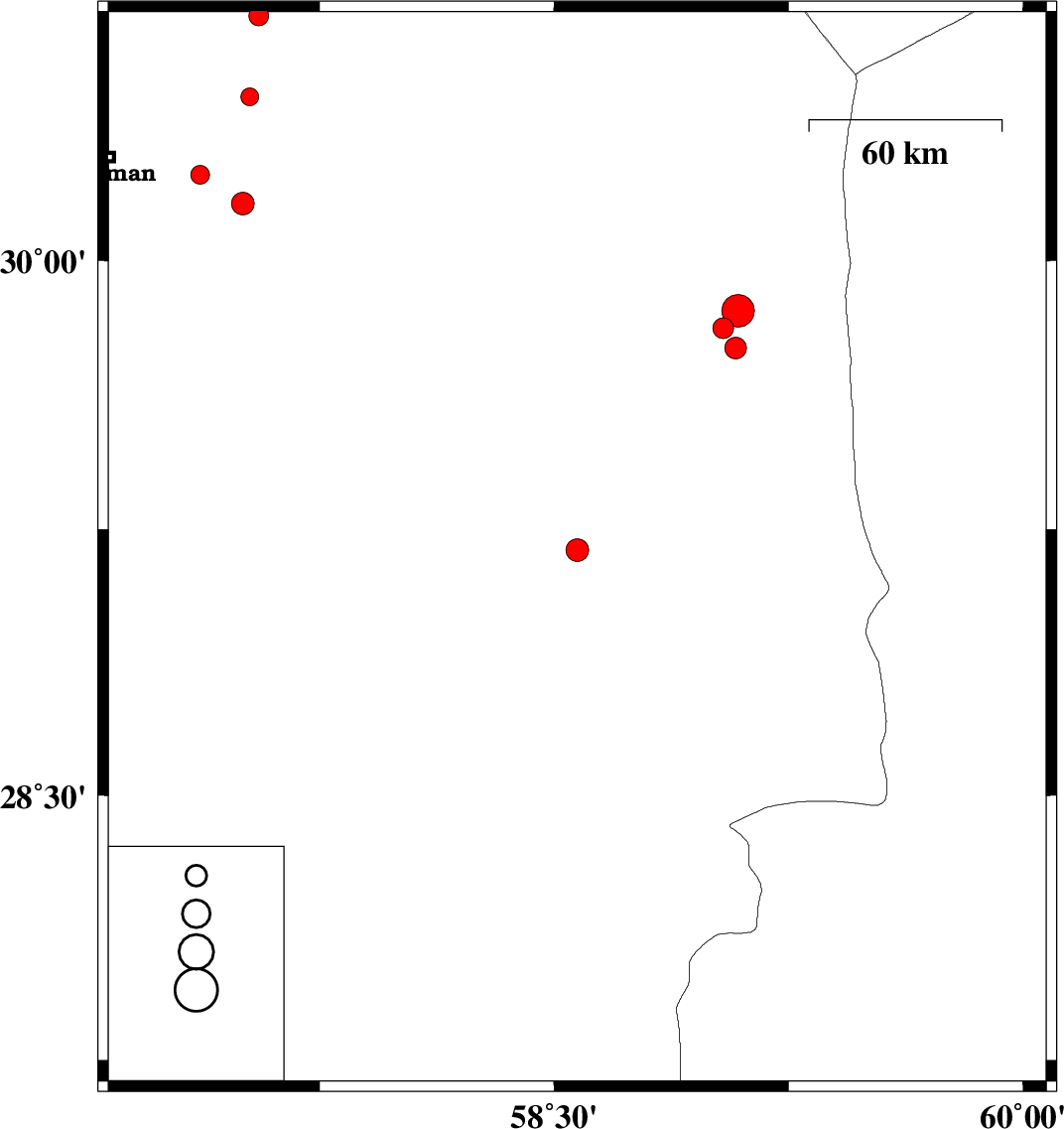
| 2017/06/12 | 12:45:11.7 | 17:15:11.7 | 29.191 | 58.574 | 14 | ML:3.3 | Kerman Province, 23 km -East of Bam | ||
| 2017/06/12 | 10:01:26.5 | 14:31:26.5 | 30.239 | 57.367 | 9 | ML:2.7 | Kerman Province, 28 km -East of Kerman | ||
| 2017/06/10 | 04:34:56.1 | 09:04:56.1 | 29.812 | 59.041 | 14 | ML:2.9 | Kerman Province, 102 km North-East of Bam | ||
| 2017/06/10 | 04:07:03.4 | 08:37:03.4 | 29.86 | 59.089 | 14 | ML:4.7 | Kerman Province, 110 km North-East of Bam | ||
| 2017/06/09 | 22:20:10.8 | 02:50:10.8 | 29.756 | 59.08 | 14 | ML:3.1 | Kerman Province, 100 km North-East of Bam | ||
| 2017/06/09 | 15:05:58.7 | 19:35:58.7 | 30.678 | 57.555 | 14 | ML:2.8 | Kerman Province, 63 km North-East of Kerman | ||
| 2017/06/06 | 12:46:10.5 | 17:16:10.5 | 30.455 | 57.527 | 17 | ML:2.6 | Kerman Province, 47 km North-East of Kerman | ||
| 2017/06/05 | 15:34:22.0 | 20:04:22.0 | 30.159 | 57.504 | 14 | ML:3.2 | Kerman Province, 43 km South-East of Kerman |