| Prel. Rep. | Date | Time(UTC) | Time(Local) | Lat. | Lon. | Depth | Mag. | Region | Waveform |
|
|
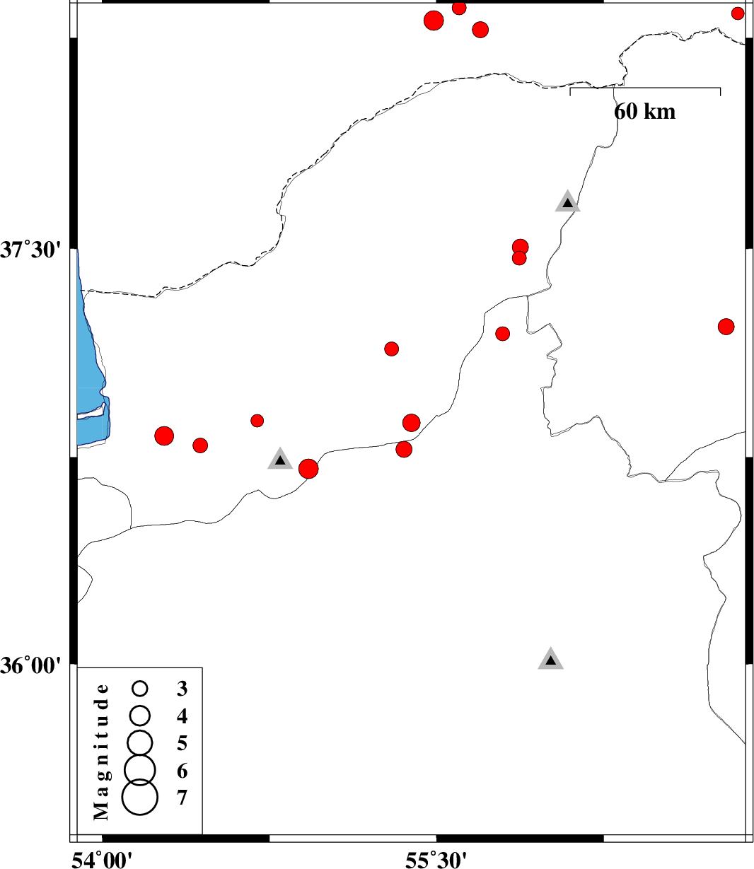
2017/03/31
|
12:05:37.2
|
16:35:37.2
| 36.874 | 55.387 | 6 |
ML:3.5
|
Golestan Province, 40 km South of Minodasht | |
|
|
2017/03/23
|
02:32:25.6
|
07:02:25.6
| 37.22 | 56.8 | 15 |
ML:3.3
|
Khorasan(north) Province, 39 km South-West of Ashkhaneh | |
|
|
2017/03/22
|
19:53:25.2
|
00:23:25.2
| 36.827 | 54.277 | 15 |
ML:3.8
|
Golestan Province, 14 km -West of Gorgan | |
|
|
2017/03/22
|
07:18:32.2
|
11:48:32.2
| 38.279 | 55.697 | 14 |
ML:3.2
|
Turkmenistan | |
|
|
2017/03/21
|
05:50:10.9
|
09:20:10.9
| 37.14 | 55.298 | 24 |
ML:2.8
|
Golestan Province, 12 km -East of Azadshahr | |
|
|
2017/03/20
|
00:30:47.0
|
04:00:47.0
| 36.882 | 54.695 | 15 |
ML:2.5
|
Golestan Province, 16 km -West of Ali Abad | |
|
|
2017/03/19
|
17:37:02.6
|
21:07:02.6
| 38.357 | 55.602 | 14 |
ML:2.8
|
Turkmenistan | |
|
|
2017/03/18
|
23:10:50.2
|
02:40:50.2
| 36.778 | 55.354 | 15 |
ML:3.2
|
Semnan Province, 32 km South-East of Ramian | |
|
|
2017/03/16
|
10:09:54.8
|
13:39:54.8
| 38.337 | 56.853 | 6 |
ML:2.5
|
Turkmenistan, 88 km North of Ashkhaneh | |
|
|
2017/03/16
|
00:53:57.4
|
04:23:57.4
| 37.466 | 55.872 | 9 |
ML:2.8
|
Golestan Province, 35 km -East of Kalaleh | |
|
|
2017/03/16
|
00:48:25.7
|
04:18:25.7
| 37.505 | 55.876 | 16 |
ML:3.2
|
Golestan Province, 37 km North-East of Kalaleh | |
|
|
2017/03/14
|
04:44:38.4
|
08:14:38.4
| 38.312 | 55.487 | 14 |
ML:3.9
|
Turkmenistan | |
|
|
2017/03/12
|
19:08:10.5
|
22:38:10.5
| 36.708 | 54.926 | 17 |
ML:4
|
Golestan Province, 23 km South of Ali Abad | |
|
|
2017/03/10
|
01:33:39.6
|
05:03:39.6
| 37.195 | 55.797 | 8 |
ML:2.8
|
Semnan Province, 36 km -East of Minodasht | |
|
|
2017/03/01
|
10:19:44.1
|
13:49:44.1
| 36.793 | 54.439 | 15 |
ML:3
|
Golestan Province, 5 km of Gorgan | |
