| Prel. Rep. | Date | Time(UTC) | Time(Local) | Lat. | Lon. | Depth | Mag. | Region | Waveform |
|
|
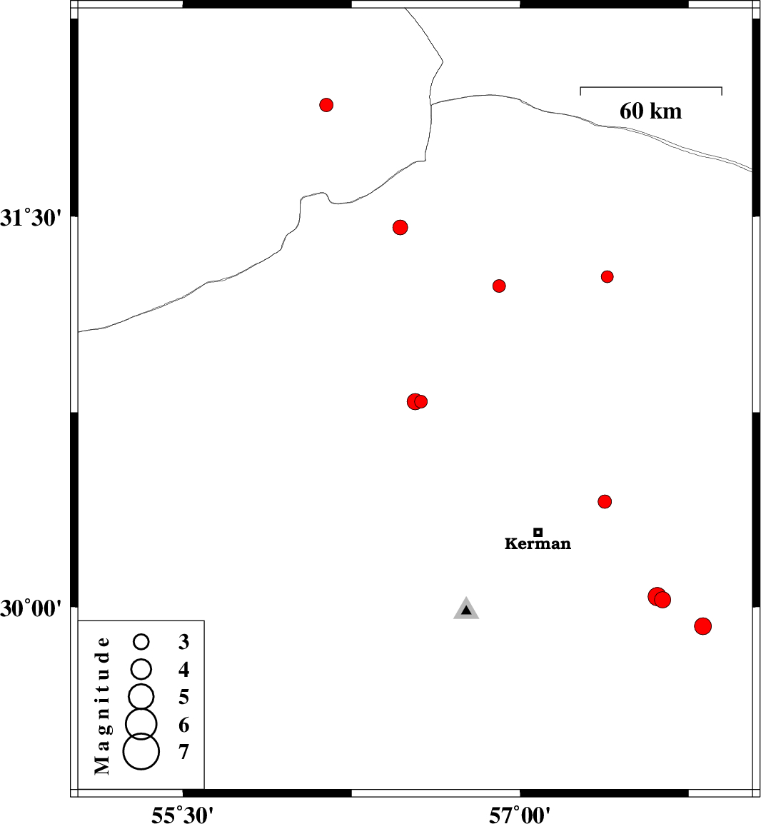
2017/02/20
|
19:38:33.9
|
23:08:33.9
| 30.791 | 56.559 | 15 |
ML:2.6
|
Kerman Province, 2 km of Zarand | |
|
|
2017/02/20
|
03:05:29.9
|
06:35:29.9
| 30.791 | 56.533 | 14 |
ML:3.3
|
Kerman Province, 4 km of Zarand | |
|
|
2017/02/14
|
12:58:26.7
|
16:28:26.7
| 31.27 | 57.388 | 16 |
ML:2.4
|
Kerman Province, 55 km -East of Ravar | |
|
|
2017/02/10
|
17:28:44.6
|
20:58:44.6
| 29.925 | 57.813 | 15 |
ML:3.4
|
Kerman Province, 81 km South-East of Kerman | |
|
|
2017/01/31
|
10:49:40.6
|
14:19:40.6
| 31.234 | 56.906 | 14 |
ML:2.6
|
Kerman Province, 10 km of Ravar | |
|
|
2017/01/27
|
11:13:37.6
|
14:43:37.6
| 31.923 | 56.138 | 14 |
ML:2.7
|
Yazd Province, 78 km North-East of Bafq | |
|
|
2017/01/26
|
06:36:02.5
|
10:06:02.5
| 30.027 | 57.634 | 14 |
ML:3.3
|
Kerman Province, 61 km South-East of Kerman | |
|
|
2017/01/26
|
05:54:37.9
|
09:24:37.9
| 30.04 | 57.609 | 14 |
ML:3.6
|
Kerman Province, 58 km South-East of Kerman | |
|
|
2017/01/22
|
19:46:40.5
|
23:16:40.5
| 30.407 | 57.376 | 14 |
ML:2.7
|
Kerman Province, 31 km North-East of Kerman | |
|
|
2017/01/21
|
16:35:07.7
|
20:05:07.7
| 31.457 | 56.467 | 16 |
ML:2.9
|
Kerman Province, 39 km North-West of Ravar | |
