
| Prel. Rep. | Date | Time(UTC) | Time(Local) | Lat. | Lon. | Depth | Mag. | Region | Waveform |
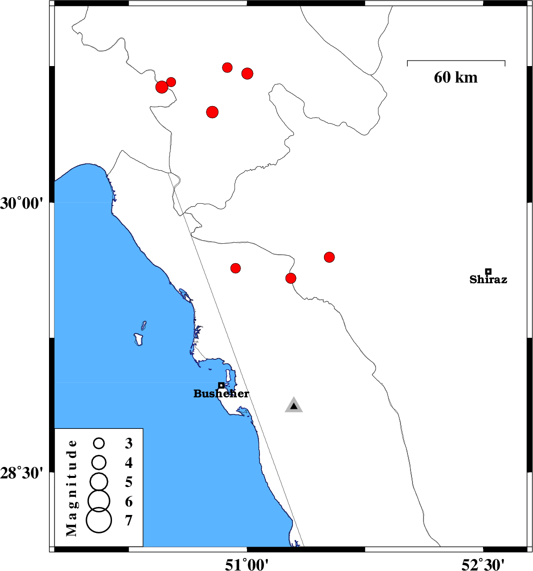
| 2016/11/17 | 21:27:49.3 | 00:57:49.3 | 29.581 | 51.278 | 6 | ML:2.9 | Bushehr Province, 36 km North of Borazjan | ||
| 2016/11/10 | 18:09:38.3 | 21:39:38.3 | 30.498 | 50.78 | 18 | ML:3.4 | Kohkiluieh va boyerahmad Province, 16 km North of Dogonbadan | ||
| 2016/11/08 | 15:09:02.9 | 18:39:02.9 | 30.709 | 51.002 | 15 | ML:3.2 | Kohkiluieh va boyerahmad Province, 43 km -East of Dehdasht | ||
| 2016/11/06 | 23:06:41.7 | 02:36:41.7 | 30.743 | 50.875 | 18 | ML:2.8 | Kohkiluieh va boyerahmad Province, 30 km -East of Dehdasht | ||
| 2016/10/28 | 14:52:30.1 | 18:22:30.1 | 30.636 | 50.459 | 15 | ML:3.5 | Khoozestan Province, 21 km -East of Behbahan | ||
| 2016/10/27 | 22:25:22.2 | 01:55:22.2 | 30.663 | 50.518 | 15 | ML:2.7 | Kohkiluieh va boyerahmad Province, 15 km South of Dehdasht | ||
| 2016/10/26 | 07:22:38.4 | 10:52:38.4 | 29.636 | 50.928 | 8 | ML:2.8 | Bushehr Province, 41 km -East of Bandar-e genaveh | ||
| 2016/10/21 | 05:19:06.1 | 08:49:06.1 | 29.697 | 51.522 | 15 | ML:3 | Fars Province, 15 km -West of Kazerun |