| Prel. Rep. | Date | Time(UTC) | Time(Local) | Lat. | Lon. | Depth | Mag. | Region | Waveform |
|
|
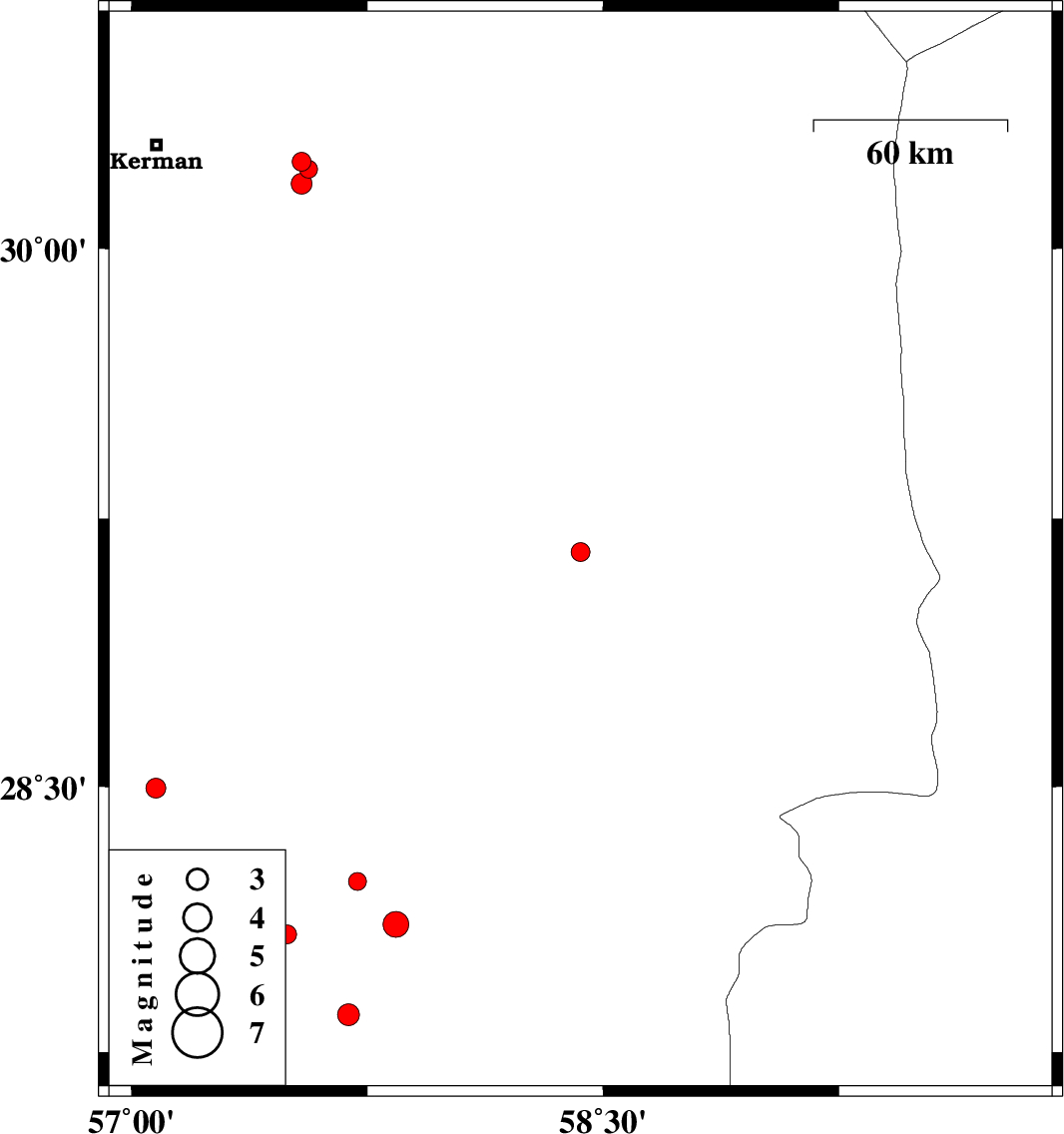
2016/10/04
|
01:35:51.7
|
05:05:51.7
| 29.156 | 58.428 | 14 |
ML:2.7
|
Kerman Province, 9 km of Bam | |
|
|
2016/10/02
|
08:19:49.2
|
11:49:49.2
| 28.083 | 57.495 | 18 |
ML:2.7
|
Kerman Province, 25 km North-West of Kahnuj | |
|
|
2016/10/02
|
02:39:35.8
|
06:09:35.8
| 27.856 | 57.69 | 16 |
ML:3.1
|
Kerman Province, 10 km of Kahnuj | |
|
|
2016/10/01
|
04:19:18.8
|
07:49:18.8
| 28.111 | 57.841 | 14 |
ML:3.6
|
Kerman Province, 23 km North-East of Kahnuj | |
|
|
2016/09/22
|
15:39:50.3
|
19:09:50.3
| 28.495 | 57.078 | 15 |
ML:2.8
|
Kerman Province, 67 km South-West of Jiroft | |
|
|
2016/09/18
|
11:25:57.6
|
15:55:57.6
| 30.24 | 57.54 | 14 |
ML:2.7
|
Kerman Province, 45 km -East of Kerman | |
|
|
2016/09/18
|
11:14:26.1
|
15:44:26.1
| 30.219 | 57.563 | 16 |
ML:2.6
|
Kerman Province, 47 km -East of Kerman | |
|
|
2016/09/15
|
10:36:05.0
|
15:06:05.0
| 28.273 | 57.261 | 14 |
ML:3.2
|
Kerman Province, 56 km North-West of Kahnuj | |
|
|
2016/09/12
|
13:54:03.1
|
18:24:03.1
| 28.232 | 57.718 | 14 |
ML:2.6
|
Kerman Province, 31 km North of Kahnuj | |
|
|
2016/09/07
|
09:39:13.3
|
14:09:13.3
| 30.179 | 57.541 | 14 |
ML:2.9
|
Kerman Province, 46 km South-East of Kerman | |
