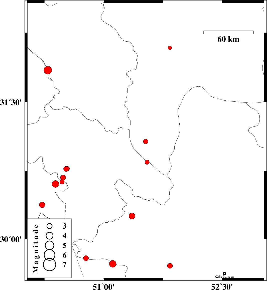
| Prel. Rep. | Date | Time(UTC) | Time(Local) | Lat. | Lon. | Depth | Mag. | Region | Waveform |
|
|
2015/11/07
|
22:24:14.6
|
01:54:14.6
| 30.253 | 51.357 | 16 |
ML:3.5
|
Fars Province, 22 km North-West of Nurabad | |
|
|
2015/11/07
|
13:32:40.6
|
17:02:40.6
| 31.07 | 51.532 | 18 |
ML:2.7
|
Esfahan Province, 24 km North of Sisakht | |
|
|
2015/11/05
|
11:21:37.1
|
14:51:37.1
| 30.77 | 50.524 | 14 |
ML:3
|
Kohkiluieh va boyerahmad Province, 4 km of Dehdasht | |
|
|
2015/11/03
|
03:53:36.1
|
07:23:36.1
| 30.376 | 50.22 | 15 |
ML:3.3
|
Khoozestan Province, 25 km South of Behbahan | |
|
|
2015/10/25
|
14:26:15.5
|
17:56:15.5
| 29.726 | 51.115 | 14 |
ML:4
|
Bushehr Province, 52 km North of Borazjan | |
|
|
2015/10/20
|
15:42:24.1
|
19:12:24.1
| 31.846 | 50.291 | 17 |
ML:4.5
|
Chaharmahal Bakhtiari Province, 40 km -East of Izeh | |
|
|
2015/10/20
|
15:17:06.4
|
18:47:06.4
| 30.606 | 50.387 | 14 |
ML:4
|
Khoozestan Province, 14 km -East of Behbahan | |
|
|
2015/10/20
|
15:10:05.3
|
18:40:05.3
| 30.628 | 50.471 | 14 |
ML:2.7
|
Khoozestan Province, 20 km South of Dehdasht | |
|
|
2015/10/20
|
15:06:57.1
|
18:36:57.1
| 30.675 | 50.484 | 14 |
ML:2.9
|
Kohkiluieh va boyerahmad Province, 15 km South of Dehdasht | |
|
|
2015/10/17
|
16:11:39.2
|
19:41:39.2
| 30.773 | 50.537 | 14 |
ML:2.7
|
Kohkiluieh va boyerahmad Province, 3 km of Dehdasht | |
|
|
2015/10/17
|
04:15:39.1
|
07:45:39.1
| 29.788 | 50.775 | 14 |
ML:2.9
|
Fars Province, 35 km North-East of Bandar-e genaveh | |
|
|
2015/10/17
|
04:00:06.0
|
07:30:06.0
| 30.844 | 51.549 | 15 |
ML:2.6
|
Kohkiluieh va boyerahmad Province, 9 km of Sisakht | |
|
|
2015/10/11
|
23:21:34.8
|
02:51:34.8
| 32.086 | 51.839 | 18 |
ML:2.1
|
Esfahan Province, 9 km of Shahreza | |
|
|
2015/10/09
|
22:05:03.7
|
01:35:03.7
| 29.703 | 51.84 | 11 |
ML:2.9
|
Fars Province, 20 km -East of Kazerun | |
