
| Prel. Rep. | Date | Time(UTC) | Time(Local) | Lat. | Lon. | Depth | Mag. | Region | Waveform |
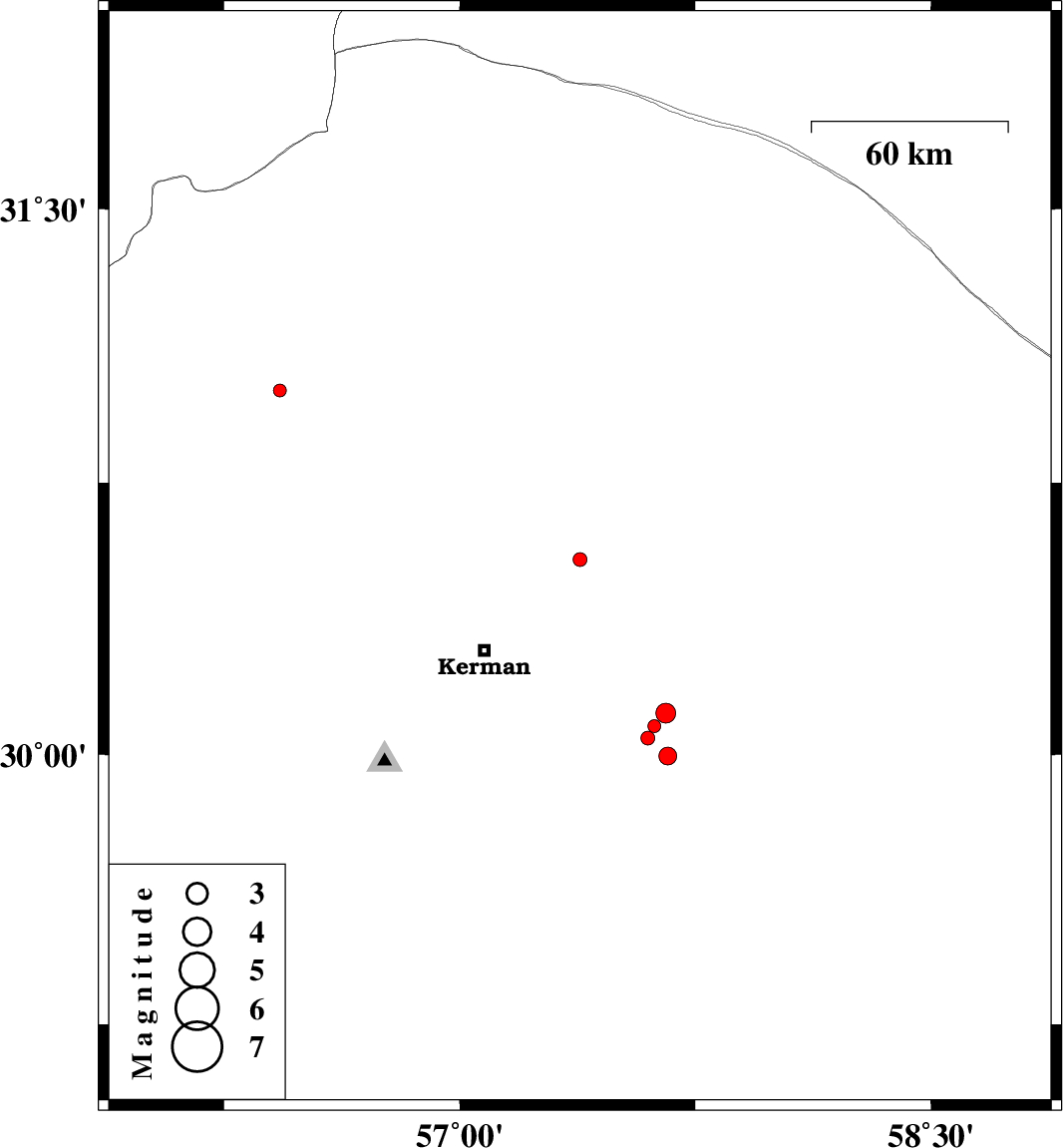
| 2015/09/16 | 22:03:54.1 | 02:33:54.1 | 30.539 | 57.383 | 14 | ML:2 | Kerman Province, 40 km North-East of Kerman | ||
| 2015/09/13 | 12:44:59.2 | 17:14:59.2 | 31.003 | 56.428 | 18 | ML:1.9 | Kerman Province, 25 km North-West of Zarand | ||
| 2015/09/11 | 15:39:39.6 | 20:09:39.6 | 30.114 | 57.657 | 14 | ML:2.8 | Kerman Province, 59 km South-East of Kerman | ||
| 2015/09/11 | 00:55:47.6 | 05:25:47.6 | 30.078 | 57.62 | 14 | ML:1.8 | Kerman Province, 57 km South-East of Kerman | ||
| 2015/09/10 | 07:35:06.8 | 12:05:06.8 | 29.996 | 57.663 | 18 | ML:2.6 | Kerman Province, 65 km South-East of Kerman | ||
| 2015/09/10 | 04:56:13.5 | 09:26:13.5 | 30.046 | 57.599 | 18 | ML:2 | Kerman Province, 57 km South-East of Kerman |