
Magnitude |
:3.1 |
| Date & Time (UTC) | 2014-08-22 01:11:18.9 |
| Date & Time (Local) | 1393/5/31 05:41:18.9 |
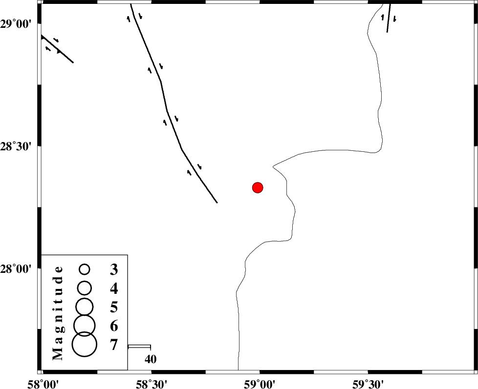
| Location | Lat:28.33 Lon: 58.99 |
| Region | Kerman Province, 107 km South-East of Bam |
Nearest Cities |
|
| 42 km South of Hoseynabad, Kerman Province | |
| 44 km South East of Mohammadabad-e gonbaki, Kerman Province | |
| 58 km North East of Borj-e abbasabad, Kerman Province | |
| 61 km South of Void, Kerman Province | |
| 71 km South East of Fahroj, Kerman Province | |
| Depth | 14 km |
| Agency | |
Faults within 150 km: |
|
| BAM_F (Length: 118 km) , Distance to epicenter: 20 km | |
| KANURAK_F (Length: 135 km) , Distance to epicenter: 92 km | |
| GOWK_F (Length: 152 km) , Distance to epicenter: 101 km | |
| Number of Phases | 4 |
| RMS | 0.3 |
| Number of Stations | 4 |
| Error in Latitude | >12.6 km |
| Error in Longitude | 21.8 km |
| Error in Depth | 44.3 km |
Download waveform in seisan format
to download seisan software Click here
to access information about IIEES stations Click here
Amplitude | ||||||||
| UID | Agency | Station | Component | Amplitude | Period | Arrival Time | Proccessing Time | Signal Clip |
| 93202 | IIEES | KRBR | E | 60 | 0.24 | 2014-08-22 01:12:45 | 2014-08-22 05:15:00 | n |
| 93203 | IIEES | AHRM | N | 4.7 | 0.16 | 2014-08-22 01:13:02 | 2014-08-22 05:15:00 | n |
Phase | ||||||||||||
| Agency | Station | Component | Phase Type | Phase Quality | First Motion | Observed Arrival Time | Time Residual | Loc. Flag | Input Weight | Distance | Azimuth | |
| IIEES | ZHSF | Z | Pg | E | 2014-08-22 01:11:55 | -0.51 | y | 225 | 50 | |||
| IIEES | ZHSF | N | Sg | E | 2014-08-22 01:12:23 | 0.38 | y | 225 | 50 | |||
| IIEES | KRBR | Z | Pn | E | 2014-08-22 01:12:02 | -0.08 | y | 284 | 311 | |||
| IIEES | BNDS | Z | Pn | E | 2014-08-22 01:12:03 | 0.22 | y | 296 | 250 | |||