
Magnitude |
:3.6 |
| Date & Time (UTC) | 2014-01-02 13:31:52.8 |
| Date & Time (Local) | 1392/10/12 17:01:52.8 |
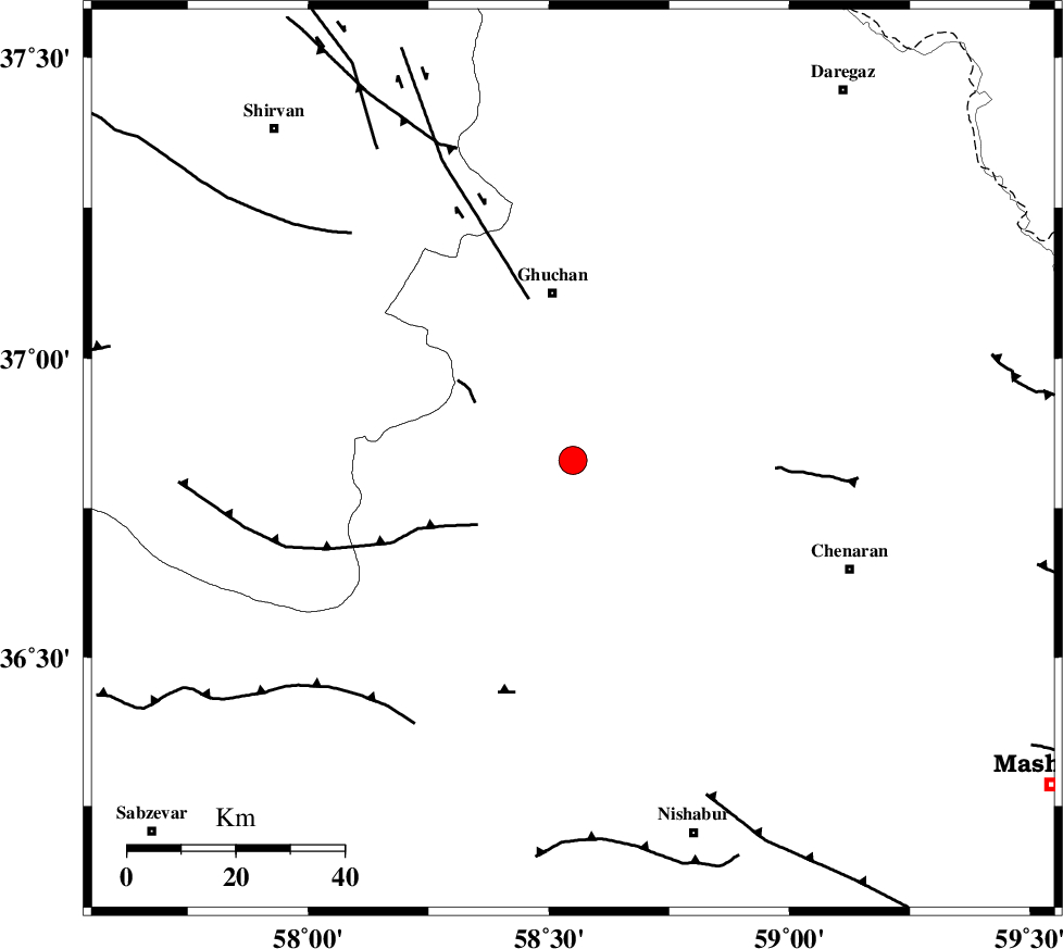
| Location | Lat:36.83 Lon: 58.55 |
| Region | Khorasan(center) Province, 32 km South of Quchan |
Nearest Cities |
|
| 7 km of Chakaneh, Khorasan(center) Province | |
| 18 km North East of Abdollahgiv, Khorasan(center) Province | |
| 26 km South of Ali Abad, Khorasan(center) Province | |
| 29 km South East of Yangi qaleh, Khorasan(center) Province | |
| 31 km South of Quchan, Khorasan(center) Province | |
| Depth | 15 km |
| Agency | |
Faults within 150 km: |
|
| BINALUD_F1 (Length: 129 km) , Distance to epicenter: 3 km | |
| GHUCHAN_F (Length: 50 km) , Distance to epicenter: 31 km | |
| BINALUD_F1 (Length: 178 km) , Distance to epicenter: 32 km | |
| Number of Phases | 7 |
| RMS | 0.2 |
| Number of Stations | 5 |
| Error in Latitude | >5.5 km |
| Error in Longitude | 8.8 km |
| Error in Depth | 6.7 km |
Download waveform in seisan format
to download seisan software Click here
to access information about IIEES stations Click here
Amplitude | ||||||||
| UID | Agency | Station | Component | Amplitude | Period | Arrival Time | Proccessing Time | Signal Clip |
| 91360 | IIEES | SHRO | E | 372.6 | 0.56 | 2014-01-02 13:33:05 | 2014-01-02 01:59:00 | n |
Phase | ||||||||||||
| Agency | Station | Component | Phase Type | Phase Quality | First Motion | Observed Arrival Time | Time Residual | Loc. Flag | Input Weight | Distance | Azimuth | |
| IIEES | BJRD | Z | Pg | E | 2014-01-02 13:32:15 | -0.24 | y | 140 | 314 | |||
| IIEES | BJRD | N | Sg | E | 2014-01-02 13:32:33 | 0.25 | y | 140 | 314 | |||
| IIEES | SHRO | E | Pn | E | 2014-01-02 13:32:30 | -0.31 | y | 245 | 249 | |||
| IIEES | TABS | Z | Pn | E | 2014-01-02 13:32:47 | 0.39 | y | 376 | 201 | |||
| IIEES | SHRT | Z | Pn | E | 2014-01-02 13:32:48 | 0 | y | 387 | 155 | |||
| IIEES | SHRT | E | Sg | E | 2014-01-02 13:33:41 | -0.01 | y | 387 | 155 | |||
| IIEES | BSRN | Z | Pn | E | 2014-01-02 13:33:07 | 0 | y | 542 | 174 | |||