
Magnitude |
:2.4 |
| Date & Time (UTC) | 2013-11-28 00:54:25.6 |
| Date & Time (Local) | 1392/9/7 04:24:25.6 |
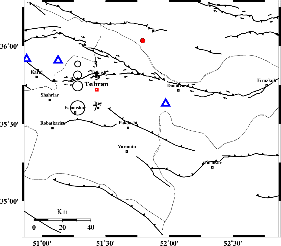
| Location | Lat:35.53 Lon: 51.86 |
| Region | Tehran Province, 18 km East of Pakdasht |
Nearest Cities |
|
| 18 km North East of Pakdasht, Tehran Province | |
| 19 km South West of Ab sard, Tehran Province | |
| 23 km North East of Khalilabad, Tehran Province | |
| 23 km South of Rudehen, Tehran Province | |
| 24 km South of Bumehen, Tehran Province | |
| Depth | 17 km |
| Agency | |
Faults within 150 km: |
|
| EYVANEKEY_F (Length: 74 km) , Distance to epicenter: 9 km | |
| KAHRIZAK_F (Length: 44 km) , Distance to epicenter: 25 km | |
| PISHAV_F (Length: 34 km) , Distance to epicenter: 29 km | |
| Number of Phases | 5 |
| RMS | 0 |
| Number of Stations | 4 |
| Error in Latitude | >2.1 km |
| Error in Longitude | 2.1 km |
| Error in Depth | 2.2 km |
Download waveform in seisan format
to download seisan software Click here
to access information about IIEES stations Click here
Amplitude | ||||||||
| UID | Agency | Station | Component | Amplitude | Period | Arrival Time | Proccessing Time | Signal Clip |
| 91093 | IIEES | GHVR | E | 78.3 | 0.88 | 2013-11-28 00:55:12 | 2013-11-28 08:01:00 | n |
Phase | ||||||||||||
| Agency | Station | Component | Phase Type | Phase Quality | First Motion | Observed Arrival Time | Time Residual | Loc. Flag | Input Weight | Distance | Azimuth | |
| IIEES | DAMV | Z | Pg | E | 2013-11-28 00:54:29 | 0 | y | 14.8 | 42 | |||
| IIEES | CHTH | Z | Pg | E | 2013-11-28 00:54:39 | 0.01 | y | 78.5 | 302 | |||
| IIEES | GHVR | Z | Pn | E | 2013-11-28 00:54:49 | 0.01 | y | 129 | 206 | |||
| IIEES | ASAO | Z | Pn | E | 2013-11-28 00:54:58 | -0.01 | y | 200 | 237 | |||
| IIEES | ASAO | N | Sg | E | 2013-11-28 00:55:22 | 0 | y | 200 | 237 | |||