
Magnitude |
:2 |
| Date & Time (UTC) | 2013-10-14 13:55:51.7 |
| Date & Time (Local) | 1392/7/22 17:25:51.7 |
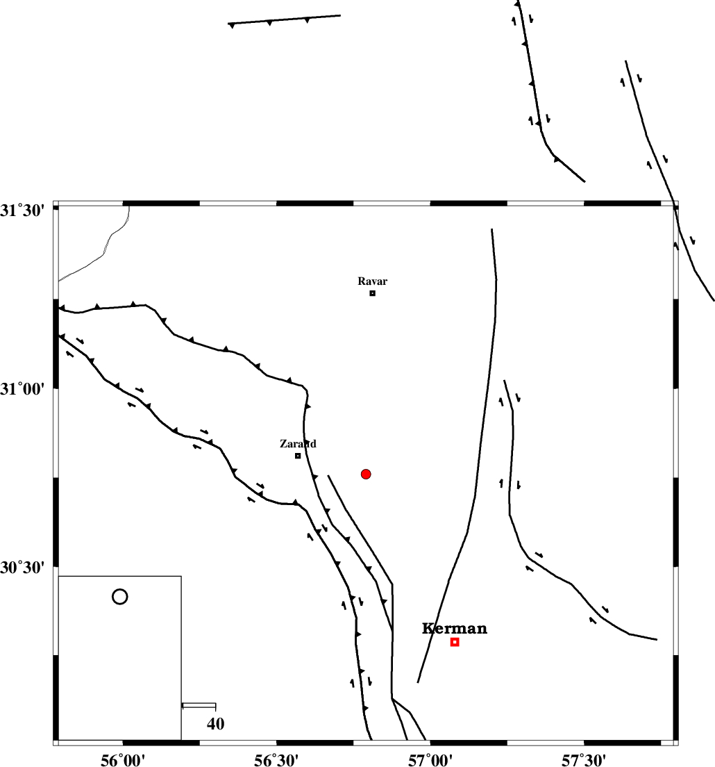
| Location | Lat:30.76 Lon: 56.79 |
| Region | Kerman Province, 22 km East of Zarand |
Nearest Cities |
|
| 4 km North of Khankuk, Kerman Province | |
| 9 km of Hatkan, Kerman Province | |
| 14 km North East of Bahaabad, Kerman Province | |
| 18 km West of Hejdak, Kerman Province | |
| 21 km North West of Chatrud, Kerman Province | |
| Depth | 18 km |
| Agency | |
Faults within 150 km: |
|
| KUHBANAN_F (Length: 189 km) , Distance to epicenter: 4 km | |
| CHATRUD_F (Length: 37 km) , Distance to epicenter: 23 km | |
| DARIVAN_F (Length: 131 km) , Distance to epicenter: 43 km | |
| Number of Phases | 5 |
| RMS | 0.1 |
| Number of Stations | 3 |
| Error in Latitude | >2.1 km |
| Error in Longitude | 2.9 km |
| Error in Depth | 5.6 km |
Download waveform in seisan format
to download seisan software Click here
to access information about IIEES stations Click here
Amplitude | ||||||||
| UID | Agency | Station | Component | Amplitude | Period | Arrival Time | Proccessing Time | Signal Clip |
| 90790 | IIEES | YZKH | N | 7.2 | 0.32 | 2013-10-14 13:57:08 | 2013-10-15 04:41:00 | n |
| 90791 | IIEES | YZKH | E | 8.4 | 0.44 | 2013-10-14 13:57:10 | 2013-10-15 04:41:00 | n |
Phase | ||||||||||||
| Agency | Station | Component | Phase Type | Phase Quality | First Motion | Observed Arrival Time | Time Residual | Loc. Flag | Input Weight | Distance | Azimuth | |
| IIEES | KRBR | Z | Pg | E | 2013-10-14 13:56:06 | -0.14 | y | 85.9 | 182 | |||
| IIEES | KRBR | E | Sg | E | 2013-10-14 13:56:17 | 0.11 | y | 85.9 | 182 | |||
| IIEES | BSRN | Z | Pn | E | 2013-10-14 13:56:31 | -0.07 | y | 260 | 58 | |||
| IIEES | BSRN | N | Sg | E | 2013-10-14 13:57:05 | 0.05 | y | 260 | 58 | |||
| IIEES | YZKH | Z | Pn | E | 2013-10-14 13:56:33 | 0.05 | y | 276 | 312 | |||