
Magnitude |
:3 |
| Date & Time (UTC) | 2013-09-20 12:42:43.9 |
| Date & Time (Local) | 1392/6/29 17:12:43.9 |
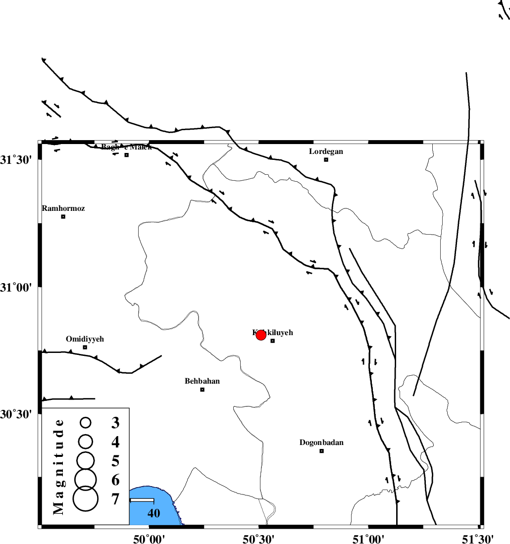
| Location | Lat:30.81 Lon: 50.51 |
| Region | Kohkiluieh va boyerahmad Province, 6 km Dehdasht |
Nearest Cities |
|
| 6 km North of Dehdasht, Kohkiluieh va boyerahmad Province | |
| 20 km South of Lendeh, Kohkiluieh va boyerahmad Province | |
| 26 km West of Savari, Kohkiluieh va boyerahmad Province | |
| 28 km North East of Mansuriyeh, Khoozestan Province | |
| 33 km North East of Dodange-ye bozorg, Khoozestan Province | |
| Depth | 14 km |
| Agency | |
Faults within 150 km: |
|
| MFF4 (Length: 62 km) , Distance to epicenter: 20 km | |
| MISHAN_F (Length: 76 km) , Distance to epicenter: 29 km | |
| MFF2 (Length: 205 km) , Distance to epicenter: 60 km | |
| Number of Phases | 5 |
| RMS | 0.1 |
| Number of Stations | 3 |
| Error in Latitude | >1.9 km |
| Error in Longitude | 3 km |
| Error in Depth | 4.1 km |
Download waveform in seisan format
to download seisan software Click here
to access information about IIEES stations Click here
Amplitude | ||||||||
| UID | Agency | Station | Component | Amplitude | Period | Arrival Time | Proccessing Time | Signal Clip |
| 90587 | IIEES | SHGR | N | 162.3 | 0.52 | 2013-09-20 12:43:46 | 2013-09-20 02:15:00 | n |
| 90588 | IIEES | SHGR | E | 170.7 | 0.4 | 2013-09-20 12:43:50 | 2013-09-20 02:15:00 | n |
| 90589 | IIEES | AHRM | E | 71.6 | 0.28 | 2013-09-20 12:43:53 | 2013-09-20 02:15:00 | n |
| 90590 | IIEES | AHRM | N | 83.7 | 0.36 | 2013-09-20 12:43:54 | 2013-09-20 02:15:00 | n |
Phase | ||||||||||||
| Agency | Station | Component | Phase Type | Phase Quality | First Motion | Observed Arrival Time | Time Residual | Loc. Flag | Input Weight | Distance | Azimuth | |
| IIEES | SHGR | Z | Pn | E | 2013-09-20 12:43:18 | 0.08 | y | 217 | 312 | |||
| IIEES | SHGR | E | Sg | E | 2013-09-20 12:43:45 | -0.07 | y | 217 | 312 | |||
| IIEES | AHRM | Z | Pn | E | 2013-09-20 12:43:20 | 0.09 | y | 229 | 160 | |||
| IIEES | AHRM | E | Sg | E | 2013-09-20 12:43:48 | -0.07 | y | 229 | 160 | |||
| IIEES | YZKH | Z | Pn | E | 2013-09-20 12:43:44 | -0.04 | y | 426 | 65 | |||