
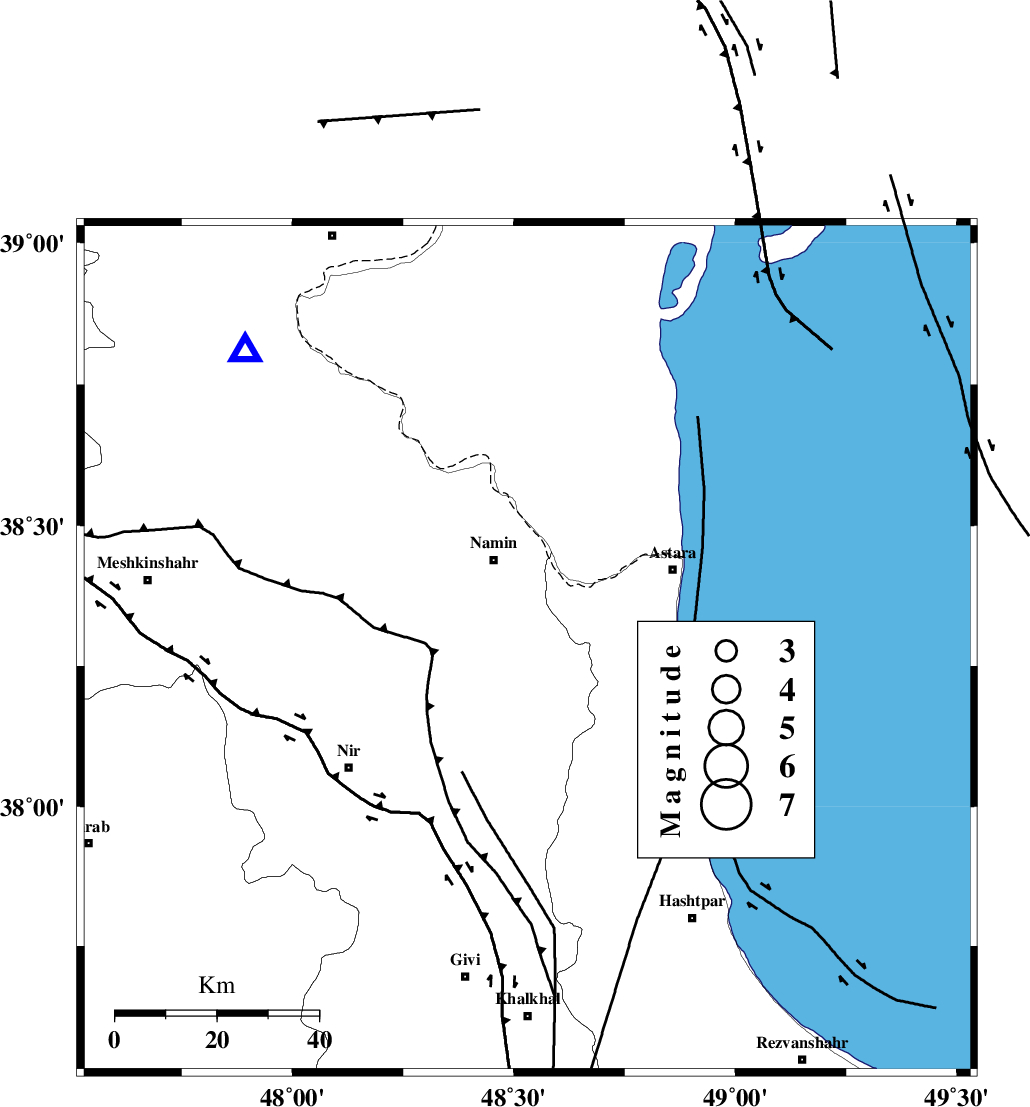
Magnitude |
:3.2 |
| Date & Time (UTC) | 2013-08-10 17:50:34.8 |
| Date & Time (Local) | 1392/5/19 22:20:34.8 |
| Location | Lat:38.28 Lon: 48.53 |
| Region | Ardebil Province, 19 km South of Namin |
Nearest Cities |
|
| 3 km of Baibiglu, Ardebil Province | |
| 10 km of Nanehkaran, Ardebil Province | |
| 14 km North East of Niar, Ardebil Province | |
| 15 km South West of Kiladeh, Gilan Province | |
| 16 km North of Hir, Ardebil Province | |
| Depth | 16 km |
| Agency | |
Faults within 150 km: |
|
| SANGAVAR_F (Length: 61 km) , Distance to epicenter: 8 km | |
| BOZQUSH (Length: 70 km) , Distance to epicenter: 29 km | |
| TALESH_F (Length: 258 km) , Distance to epicenter: 29 km | |
| Number of Phases | 6 |
| RMS | 0.1 |
| Number of Stations | 4 |
| Error in Latitude | >2 km |
| Error in Longitude | 5.4 km |
| Error in Depth | 4.1 km |
Download waveform in seisan format
to download seisan software Click here
to access information about IIEES stations Click here
Amplitude | ||||||||
| UID | Agency | Station | Component | Amplitude | Period | Arrival Time | Proccessing Time | Signal Clip |
| 90197 | IIEES | GRMI | N | 1933.3 | 0.2 | 2013-08-10 17:51:02 | 2013-08-10 07:17:00 | n |
| 90198 | IIEES | ZNJK | E | 251.6 | 0.44 | 2013-08-10 17:51:29 | 2013-08-10 07:17:00 | n |
| 90199 | IIEES | ZNJK | N | 170.5 | 0.52 | 2013-08-10 17:51:29 | 2013-08-10 07:17:00 | n |
| 90200 | IIEES | THKV | N | 44.2 | 0.52 | 2013-08-10 17:52:13 | 2013-08-10 07:17:00 | n |
| 90201 | IIEES | THKV | E | 69.7 | 0.44 | 2013-08-10 17:52:14 | 2013-08-10 07:17:00 | n |
Phase | ||||||||||||
| Agency | Station | Component | Phase Type | Phase Quality | First Motion | Observed Arrival Time | Time Residual | Loc. Flag | Input Weight | Distance | Azimuth | |
| IIEES | GRMI | Z | Pg | E | 2013-08-10 17:50:48 | 0.16 | y | 80.9 | 317 | |||
| IIEES | GRMI | N | Sg | E | 2013-08-10 17:50:58 | -0.14 | y | 80.9 | 317 | |||
| IIEES | ZNJK | Z | Pg | E | 2013-08-10 17:51:04 | 0.05 | y | 179 | 175 | |||
| IIEES | ZNJK | N | Sg | E | 2013-08-10 17:51:26 | -0.06 | y | 179 | 175 | |||
| IIEES | THKV | Z | Pn | E | 2013-08-10 17:51:24 | -0.08 | y | 335 | 141 | |||
| IIEES | SNGE | Z | Pn | E | 2013-08-10 17:51:28 | 0.07 | y | 369 | 197 | |||