
Magnitude |
:3 |
| Date & Time (UTC) | 2013-06-15 02:34:26.0 |
| Date & Time (Local) | 1392/3/25 07:04:26.0 |
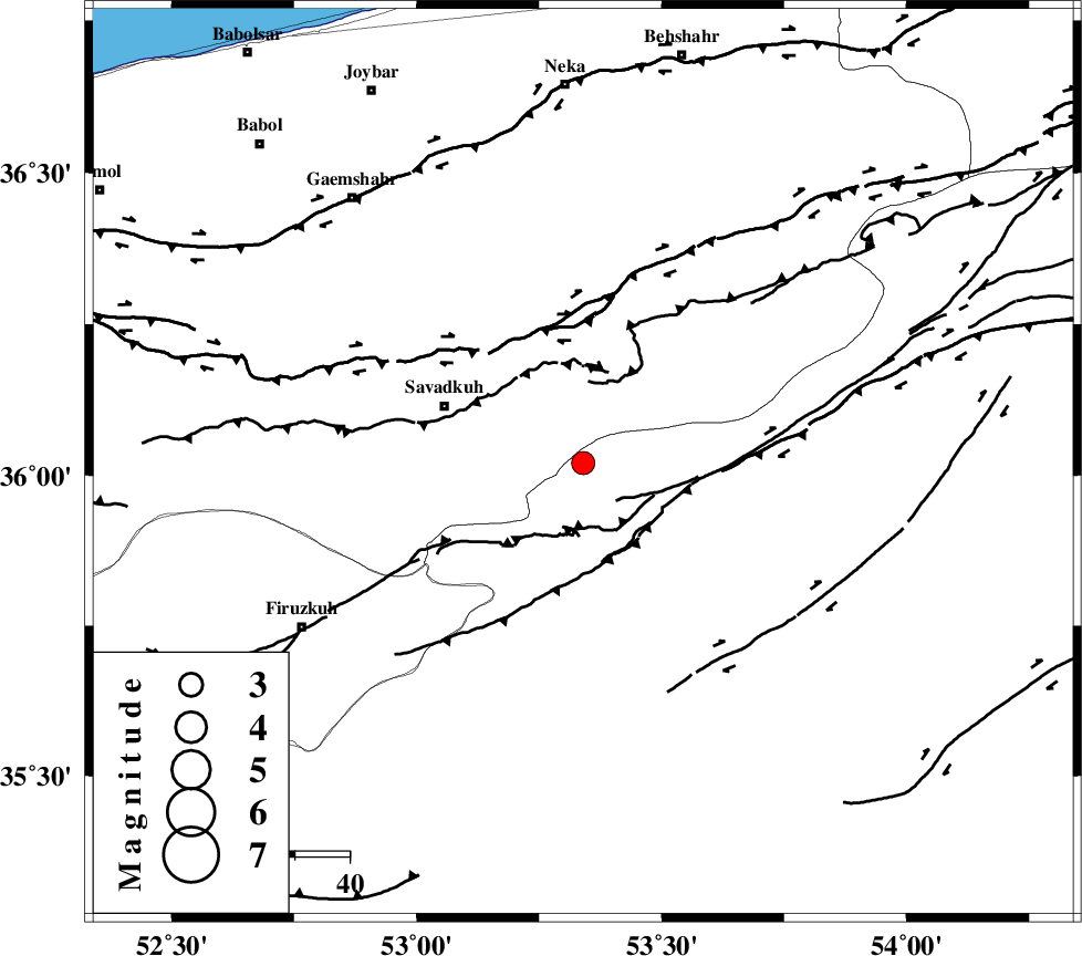
| Location | Lat:36.02 Lon: 53.34 |
| Region | Semnan Province, 28 km East of Pol-E-Sefid |
Nearest Cities |
|
| 11 km East of Sangdeh, Mazandaran Province | |
| 16 km North of Chashem, Semnan Province | |
| 27 km East of Shurmast-e peyrudbar, Mazandaran Province | |
| 28 km East of Pol-E-Sefid, Mazandaran Province | |
| 28 km North of Shahmirzad, Semnan Province | |
| Depth | 15 km |
| Agency | |
Faults within 150 km: |
|
| N_ALBORZ_F (Length: 360 km) , Distance to epicenter: 26 km | |
| ATARI_F (Length: 185 km) , Distance to epicenter: 33 km | |
| DAMGHAN_F (Length: 95 km) , Distance to epicenter: 47 km | |
| Number of Phases | 5 |
| RMS | 0.1 |
| Number of Stations | 6 |
| Error in Latitude | >2.4 km |
| Error in Longitude | 1.3 km |
| Error in Depth | 0 km |
Download waveform in seisan format
to download seisan software Click here
to access information about IIEES stations Click here
Amplitude | ||||||||
| UID | Agency | Station | Component | Amplitude | Period | Arrival Time | Proccessing Time | Signal Clip |
| 89649 | IIEES | GHVR | N | 61.8 | 0.56 | 2013-06-15 02:35:45 | 2013-06-15 04:08:00 | n |
| 89650 | IIEES | GHVR | E | 106.9 | 0.44 | 2013-06-15 02:35:45 | 2013-06-15 04:08:00 | n |
Phase | ||||||||||||
| Agency | Station | Component | Phase Type | Phase Quality | First Motion | Observed Arrival Time | Time Residual | Loc. Flag | Input Weight | Distance | Azimuth | |
| IIEES | CHTH | Z | Pn | E | 2013-06-15 02:34:58 | 0.04 | y | 200 | 267 | |||
| IIEES | MRVT | Z | Pn | E | 2013-06-15 02:35:11 | 0.03 | y | 305 | 53 | |||
| IIEES | ASAO | Z | Pn | E | 2013-06-15 02:35:16 | -0.1 | y | 343 | 243 | |||
| IIEES | YZKH | Z | Pn | E | 2013-06-15 02:35:25 | 0.17 | y | 419 | 164 | |||
| IIEES | TABS | Z | Pn | E | 2013-06-15 02:35:27 | -0.16 | y | 434 | 126 | |||