
Magnitude |
:3.3 |
| Date & Time (UTC) | 2013-01-16 15:19:41.8 |
| Date & Time (Local) | 1391/10/27 18:49:41.8 |
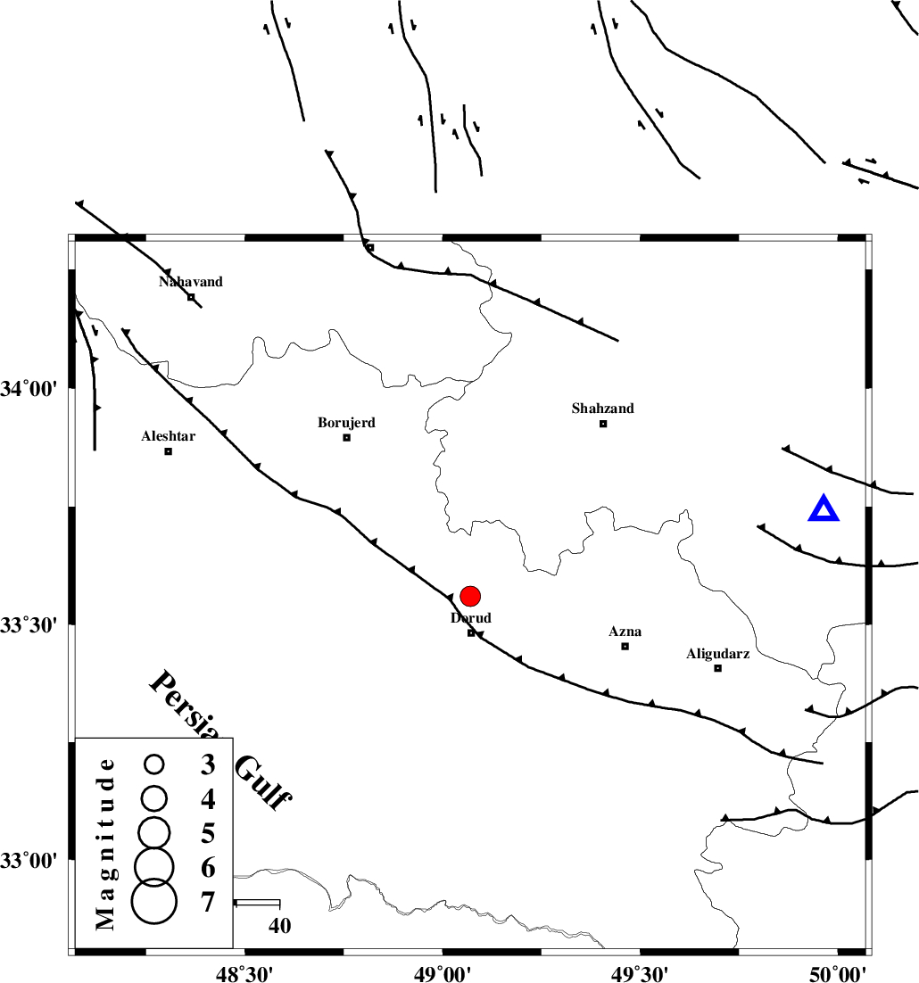
| Location | Lat:33.56 Lon: 49.07 |
| Region | Lorestan Province, 9 km Dorud |
Nearest Cities |
|
| 6 km North of Zhan, Lorestan Province | |
| 9 km North of Dorud, Lorestan Province | |
| 9 km North of Void, Lorestan Province | |
| 12 km East of Kagheh, Lorestan Province | |
| 15 km North West of Heshmatabad, Lorestan Province | |
| Depth | 16 km |
| Agency | |
Faults within 150 km: |
|
| MAIN_ZAGROS_R_F (Length: 1106 km) , Distance to epicenter: 7 km | |
| DORUD (Length: 100 km) , Distance to epicenter: 7 km | |
| HZF4 (Length: 492 km) , Distance to epicenter: 38 km | |
| Number of Phases | 6 |
| RMS | 0.1 |
| Number of Stations | 4 |
| Error in Latitude | >2.3 km |
| Error in Longitude | 5.8 km |
| Error in Depth | 4.8 km |
Download waveform in seisan format
to download seisan software Click here
to access information about IIEES stations Click here
Amplitude | ||||||||
| UID | Agency | Station | Component | Amplitude | Period | Arrival Time | Proccessing Time | Signal Clip |
| 87636 | IIEES | SHGR | N | 523.2 | 0.28 | 2013-01-16 15:20:33 | 2013-01-16 03:49:00 | n |
| 87637 | IIEES | SHGR | E | 398.3 | 0.32 | 2013-01-16 15:20:35 | 2013-01-16 03:49:00 | n |
Phase | ||||||||||||
| Agency | Station | Component | Phase Type | Phase Quality | First Motion | Observed Arrival Time | Time Residual | Loc. Flag | Input Weight | Distance | Azimuth | |
| IIEES | KHMZ | Z | Pg | E | 2013-01-16 15:19:56 | -0.05 | y | 85.5 | 76 | |||
| IIEES | ASAO | Z | Pg | E | 2013-01-16 15:20:05 | 0.03 | y | 141 | 39 | |||
| IIEES | SHGR | Z | Pg | E | 2013-01-16 15:20:08 | -0.15 | y | 163 | 189 | |||
| IIEES | SHGR | N | Sg | E | 2013-01-16 15:20:28 | 0.13 | y | 163 | 189 | |||
| IIEES | CHTH | Z | Pn | E | 2013-01-16 15:20:29 | 0 | y | 322 | 35 | |||
| IIEES | CHTH | N | Sg | E | 2013-01-16 15:21:12 | 0.05 | y | 322 | 35 | |||