
Magnitude |
:3.3 |
| Date & Time (UTC) | 2012-12-18 22:30:55.0 |
| Date & Time (Local) | 1391/9/29 02:00:55.0 |
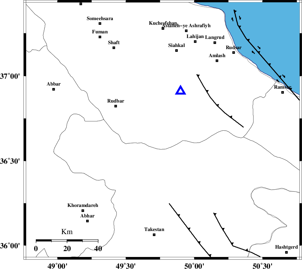
| Location | Lat:36.68 Lon: 49.77 |
| Region | Gilan Province, 34 km South-East of Rudbar |
Nearest Cities |
|
| 3 km of Jirhandeh, Gilan Province | |
| 20 km West of Kelishom, Gilan Province | |
| 22 km South East of Dashtvil, Gilan Province | |
| 23 km South West of Barresar, Gilan Province | |
| 24 km North East of Kuhgir-e sofla, Ghazvin Province | |
| Depth | 15 km |
| Agency | |
Faults within 150 km: |
|
| RUDBAR_F (Length: 93 km) , Distance to epicenter: 8 km | |
| ALAMUTRUD_F (Length: 140 km) , Distance to epicenter: 13 km | |
| N_QAZVIN_F (Length: 72 km) , Distance to epicenter: 30 km | |
| Number of Phases | 6 |
| RMS | 0.1 |
| Number of Stations | 5 |
| Error in Latitude | >3 km |
| Error in Longitude | 2.6 km |
| Error in Depth | 3.8 km |
Download waveform in seisan format
to download seisan software Click here
to access information about IIEES stations Click here
Amplitude | ||||||||
| UID | Agency | Station | Component | Amplitude | Period | Arrival Time | Proccessing Time | Signal Clip |
| 87370 | IIEES | THKV | E | 550.4 | 0.12 | 2012-12-18 22:31:33 | 2012-12-18 10:57:00 | n |
Phase | ||||||||||||
| Agency | Station | Component | Phase Type | Phase Quality | First Motion | Observed Arrival Time | Time Residual | Loc. Flag | Input Weight | Distance | Azimuth | |
| IIEES | ZNJK | Z | Pg | E | 2012-12-18 22:31:11 | 0 | y | 96.6 | 270 | |||
| IIEES | THKV | Z | Pg | E | 2012-12-18 22:31:17 | 0.18 | y | 131 | 130 | |||
| IIEES | THKV | N | Sg | E | 2012-12-18 22:31:33 | 0.03 | y | 131 | 130 | |||
| IIEES | CHTH | Z | Pg | E | 2012-12-18 22:31:19 | -0.21 | y | 149 | 124 | |||
| IIEES | ASAO | Z | Pn | E | 2012-12-18 22:31:32 | -0.02 | y | 237 | 174 | |||
| IIEES | GRMI | Z | Pn | E | 2012-12-18 22:31:38 | 0.02 | y | 289 | 326 | |||