
Magnitude |
:2.9 |
| Date & Time (UTC) | 2012-07-05 06:47:33.2 |
| Date & Time (Local) | 1391/4/15 11:17:33.2 |
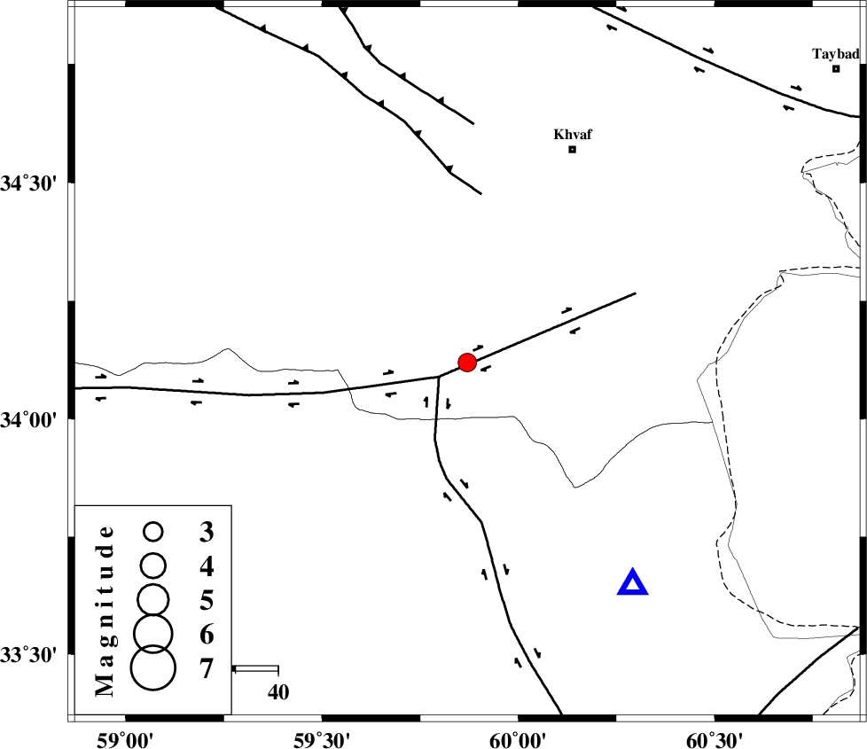
| Location | Lat:34.12 Lon: 59.87 |
| Region | Khorasan(center) Province, 55 km South-West of Khaf |
Nearest Cities |
|
| 17 km South of Ebrahimi, Khorasan(center) Province | |
| 23 km West of Pasgah-e chazul, Khorasan(center) Province | |
| 25 km South of Zuzan, Khorasan(center) Province | |
| 26 km South West of Biasabad, Khorasan(center) Province | |
| 28 km South of Qasemabad, Khorasan(center) Province | |
| Depth | 15 km |
| Agency | |
Faults within 150 km: |
|
| DASHT_E_BAYAZ_F (Length: 177 km) , Distance to epicenter: 7 km | |
| ABRIZ_F (Length: 114 km) , Distance to epicenter: 7 km | |
| JANGAL_F (Length: 111 km) , Distance to epicenter: 40 km | |
| Number of Phases | 5 |
| RMS | 0.1 |
| Number of Stations | 3 |
| Error in Latitude | >5.1 km |
| Error in Longitude | 2.4 km |
| Error in Depth | 7 km |
Download waveform in seisan format
to download seisan software Click here
to access information about IIEES stations Click here
Amplitude | ||||||||
| UID | Agency | Station | Component | Amplitude | Period | Arrival Time | Proccessing Time | Signal Clip |
| 84386 | IIEES | SHRT | N | 780.5 | 0.12 | 2012-07-05 06:47:54 | 2012-07-05 07:33:00 | n |
| 84387 | IIEES | SHRT | E | 710.5 | 0.11 | 2012-07-05 06:47:55 | 2012-07-05 07:33:00 | n |
Phase | ||||||||||||
| Agency | Station | Component | Phase Type | Phase Quality | First Motion | Observed Arrival Time | Time Residual | Loc. Flag | Input Weight | Distance | Azimuth | |
| IIEES | SHRT | Z | Pg | E | 2012-07-05 06:47:44 | 0.14 | y | 65.6 | 143 | |||
| IIEES | SHRT | N | Sg | E | 2012-07-05 06:47:53 | -0.12 | y | 65.6 | 143 | |||
| IIEES | TABS | Z | Pn | E | 2012-07-05 06:48:13 | 0.09 | y | 260 | 259 | |||
| IIEES | TABS | E | Sg | E | 2012-07-05 06:48:46 | -0.02 | y | 260 | 259 | |||
| IIEES | SHRO | Z | Pn | E | 2012-07-05 06:48:31 | -0.12 | y | 409 | 302 | |||