
Magnitude |
:2.8 |
| Date & Time (UTC) | 2011-12-03 02:18:09.3 |
| Date & Time (Local) | 1390/9/12 05:48:09.3 |
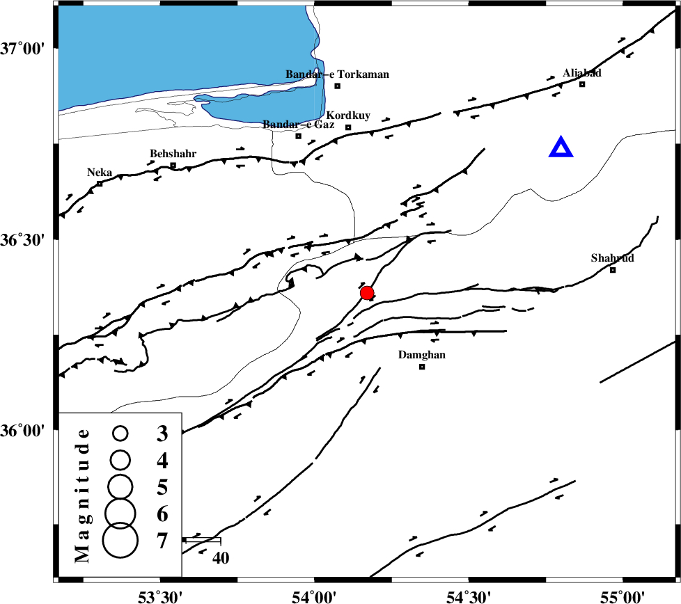
| Location | Lat:36.36 Lon: 54.17 |
| Region | Semnan Province, 27 km North-West of Damghan |
Nearest Cities |
|
| 27 km North West of Damghan, Semnan Province | |
| 33 km South West of Cheharbagh, Golestan Province | |
| 34 km North of Seydabad, Semnan Province | |
| 37 km North of Amirabad, Semnan Province | |
| 37 km South East of Sefid chah, Mazandaran Province | |
| Depth | 15 km |
| Agency | |
Faults within 150 km: |
|
| ASTANEH_F (Length: 72 km) , Distance to epicenter: 10 km | |
| N_ALBORZ_F (Length: 360 km) , Distance to epicenter: 17 km | |
| DAMGHAN_F (Length: 95 km) , Distance to epicenter: 18 km | |
| Number of Phases | 6 |
| RMS | 0.2 |
| Number of Stations | 7 |
| Error in Latitude | >5.2 km |
| Error in Longitude | 3.5 km |
| Error in Depth | 8.7 km |
Download waveform in seisan format
to download seisan software Click here
to access information about IIEES stations Click here
Amplitude | ||||||||
| UID | Agency | Station | Component | Amplitude | Period | Arrival Time | Proccessing Time | Signal Clip |
| 80872 | IIEES | SHRO | N | 96.5 | 0.4 | 2011-12-03 02:19:01 | 2011-12-03 02:02:00 | n |
| 80873 | IIEES | MRVT | N | 47 | 0.44 | 2011-12-03 02:19:20 | 2011-12-03 02:02:00 | n |
| 80874 | IIEES | MRVT | E | 46.5 | 0.31 | 2011-12-03 02:19:20 | 2011-12-03 02:02:00 | n |
| 80875 | IIEES | GHVR | E | 55.5 | 0.32 | 2011-12-03 02:19:52 | 2011-12-03 02:02:00 | n |
Phase | ||||||||||||
| Agency | Station | Component | Phase Type | Phase Quality | First Motion | Observed Arrival Time | Time Residual | Loc. Flag | Input Weight | Distance | Azimuth | |
| IIEES | SHRO | Z | Pg | E | 2011-12-03 02:18:37 | 0 | y | 170 | 103 | |||
| IIEES | MRVT | Z | Pn | E | 2011-12-03 02:18:44 | 0.1 | y | 223 | 49 | |||
| IIEES | CHTH | E | Pn | E | 2011-12-03 02:18:52 | 0.3 | y | 279 | 260 | |||
| IIEES | ASAO | Z | Pn | E | 2011-12-03 02:19:10 | -0.14 | y | 427 | 243 | |||
| IIEES | GRMI | Z | Pn | E | 2011-12-03 02:19:33 | -0.38 | y | 618 | 298 | |||
| IIEES | SHRT | Z | Pn | E | 2011-12-03 02:19:35 | -0.14 | y | 634 | 117 | |||