
Magnitude |
:3.4 |
| Date & Time (UTC) | 2011-07-07 22:19:48.1 |
| Date & Time (Local) | 1390/4/17 02:49:48.1 |
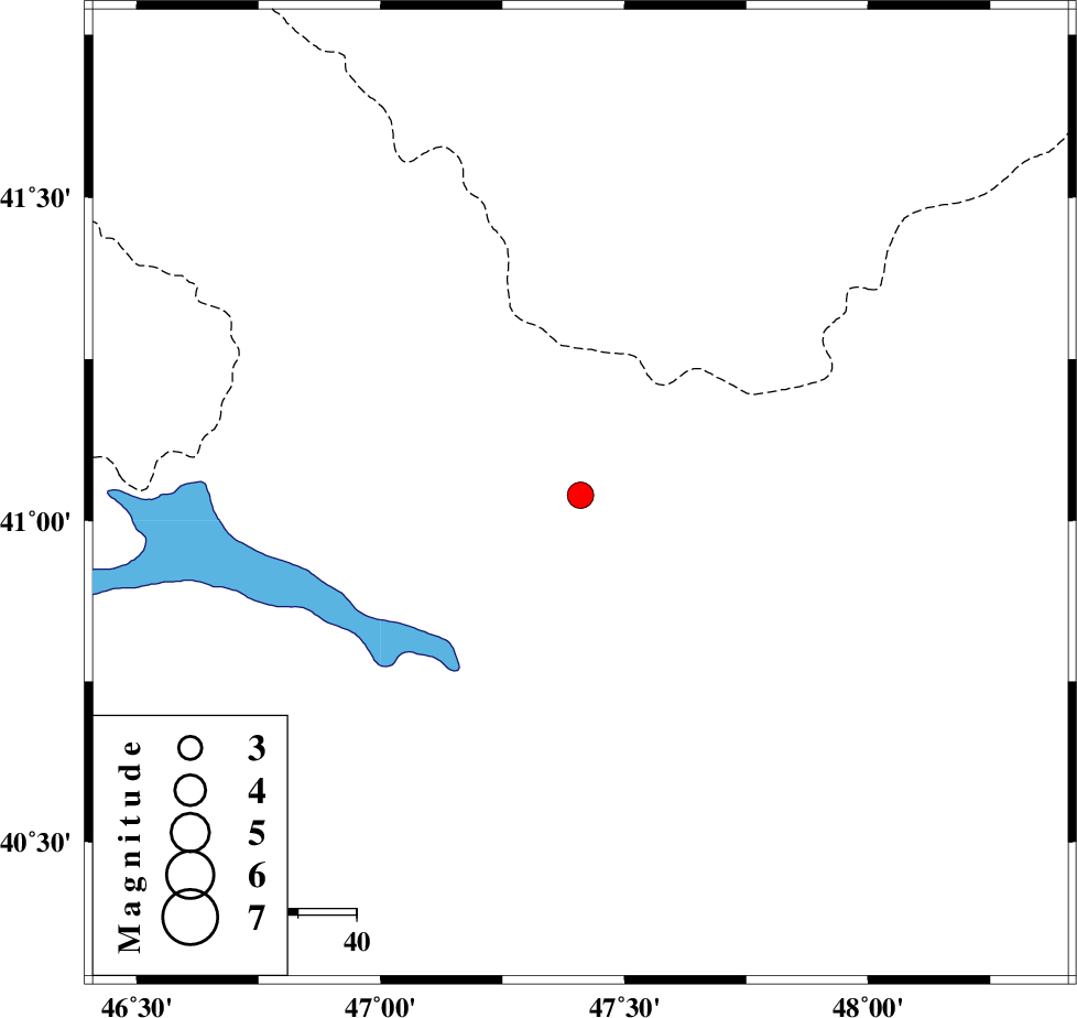
| Location | Lat:41.04 Lon: 47.41 |
| Region | Azerbaijan |
Nearest Cities |
|
| 160 km North West of Pars Abad, Ardebil Province | |
| 161 km North West of Kushlu, Ardebil Province | |
| 165 km North West of Tazeh kand-e gadim, Ardebil Province | |
| 179 km North of Aslanduz, Ardebil Province | |
| 180 km North West of Jaefarabad, Ardebil Province | |
| Depth | 16 km |
| Agency | |
Faults within 150 km: |
|
| Number of Phases | 8 |
| RMS | 0 |
| Number of Stations | 6 |
| Error in Latitude | >6.3 km |
| Error in Longitude | 3 km |
| Error in Depth | 9.3 km |
Download waveform in seisan format
to download seisan software Click here
to access information about IIEES stations Click here
Amplitude | ||||||||
| UID | Agency | Station | Component | Amplitude | Period | Arrival Time | Proccessing Time | Signal Clip |
| 79565 | IIEES | GRMI | N | 219.9 | 0.28 | 2011-07-07 22:21:03 | 2011-07-07 11:00:00 | n |
| 79566 | IIEES | GRMI | E | 228.5 | 0.24 | 2011-07-07 22:21:04 | 2011-07-07 11:00:00 | n |
Phase | ||||||||||||
| Agency | Station | Component | Phase Type | Phase Quality | First Motion | Observed Arrival Time | Time Residual | Loc. Flag | Input Weight | Distance | Azimuth | |
| IIEES | GRMI | Z | Pn | E | 2011-07-07 22:20:26 | 0.01 | y | 251 | 170 | |||
| IIEES | GRMI | E | Sg | E | 2011-07-07 22:20:59 | -0.01 | y | 251 | 170 | |||
| IIEES | MAKU | Z | Pn | E | 2011-07-07 22:20:32 | -0.04 | y | 298 | 232 | |||
| IIEES | MAKU | N | Sg | E | 2011-07-07 22:21:12 | 0.02 | y | 298 | 232 | |||
| IIEES | THKV | N | Pn | E | 2011-07-07 22:21:15 | -0.06 | y | 644 | 151 | |||
| IIEES | CHTH | Z | Pn | E | 2011-07-07 22:21:17 | 0.08 | y | 655 | 149 | |||
| IIEES | SNGE | N | Pn | E | 2011-07-07 22:21:17 | 0.03 | y | 660 | 180 | |||
| IIEES | SHRO | Z | Pn | E | 2011-07-07 22:21:51 | 0 | y | 935 | 124 | |||