
Magnitude |
:3 |
| Date & Time (UTC) | 2011-06-05 23:57:39.5 |
| Date & Time (Local) | 1390/3/16 04:27:39.5 |
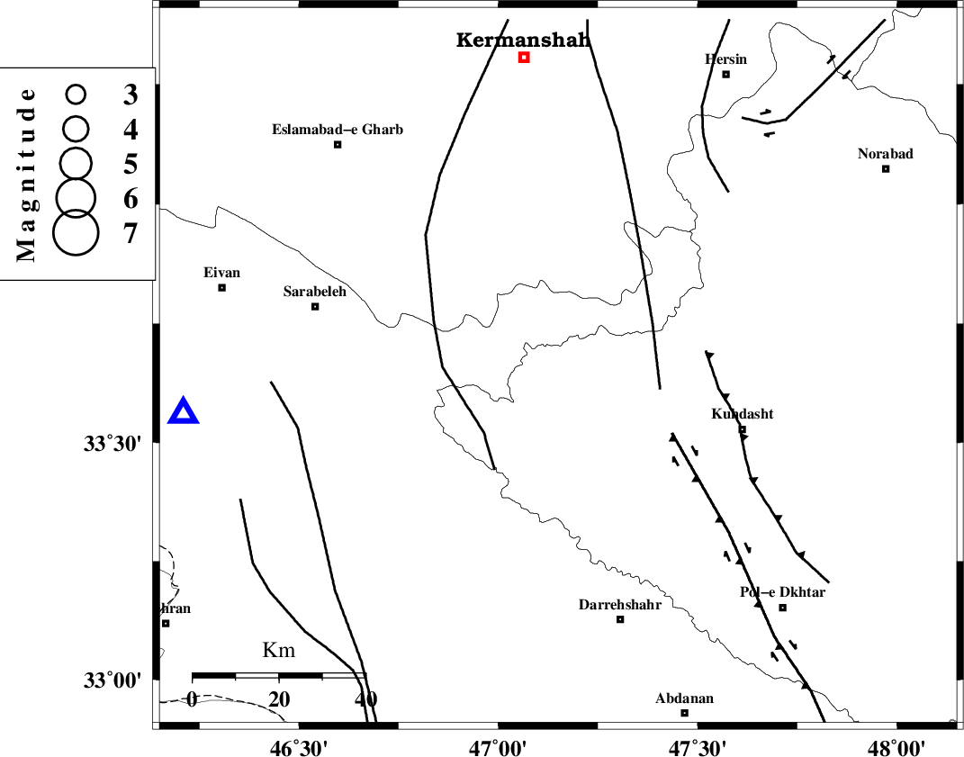
| Location | Lat:33.66 Lon: 47.15 |
| Region | Lorestan Province, 45 km North-West of Kuhdasht |
Nearest Cities |
|
| 23 km North West of Garab, Lorestan Province | |
| 30 km South of Chenar, Kermanshah Province | |
| 32 km East of Belaveh tare-e sofla, Ilam Province | |
| 34 km North West of Kunani, Lorestan Province | |
| 35 km South East of Qale-ye harsam, Kermanshah Province | |
| Depth | 18 km |
| Agency | |
Faults within 150 km: |
|
| HZF4 (Length: 492 km) , Distance to epicenter: 38 km | |
| BALARUD_F_Z1 (Length: 87 km) , Distance to epicenter: 69 km | |
| MFF7 (Length: 99 km) , Distance to epicenter: 69 km | |
| Number of Phases | 5 |
| RMS | 0 |
| Number of Stations | 3 |
| Error in Latitude | >3.6 km |
| Error in Longitude | 2.9 km |
| Error in Depth | 5.7 km |
Download waveform in seisan format
to download seisan software Click here
to access information about IIEES stations Click here
Amplitude | ||||||||
| UID | Agency | Station | Component | Amplitude | Period | Arrival Time | Proccessing Time | Signal Clip |
| 79232 | IIEES | SNGE | E | 567.4 | 0.72 | 2011-06-05 23:58:32 | 2011-06-06 12:16:00 | n |
| 79233 | IIEES | SNGE | N | 511.6 | 0.4 | 2011-06-05 23:58:32 | 2011-06-06 12:16:00 | n |
| 79234 | IIEES | KHMZ | E | 46.9 | 0.56 | 2011-06-05 23:59:03 | 2011-06-06 12:16:00 | n |
| 79235 | IIEES | KHMZ | N | 40.4 | 0.52 | 2011-06-05 23:59:09 | 2011-06-06 12:16:00 | n |
| 79236 | IIEES | ASAO | E | 34.9 | 0.92 | 2011-06-05 23:59:09 | 2011-06-06 12:16:00 | n |
| 79237 | IIEES | ASAO | N | 50.5 | 0.6 | 2011-06-05 23:59:11 | 2011-06-06 12:16:00 | n |
Phase | ||||||||||||
| Agency | Station | Component | Phase Type | Phase Quality | First Motion | Observed Arrival Time | Time Residual | Loc. Flag | Input Weight | Distance | Azimuth | |
| IIEES | SNGE | Z | Pg | E | 2011-06-05 23:58:06 | 0 | y | 160 | 7 | |||
| IIEES | SNGE | E | Sg | E | 2011-06-05 23:58:25 | 0 | y | 160 | 7 | |||
| IIEES | KHMZ | Z | Pn | E | 2011-06-05 23:58:19 | 0 | y | 261 | 87 | |||
| IIEES | ASAO | Z | Pn | E | 2011-06-05 23:58:22 | 0 | y | 283 | 69 | |||
| IIEES | ASAO | E | Sg | E | 2011-06-05 23:58:59 | 0 | y | 283 | 69 | |||