
Magnitude |
:3.1 |
| Date & Time (UTC) | 2011-06-05 13:35:53.0 |
| Date & Time (Local) | 1390/3/15 18:05:53.0 |
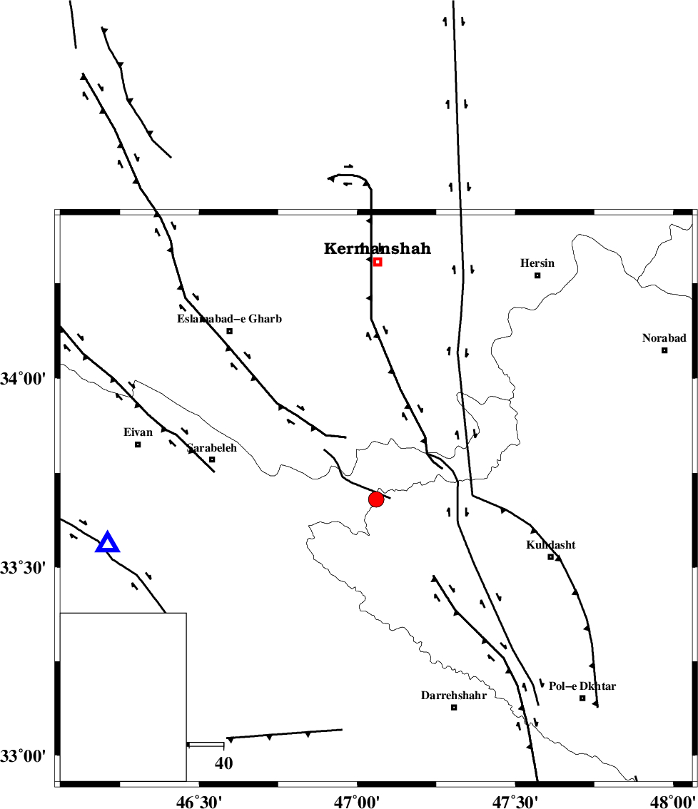
| Location | Lat:33.68 Lon: 47.06 |
| Region | Lorestan Province, 50 km South-East of Sar Ableh |
Nearest Cities |
|
| 24 km North East of Belaveh tare-e sofla, Ilam Province | |
| 28 km South East of Qale-ye harsam, Kermanshah Province | |
| 28 km South of Chenar, Kermanshah Province | |
| 29 km North West of Garab, Lorestan Province | |
| 34 km South East of Darbid-e mansuri, Kermanshah Province | |
| Depth | 14 km |
| Agency | |
Faults within 150 km: |
|
| HZF4 (Length: 492 km) , Distance to epicenter: 39 km | |
| MFF7 (Length: 99 km) , Distance to epicenter: 65 km | |
| BALARUD_F_Z1 (Length: 87 km) , Distance to epicenter: 73 km | |
| Number of Phases | 6 |
| RMS | 0.1 |
| Number of Stations | 4 |
| Error in Latitude | >3.5 km |
| Error in Longitude | 3.2 km |
| Error in Depth | 5.6 km |
Download waveform in seisan format
to download seisan software Click here
to access information about IIEES stations Click here
Amplitude | ||||||||
| UID | Agency | Station | Component | Amplitude | Period | Arrival Time | Proccessing Time | Signal Clip |
| 79228 | IIEES | SNGE | N | 953.5 | 0.48 | 2011-06-05 13:36:45 | 2011-06-05 02:38:00 | n |
| 79229 | IIEES | KHMZ | E | 54.8 | 0.64 | 2011-06-05 13:37:17 | 2011-06-05 02:38:00 | n |
| 79230 | IIEES | ASAO | E | 49.5 | 0.6 | 2011-06-05 13:37:23 | 2011-06-05 02:38:00 | n |
| 79231 | IIEES | ASAO | N | 61.1 | 0.6 | 2011-06-05 13:37:25 | 2011-06-05 02:38:00 | n |
Phase | ||||||||||||
| Agency | Station | Component | Phase Type | Phase Quality | First Motion | Observed Arrival Time | Time Residual | Loc. Flag | Input Weight | Distance | Azimuth | |
| IIEES | SNGE | Z | Pg | E | 2011-06-05 13:36:19 | -0.1 | y | 159 | 9 | |||
| IIEES | SNGE | N | Sg | E | 2011-06-05 13:36:38 | 0 | y | 159 | 9 | |||
| IIEES | KHMZ | Z | Pn | E | 2011-06-05 13:36:34 | 0 | y | 269 | 88 | |||
| IIEES | ASAO | Z | Pn | E | 2011-06-05 13:36:37 | 0.1 | y | 290 | 70 | |||
| IIEES | ASAO | N | Sg | E | 2011-06-05 13:37:14 | 0 | y | 290 | 70 | |||
| IIEES | GRMI | Z | Pn | E | 2011-06-05 13:37:12 | 0 | y | 574 | 7 | |||