
Magnitude |
:3.4 |
| Date & Time (UTC) | 2011-05-29 06:15:20.0 |
| Date & Time (Local) | 1390/3/8 10:45:20.0 |
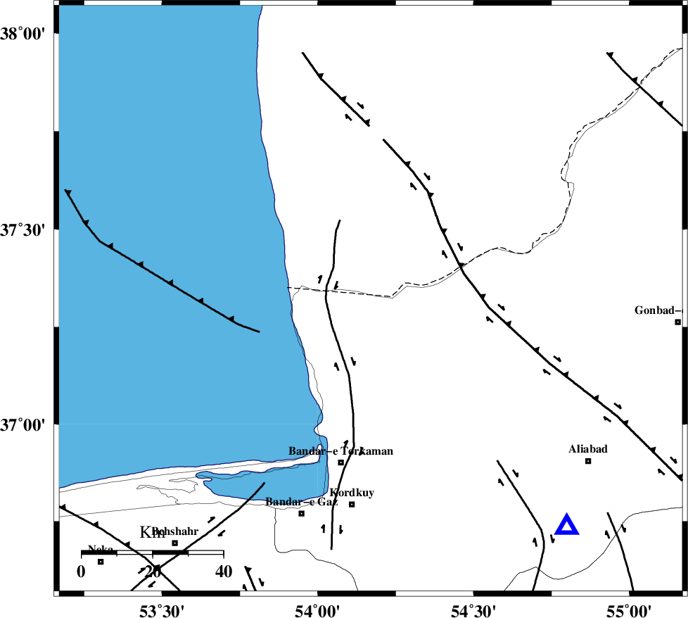
| Location | Lat:37.32 Lon: 54.17 |
| Region | Golestan Province, 47 km North of Bandar-e torkaman |
Nearest Cities |
|
| 26 km North of Gomishtappeh, Golestan Province | |
| 35 km North of Banavar, Golestan Province | |
| 43 km North West of Aq Qaleh, Golestan Province | |
| 45 km North West of Qanqarmeh, Golestan Province | |
| 47 km North of Bandar-e torkaman, Golestan Province | |
| Depth | 15 km |
| Agency | |
Faults within 150 km: |
|
| KHAZAR_F (Length: 523 km) , Distance to epicenter: 58 km | |
| N_ALBORZ_F (Length: 360 km) , Distance to epicenter: 81 km | |
| SHAVAR_F (Length: 87 km) , Distance to epicenter: 86 km | |
| Number of Phases | 6 |
| RMS | 0.1 |
| Number of Stations | 6 |
| Error in Latitude | >2.8 km |
| Error in Longitude | 1.8 km |
| Error in Depth | 0 km |
Download waveform in seisan format
to download seisan software Click here
to access information about IIEES stations Click here
Amplitude | ||||||||
| UID | Agency | Station | Component | Amplitude | Period | Arrival Time | Proccessing Time | Signal Clip |
| 79164 | IIEES | MRVT | N | 355.1 | 0.26 | 2011-05-29 06:16:14 | 2011-05-29 06:33:00 | n |
| 79165 | IIEES | TABS | N | 53.8 | 0.63 | 2011-05-29 06:17:50 | 2011-05-29 06:33:00 | n |
Phase | ||||||||||||
| Agency | Station | Component | Phase Type | Phase Quality | First Motion | Observed Arrival Time | Time Residual | Loc. Flag | Input Weight | Distance | Azimuth | |
| IIEES | MRVT | Z | Pn | E | 2011-05-29 06:15:49 | 0 | y | 174 | 77 | |||
| IIEES | SHRO | Z | Pn | E | 2011-05-29 06:15:55 | 0 | y | 220 | 131 | |||
| IIEES | TABS | Z | Pn | E | 2011-05-29 06:16:28 | 0.2 | y | 487 | 146 | |||
| IIEES | NASN | Z | Pn | E | 2011-05-29 06:16:31 | -0.1 | y | 516 | 194 | |||
| IIEES | GRMI | Z | Pn | E | 2011-05-29 06:16:39 | 0 | y | 575 | 289 | |||
| IIEES | SHRT | Z | Pn | E | 2011-05-29 06:16:52 | -0.3 | y | 689 | 124 | |||