
Magnitude |
:2.7 |
| Date & Time (UTC) | 2011-05-17 01:09:38.4 |
| Date & Time (Local) | 1390/2/27 05:39:38.4 |
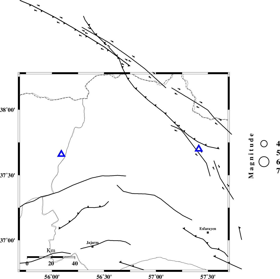
| Location | Lat:37.52 Lon: 56.69 |
| Region | Khorasan(north) Province, 22 km West of Ashkhaneh |
Nearest Cities |
|
| 22 km West of Ashkhaneh, Khorasan(north) Province | |
| 23 km North West of Shogan, Khorasan(north) Province | |
| 31 km South West of Pish qaleh, Khorasan(north) Province | |
| 40 km South East of Garmab, Khorasan(north) Province | |
| 53 km South West of Tangehzar, Khorasan(north) Province | |
| Depth | 18 km |
| Agency | |
Faults within 150 km: |
|
| ROBATE_QARABIL_F (Length: 168 km) , Distance to epicenter: 19 km | |
| ESFARAYEN_F (Length: 111 km) , Distance to epicenter: 34 km | |
| JAJARAM_F (Length: 77 km) , Distance to epicenter: 50 km | |
| Number of Phases | 5 |
| RMS | 0.1 |
| Number of Stations | 3 |
| Error in Latitude | >2 km |
| Error in Longitude | 2 km |
| Error in Depth | 4.7 km |
Download waveform in seisan format
to download seisan software Click here
to access information about IIEES stations Click here
Amplitude | ||||||||
| UID | Agency | Station | Component | Amplitude | Period | Arrival Time | Proccessing Time | Signal Clip |
| 79026 | IIEES | MRVT | E | 1291.4 | 0.2 | 2011-05-17 01:09:57 | 2011-05-17 01:28:00 | n |
| 79027 | IIEES | MRVT | N | 1162 | 0.4 | 2011-05-17 01:09:58 | 2011-05-17 01:28:00 | n |
| 79028 | IIEES | BJRD | E | 205.6 | 0.6 | 2011-05-17 01:10:08 | 2011-05-17 01:28:00 | n |
| 79029 | IIEES | SHRO | N | 53.1 | 0.32 | 2011-05-17 01:10:35 | 2011-05-17 01:28:00 | n |
| 79030 | IIEES | SHRO | E | 46.9 | 0.64 | 2011-05-17 01:10:38 | 2011-05-17 01:28:00 | n |
Phase | ||||||||||||
| Agency | Station | Component | Phase Type | Phase Quality | First Motion | Observed Arrival Time | Time Residual | Loc. Flag | Input Weight | Distance | Azimuth | |
| IIEES | MRVT | Z | Pg | E | 2011-05-17 01:09:48 | 0 | y | 55.6 | 287 | |||
| IIEES | BJRD | N | Pg | E | 2011-05-17 01:09:50 | 0.2 | y | 66.4 | 72 | |||
| IIEES | BJRD | E | Sg | E | 2011-05-17 01:09:58 | -0.1 | y | 66.4 | 72 | |||
| IIEES | SHRO | Z | Pn | E | 2011-05-17 01:10:07 | 0 | y | 178 | 200 | |||
| IIEES | SHRO | E | Sg | E | 2011-05-17 01:10:29 | 0 | y | 178 | 200 | |||