
Magnitude |
:3.6 |
| Date & Time (UTC) | 2011-01-08 10:29:49.7 |
| Date & Time (Local) | 1389/10/18 13:59:49.7 |
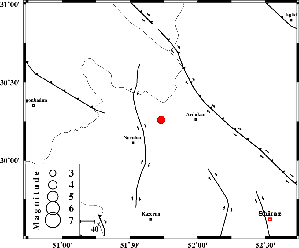
| Location | Lat:30.26 Lon: 51.73 |
| Region | Fars Province, 25 km West of Ardakan |
Nearest Cities |
|
| 21 km North East of Masiri, Fars Province | |
| 25 km West of Ardakan, Fars Province | |
| 25 km South West of Kamhar, Fars Province | |
| 26 km North East of Nurabad, Fars Province | |
| 27 km North East of Gachgaran, Fars Province | |
| Depth | 14 km |
| Agency | |
Faults within 150 km: |
|
| KAZERUN_F (Length: 96 km) , Distance to epicenter: 20 km | |
| HZF3 (Length: 197 km) , Distance to epicenter: 24 km | |
| MISHAN_F (Length: 76 km) , Distance to epicenter: 43 km | |
| Number of Phases | 6 |
| RMS | 0.3 |
| Number of Stations | 4 |
| Error in Latitude | >8.6 km |
| Error in Longitude | 5.8 km |
| Error in Depth | 27.9 km |
Download waveform in seisan format
to download seisan software Click here
to access information about IIEES stations Click here
Amplitude | ||||||||
| UID | Agency | Station | Component | Amplitude | Period | Arrival Time | Proccessing Time | Signal Clip |
| 76990 | IIEES | AHRM | N | 1191.1 | 0.68 | 2011-01-08 10:30:39 | 2011-01-08 10:51:00 | n |
| 76991 | IIEES | GHIR | N | 320.1 | 0.77 | 2011-01-08 10:31:11 | 2011-01-08 10:51:00 | n |
Phase | ||||||||||||
| Agency | Station | Component | Phase Type | Phase Quality | First Motion | Observed Arrival Time | Time Residual | Loc. Flag | Input Weight | Distance | Azimuth | |
| IIEES | AHRM | Z | Pg | E | 2011-01-08 10:30:15 | -0.6 | y | 161 | 195 | |||
| IIEES | AHRM | E | Sg | E | 2011-01-08 10:30:35 | 0.3 | y | 161 | 195 | |||
| IIEES | GHIR | Z | Pg | E | 2011-01-08 10:30:30 | -0.1 | y | 251 | 151 | |||
| IIEES | GHIR | N | Sg | E | 2011-01-08 10:31:00 | 0.2 | y | 251 | 151 | |||
| IIEES | NASN | Z | Pn | E | 2011-01-08 10:30:34 | 0 | y | 299 | 20 | |||
| IIEES | SHGR | Z | Pn | E | 2011-01-08 10:30:40 | 0.2 | y | 346 | 307 | |||