
Magnitude |
:3 |
| Date & Time (UTC) | 2010-12-01 10:06:00.8 |
| Date & Time (Local) | 1389/9/10 13:36:00.8 |
| Location | Lat:35.76 Lon: 57.85 |
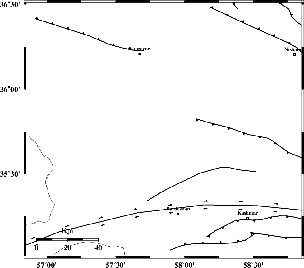
| Region | Khorasan(center) Province, 56 km North-West of Bardeskan |
Nearest Cities |
|
| 9 km of Tondak, Khorasan(center) Province | |
| 22 km East of Bejdan, Khorasan(center) Province | |
| 23 km South of Sheshtamad, Khorasan(center) Province | |
| 28 km North West of Ghaleh meidan, Khorasan(center) Province | |
| 44 km South West of Shamkan, Khorasan(center) Province | |
| Depth | 18 km |
| Agency | |
Faults within 150 km: |
|
| BALHAR_F (Length: 117 km) , Distance to epicenter: 22 km | |
| BIJVARD_F (Length: 83 km) , Distance to epicenter: 37 km | |
| DORUNEH_F (Length: 713 km) , Distance to epicenter: 53 km | |
| Number of Phases | 6 |
| RMS | 0.2 |
| Number of Stations | 5 |
| Error in Latitude | >2.3 km |
| Error in Longitude | 5.6 km |
| Error in Depth | 7.3 km |
Download waveform in seisan format
to download seisan software Click here
to access information about IIEES stations Click here
Amplitude | ||||||||
| UID | Agency | Station | Component | Amplitude | Period | Arrival Time | Proccessing Time | Signal Clip |
| 74890 | IIEES | SHRO | N | 124.9 | 0.49 | 2010-12-01 10:06:54 | 2010-12-01 10:38:00 | n |
| 74891 | IIEES | SHRO | E | 123.5 | 0.53 | 2010-12-01 10:07:01 | 2010-12-01 10:38:00 | n |
| 74892 | IIEES | TABS | N | 94.9 | 0.62 | 2010-12-01 10:07:24 | 2010-12-01 10:38:00 | n |
| 74893 | IIEES | SHRT | E | 79.4 | 0.63 | 2010-12-01 10:07:38 | 2010-12-01 10:38:00 | n |
| 74894 | IIEES | SHRT | N | 74.3 | 0.53 | 2010-12-01 10:07:46 | 2010-12-01 10:38:00 | n |
Phase | ||||||||||||
| Agency | Station | Component | Phase Type | Phase Quality | First Motion | Observed Arrival Time | Time Residual | Loc. Flag | Input Weight | Distance | Azimuth | |
| IIEES | SHRO | N | Pg | E | 2010-12-01 10:06:28 | 0.2 | y | 168 | 280 | |||
| IIEES | BJRD | Z | Pn | E | 2010-12-01 10:06:35 | -0.1 | y | 219 | 350 | |||
| IIEES | BJRD | N | Sg | E | 2010-12-01 10:07:03 | 0 | y | 219 | 350 | |||
| IIEES | TABS | Z | Pn | E | 2010-12-01 10:06:38 | -0.3 | y | 243 | 196 | |||
| IIEES | MRVT | Z | Pn | E | 2010-12-01 10:06:40 | 0.1 | y | 264 | 324 | |||
| IIEES | SHRT | Z | Pn | E | 2010-12-01 10:06:48 | 0.2 | y | 324 | 136 | |||