
Magnitude |
:2.6 |
| Date & Time (UTC) | 2010-11-06 04:22:00.2 |
| Date & Time (Local) | 1389/8/15 07:52:00.2 |
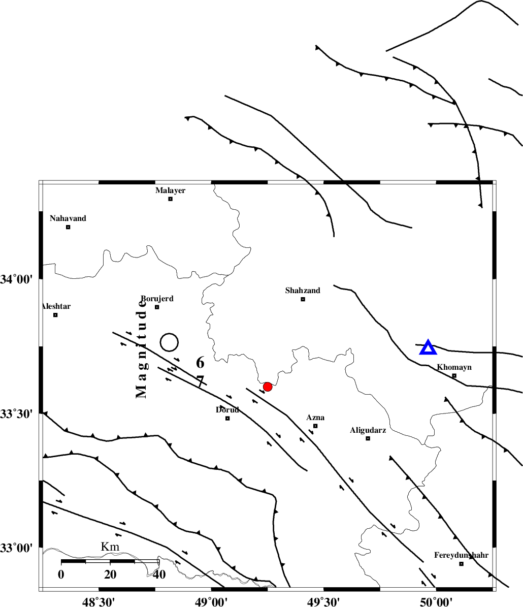
| Location | Lat:33.6 Lon: 49.25 |
| Region | Lorestan Province, 21 km North-East of Dorud |
Nearest Cities |
|
| 13 km North East of Zhan, Lorestan Province | |
| 17 km North of Heshmatabad, Lorestan Province | |
| 18 km North of Darband, Lorestan Province | |
| 19 km South of Hendudar, Markazi Province | |
| 21 km North East of Dorud, Lorestan Province | |
| Depth | 8 km |
| Agency | |
Faults within 150 km: |
|
| MAIN_ZAGROS_R_F (Length: 1106 km) , Distance to epicenter: 14 km | |
| DORUD (Length: 100 km) , Distance to epicenter: 19 km | |
| HZF4 (Length: 492 km) , Distance to epicenter: 48 km | |
| Number of Phases | 4 |
| RMS | 0 |
| Number of Stations | 4 |
| Error in Latitude | >2.8 km |
| Error in Longitude | 4.4 km |
| Error in Depth | 3.8 km |
Download waveform in seisan format
to download seisan software Click here
to access information about IIEES stations Click here
Amplitude | ||||||||
| UID | Agency | Station | Component | Amplitude | Period | Arrival Time | Proccessing Time | Signal Clip |
| 72990 | IIEES | ASAO | E | 143.3 | 0.42 | 2010-11-06 04:22:46 | 2010-11-06 05:02:00 | n |
| 72991 | IIEES | SHGR | N | 96.2 | 0.5 | 2010-11-06 04:22:50 | 2010-11-06 05:02:00 | n |
| 72992 | IIEES | SHGR | E | 76.1 | 0.43 | 2010-11-06 04:22:58 | 2010-11-06 05:02:00 | n |
| 72993 | IIEES | GHVR | N | 51.4 | 0.4 | 2010-11-06 04:23:10 | 2010-11-06 05:02:00 | n |
Phase | ||||||||||||
| Agency | Station | Component | Phase Type | Phase Quality | First Motion | Observed Arrival Time | Time Residual | Loc. Flag | Input Weight | Distance | Azimuth | |
| IIEES | KHMZ | Z | Pg | E | 2010-11-06 04:22:12 | 0 | y | 67.8 | 76 | |||
| IIEES | ASAO | Z | Pg | E | 2010-11-06 04:22:22 | 0 | y | 127 | 34 | |||
| IIEES | SHGR | Z | Pn | E | 2010-11-06 04:22:29 | 0 | y | 170 | 194 | |||
| IIEES | GHVR | Z | Pn | E | 2010-11-06 04:22:34 | 0 | y | 208 | 61 | |||