
Magnitude |
:3.1 |
| Date & Time (UTC) | 2010-08-06 06:57:11.3 |
| Date & Time (Local) | 1389/5/15 11:27:11.3 |
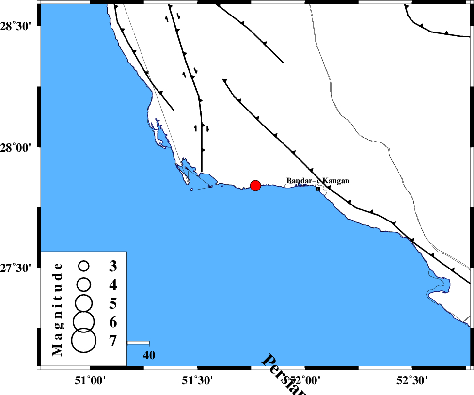
| Location | Lat:27.84 Lon: 51.77 |
| Region | Bushehr Province, 29 km West of Bandar-e kangan |
Nearest Cities |
|
| 26 km South of Abdan, Bushehr Province | |
| 29 km North West of Bandar-e kangan, Bushehr Province | |
| 37 km South West of Riz, Bushehr Province | |
| 38 km South East of Bardkhun, Bushehr Province | |
| 44 km South East of Abkesh, Bushehr Province | |
| Depth | 14 km |
| Agency | |
Faults within 150 km: |
|
| MFF3 (Length: 292 km) , Distance to epicenter: 23 km | |
| BORAZJAN_F (Length: 168 km) , Distance to epicenter: 25 km | |
| ZFF2 (Length: 84 km) , Distance to epicenter: 51 km | |
| Number of Phases | 4 |
| RMS | 0 |
| Number of Stations | 3 |
| Error in Latitude | >7 km |
| Error in Longitude | 2.6 km |
| Error in Depth | 6.4 km |
Download waveform in seisan format
to download seisan software Click here
to access information about IIEES stations Click here
Amplitude | ||||||||
| UID | Agency | Station | Component | Amplitude | Period | Arrival Time | Proccessing Time | Signal Clip |
| 67830 | IIEES | GHIR | N | 365.4 | 0.64 | 2010-08-06 06:57:56 | 2010-08-06 07:13:00 | n |
| 67831 | IIEES | GHIR | E | 518.1 | 0.44 | 2010-08-06 06:57:58 | 2010-08-06 07:13:00 | n |
| 67832 | IIEES | KRBR | N | 9.1 | 0.48 | 2010-08-06 06:59:27 | 2010-08-06 07:13:00 | n |
| 67833 | IIEES | KRBR | E | 12.3 | 0.56 | 2010-08-06 06:59:48 | 2010-08-06 07:13:00 | n |
Phase | ||||||||||||
| Agency | Station | Component | Phase Type | Phase Quality | First Motion | Observed Arrival Time | Time Residual | Loc. Flag | Input Weight | Distance | Azimuth | |
| IIEES | AHRM | Z | P | E | 2010-08-06 06:57:31 | 0 | y | 123 | 338 | |||
| IIEES | GHIR | Z | Pg | E | 2010-08-06 06:57:32 | -0.1 | y | 129 | 67 | |||
| IIEES | GHIR | N | Sg | E | 2010-08-06 06:57:48 | 0 | y | 129 | 67 | |||
| IIEES | KRBR | Z | P | E | 2010-08-06 06:58:26 | 0.1 | y | 542 | 63 | |||