
Magnitude |
:3.1 |
| Date & Time (UTC) | 2010-06-20 19:11:50.8 |
| Date & Time (Local) | 1389/3/30 23:41:50.8 |
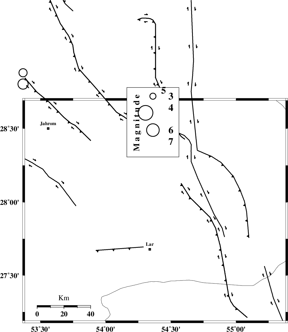
| Location | Lat:27.94 Lon: 54.38 |
| Region | Fars Province, 29 km North of Lar |
Nearest Cities |
|
| 11 km North of Dehkuyeh, Fars Province | |
| 27 km North of Latifi, Fars Province | |
| 29 km North of Lar, Fars Province | |
| 38 km North East of Grash, Fars Province | |
| 41 km North East of Avaz, Fars Province | |
| Depth | 15 km |
| Agency | |
Faults within 150 km: |
|
| BERIZ_F (Length: 49 km) , Distance to epicenter: 20 km | |
| LAR_F (Length: 99 km) , Distance to epicenter: 45 km | |
| HZF2 (Length: 437 km) , Distance to epicenter: 60 km | |
| Number of Phases | 3 |
| RMS | 0 |
| Number of Stations | 3 |
| Error in Latitude | >3.4 km |
| Error in Longitude | 1.6 km |
| Error in Depth | 0 km |
Download waveform in seisan format
to download seisan software Click here
to access information about IIEES stations Click here
Amplitude | ||||||||
| UID | Agency | Station | Component | Amplitude | Period | Arrival Time | Proccessing Time | Signal Clip |
| 64738 | IIEES | BNDS | E | 154.1 | 1.05 | 2010-06-20 19:13:00 | 2010-06-21 02:39:00 | n |
| 64739 | IIEES | KRBR | E | 69.8 | 0.54 | 2010-06-20 19:13:41 | 2010-06-21 02:39:00 | n |
| 64740 | IIEES | KRBR | N | 78.3 | 1.89 | 2010-06-20 19:13:43 | 2010-06-21 02:39:00 | n |
Phase | ||||||||||||
| Agency | Station | Component | Phase Type | Phase Quality | First Motion | Observed Arrival Time | Time Residual | Loc. Flag | Input Weight | Distance | Azimuth | |
| IIEES | GHIR | Z | Pg | E | 2010-06-20 19:12:14 | 0 | y | 142 | 286 | |||
| IIEES | BNDS | Z | Pg | E | 2010-06-20 19:12:21 | 0 | y | 187 | 108 | |||
| IIEES | KRBR | Z | Pn | E | 2010-06-20 19:12:38 | 0 | y | 324 | 45 | |||