
Magnitude |
:2.6 |
| Date & Time (UTC) | 2010-06-13 13:22:28.8 |
| Date & Time (Local) | 1389/3/23 17:52:28.8 |
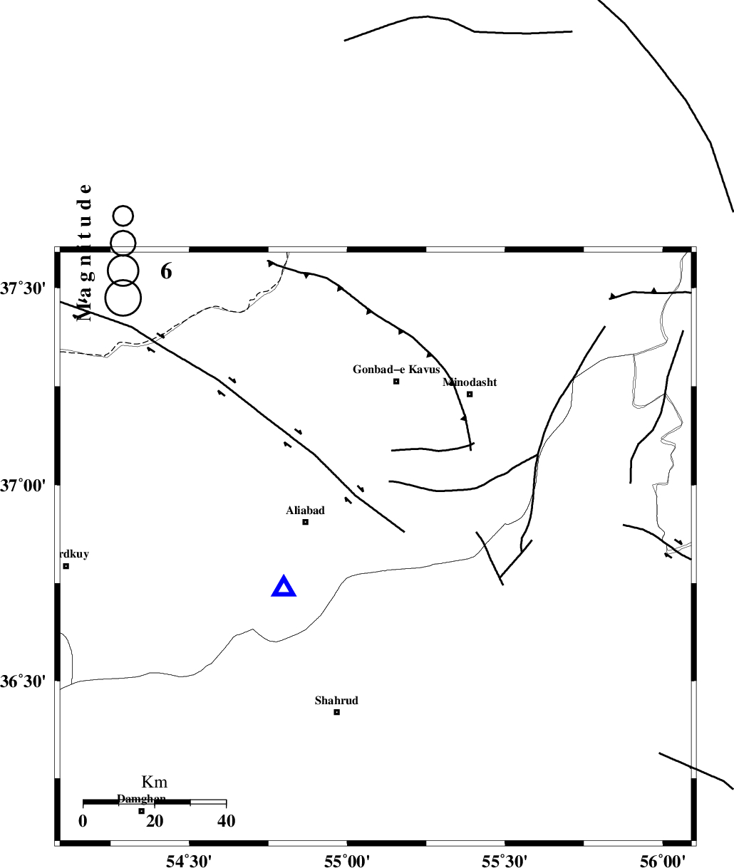
| Location | Lat:36.84 Lon: 55.09 |
| Region | Golestan Province, 20 km South of Ramian |
Nearest Cities |
|
| 20 km South of Ramian, Golestan Province | |
| 21 km East of Ali Abad, Golestan Province | |
| 21 km South East of Khanbebin, Golestan Province | |
| 22 km South of Deland, Golestan Province | |
| 23 km North of Qaleh-ye nokharqan, Semnan Province | |
| Depth | 14 km |
| Agency | |
Faults within 150 km: |
|
| SHAVAR_F (Length: 87 km) , Distance to epicenter: 11 km | |
| KHAZAR_F (Length: 523 km) , Distance to epicenter: 22 km | |
| ROBATE_QARABIL_F (Length: 168 km) , Distance to epicenter: 31 km | |
| Number of Phases | 5 |
| RMS | 0.3 |
| Number of Stations | 4 |
| Error in Latitude | >5.4 km |
| Error in Longitude | 7.1 km |
| Error in Depth | 11.3 km |
Download waveform in seisan format
to download seisan software Click here
to access information about IIEES stations Click here
Amplitude | ||||||||
| UID | Agency | Station | Component | Amplitude | Period | Arrival Time | Proccessing Time | Signal Clip |
| 64718 | IIEES | MRVT | N | 97.3 | 0.52 | 2010-06-13 13:23:11 | 2010-06-19 09:34:00 | n |
| 64719 | IIEES | MRVT | E | 154.6 | 0.24 | 2010-06-13 13:23:12 | 2010-06-19 09:34:00 | n |
| 64720 | IIEES | DAMV | E | 22.6 | 0.4 | 2010-06-13 13:23:57 | 2010-06-19 09:34:00 | n |
| 64721 | IIEES | DAMV | N | 22 | 0.36 | 2010-06-13 13:24:00 | 2010-06-19 09:34:00 | n |
Phase | ||||||||||||
| Agency | Station | Component | Phase Type | Phase Quality | First Motion | Observed Arrival Time | Time Residual | Loc. Flag | Input Weight | Distance | Azimuth | |
| IIEES | SHRO | Z | Pg | E | 2010-06-13 13:22:49 | -0.1 | y | 124 | 138 | |||
| IIEES | MRVT | Z | Pg | E | 2010-06-13 13:22:49 | -0.4 | y | 127 | 44 | |||
| IIEES | BJRD | Z | Pn | E | 2010-06-13 13:23:04 | 0.1 | y | 226 | 64 | |||
| IIEES | BJRD | N | Sg | E | 2010-06-13 13:23:33 | 0.3 | y | 226 | 64 | |||
| IIEES | DAMV | Z | Pn | E | 2010-06-13 13:23:15 | 0.2 | y | 311 | 245 | |||