
Magnitude |
:3.4 |
| Date & Time (UTC) | 2008-06-15 12:43:30.4 |
| Date & Time (Local) | 1387/3/26 17:13:30.4 |
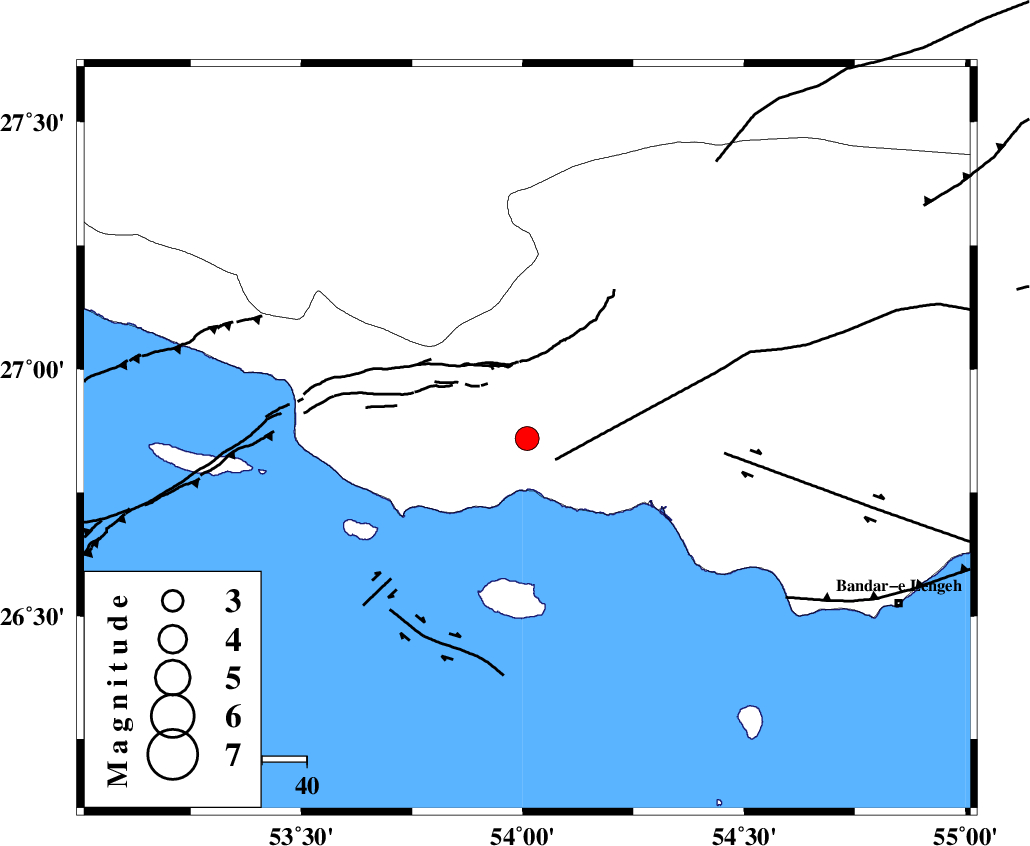
| Location | Lat:26.86 Lon: 54.01 |
| Region | 51 km South-West of Bastak, Hormozgan Province |
Nearest Cities |
|
| 32 km South West of Jenah, Hormozgan Province | |
| 44 km South East of Ahl, Fars Province | |
| 51 km South West of Bastak, Hormozgan Province | |
| 56 km South East of Ashkenan, Fars Province | |
| 71 km South of Bagh, Fars Province | |
| Depth | 14 km |
| Agency | |
Faults within 150 km: |
|
| MFF3 (Length: 292 km) , Distance to epicenter: 7 km | |
| ZFF1 (Length: 165 km) , Distance to epicenter: 12 km | |
| MFF1 (Length: 180 km) , Distance to epicenter: 24 km | |
| Number of Phases | 4 |
| RMS | 0 |
| Number of Stations | 3 |
| Error in Latitude | >7.7 km |
| Error in Longitude | 5.1 km |
| Error in Depth | 5.1 km |
Download waveform in seisan format
to download seisan software Click here
to access information about IIEES stations Click here
Amplitude | ||||||||
| UID | Agency | Station | Component | Amplitude | Period | Arrival Time | Proccessing Time | Signal Clip |
| 49364 | IIEES | GHIR | E | 387.7 | 0.56 | 2008-06-15 12:44:26 | 2009-01-18 12:56:00 | n |
| 49365 | IIEES | GHIR | N | 317 | 0.6 | 2008-06-15 12:44:38 | 2009-01-18 12:56:00 | n |
| 49366 | IIEES | BNDS | N | 407.8 | 0.52 | 2008-06-15 12:44:57 | 2009-01-18 12:56:00 | n |
| 49367 | IIEES | KRBR | N | 59 | 0.56 | 2008-06-15 12:45:45 | 2009-01-18 12:56:00 | n |
| 49368 | IIEES | KRBR | E | 59 | 0.64 | 2008-06-15 12:45:47 | 2009-01-18 12:56:00 | n |
Phase | ||||||||||||
| Agency | Station | Component | Phase Type | Phase Quality | First Motion | Observed Arrival Time | Time Residual | Loc. Flag | Input Weight | Distance | Azimuth | |
| IIEES | GHIR | Z | Pg | E | 2008-06-15 12:44:01 | 0 | y | 188 | 328 | |||
| IIEES | GHIR | N | Sg | E | 2008-06-15 12:44:24 | 0 | y | 188 | 328 | |||
| IIEES | BNDS | Z | Pg | E | 2008-06-15 12:44:06 | 0 | y | 222 | 74 | |||
| IIEES | KRBR | Z | Pn | E | 2008-06-15 12:44:32 | 0.1 | y | 439 | 37 | |||