
Magnitude |
:2.7 |
| Date & Time (UTC) | 2007-06-28 12:04:13.9 |
| Date & Time (Local) | 1386/4/7 15:34:13.9 |
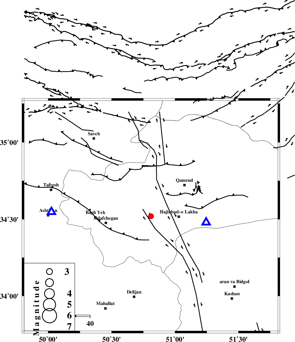
| Location | Lat:34.52 Lon: 50.81 |
| Region | 15 km South of Qom, Qom Province |
Nearest Cities |
|
| 15 km South of Qom, Qom Province | |
| 17 km North of Kahak, Qom Province | |
| 20 km North West of Hajiabad-e lakha, Qom Province | |
| 33 km North East of Salafchegan, Qom Province | |
| 33 km South West of Qamrud, Qom Province | |
| Depth | 36 km |
| Agency | |
Faults within 150 km: |
|
| INDES_F (Length: 98 km) , Distance to epicenter: 24 km | |
| KUSHK_E_NOSRAT_F (Length: 230 km) , Distance to epicenter: 41 km | |
| KASHAN_F (Length: 44 km) , Distance to epicenter: 59 km | |
| Number of Phases | 7 |
| RMS | 0.2 |
| Number of Stations | 4 |
| Error in Latitude | >3.6 km |
| Error in Longitude | 5.6 km |
| Error in Depth | 8.4 km |
Download waveform in seisan format
to download seisan software Click here
to access information about IIEES stations Click here
Amplitude | ||||||||
| UID | Agency | Station | Component | Amplitude | Period | Arrival Time | Proccessing Time | Signal Clip |
| 38677 | IIEES | GHVR | N | 435.7 | 0.16 | 2007-06-28 12:04:29 | 2007-07-30 02:44:00 | n |
| 38678 | IIEES | GHVR | E | 300.8 | 0.24 | 2007-06-28 12:04:30 | 2007-07-30 02:44:00 | n |
| 38679 | IIEES | DAMV | N | 137.9 | 0.2 | 2007-06-28 12:05:01 | 2007-07-30 02:44:00 | n |
| 38680 | IIEES | DAMV | E | 165.5 | 0.16 | 2007-06-28 12:05:01 | 2007-07-30 02:44:00 | n |
Phase | ||||||||||||
| Agency | Station | Component | Phase Type | Phase Quality | First Motion | Observed Arrival Time | Time Residual | Loc. Flag | Input Weight | Distance | Azimuth | |
| IIEES | GHVR | Z | Pg | E | 2007-06-28 12:04:22 | -0.1 | y | 39.8 | 96 | |||
| IIEES | GHVR | E | Sg | E | 2007-06-28 12:04:29 | 0.1 | y | 39.8 | 96 | |||
| IIEES | THKV | Z | Pg | E | 2007-06-28 12:04:39 | 0.3 | y | 155 | 2 | |||
| IIEES | CHTH | Z | Pg | E | 2007-06-28 12:04:39 | -0.2 | y | 157 | 10 | |||
| IIEES | CHTH | E | Sg | E | 2007-06-28 12:04:58 | -0.1 | y | 157 | 10 | |||
| IIEES | DAMV | Z | Pg | E | 2007-06-28 12:04:40 | 0 | y | 162 | 40 | |||
| IIEES | DAMV | E | Sg | E | 2007-06-28 12:05:00 | 0.1 | y | 162 | 40 | |||