
Magnitude |
:2.6 |
| Date & Time (UTC) | 2007-01-24 01:33:01.8 |
| Date & Time (Local) | 1385/11/4 05:03:01.8 |
| Location | Lat:29.13 Lon: 57.4 |
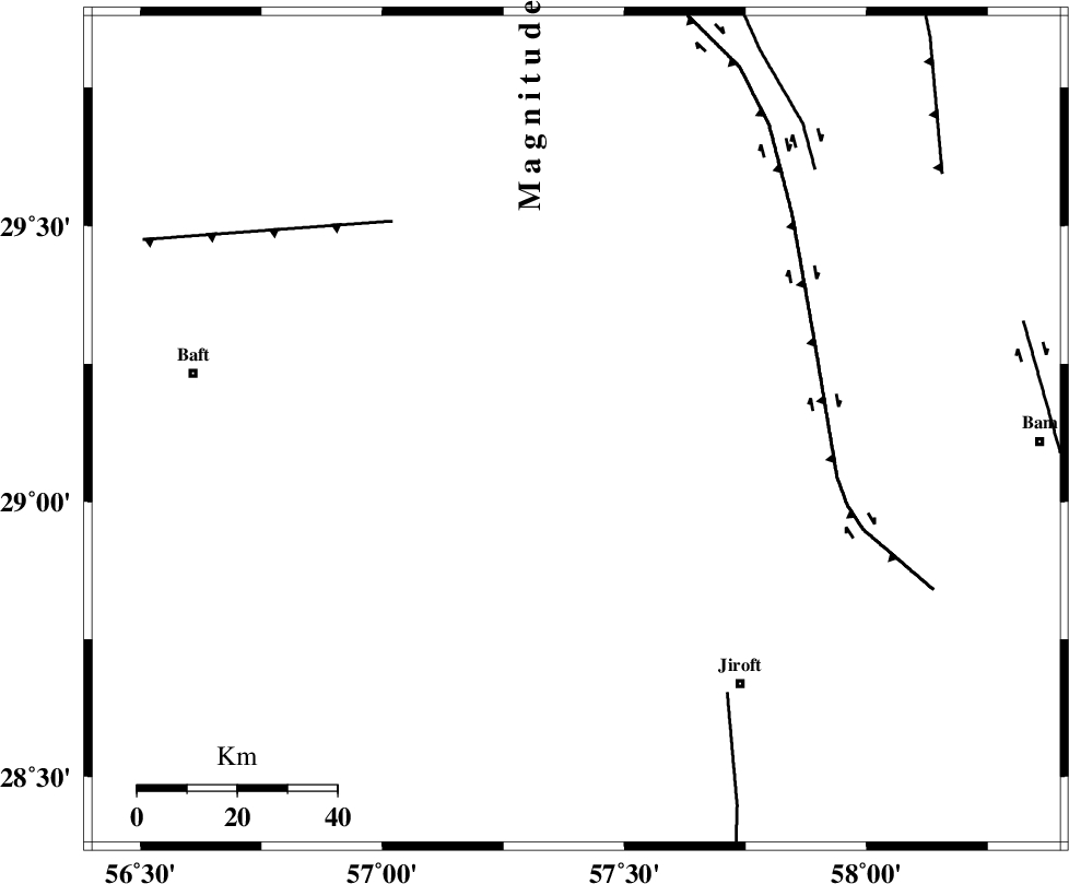
| Region | 60 km North-West of Jiroft, Kerman Province |
Nearest Cities |
|
| 15 km North of Eslamabad, Kerman Province | |
| 19 km North West of Sahebabad, Kerman Province | |
| 25 km North West of Delfard, Kerman Province | |
| 28 km South East of Hanza, Kerman Province | |
| 29 km South of Groh, Kerman Province | |
| Depth | 16 km |
| Agency | |
Faults within 150 km: |
|
| GOWK_F (Length: 152 km) , Distance to epicenter: 51 km | |
| LALEHZAR_F (Length: 52 km) , Distance to epicenter: 56 km | |
| SABZEVARAN_F (Length: 190 km) , Distance to epicenter: 61 km | |
| Number of Phases | 4 |
| RMS | 0 |
| Number of Stations | 3 |
| Error in Latitude | >1.1 km |
| Error in Longitude | 1.7 km |
| Error in Depth | 0 km |
Download waveform in seisan format
to download seisan software Click here
to access information about IIEES stations Click here
Amplitude | ||||||||
| UID | Agency | Station | Component | Amplitude | Period | Arrival Time | Proccessing Time | Signal Clip |
| 37418 | IIEES | KRBR | N | 178.5 | 0.07 | 2007-01-24 01:33:38 | 2007-05-09 05:26:00 | n |
| 37419 | IIEES | KRBR | E | 196 | 0.24 | 2007-01-24 01:33:39 | 2007-05-09 05:26:00 | n |
| 37420 | IIEES | ZHSF | N | 13.1 | 0.67 | 2007-01-24 01:34:30 | 2007-05-09 05:26:00 | n |
Phase | ||||||||||||
| Agency | Station | Component | Phase Type | Phase Quality | First Motion | Observed Arrival Time | Time Residual | Loc. Flag | Input Weight | Distance | Azimuth | |
| IIEES | KRBR | Z | Pg | E | 2007-01-24 01:33:21 | 0 | y | 113 | 327 | |||
| IIEES | KRBR | N | Sg | E | 2007-01-24 01:33:35 | 0 | y | 113 | 327 | |||
| IIEES | BNDS | Z | Pg | E | 2007-01-24 01:33:38 | 0 | y | 227 | 212 | |||
| IIEES | ZHSF | Z | Pn | E | 2007-01-24 01:33:50 | 0 | y | 332 | 80 | |||