
Magnitude |
:2.5 |
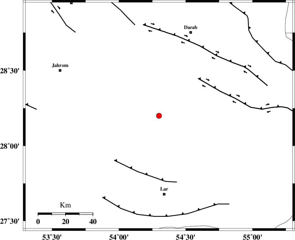
| Date & Time (UTC) | 2007-01-01 20:03:24.3 |
| Date & Time (Local) | 1385/10/11 23:33:24.3 |
| Location | Lat:28.2 Lon: 54.3 |
| Region | 57 km North of Lar, Fars Province |
Nearest Cities |
|
| 13 km South of Shahr-e pir, Fars Province | |
| 21 km South West of Hajiabad, Fars Province | |
| 25 km South East of Dabiran, Fars Province | |
| 41 km North West of Dehkuyeh, Fars Province | |
| 42 km North East of Juyam, Fars Province | |
| Depth | 17 km |
| Agency | |
Faults within 150 km: |
|
| HZF2 (Length: 437 km) , Distance to epicenter: 40 km | |
| BERIZ_F (Length: 49 km) , Distance to epicenter: 44 km | |
| HZF1 (Length: 102 km) , Distance to epicenter: 60 km | |
| Number of Phases | 4 |
| RMS | 0 |
| Number of Stations | 3 |
| Error in Latitude | >2.1 km |
| Error in Longitude | 1.5 km |
| Error in Depth | 4 km |
Download waveform in seisan format
to download seisan software Click here
to access information about IIEES stations Click here
Amplitude | ||||||||
| UID | Agency | Station | Component | Amplitude | Period | Arrival Time | Proccessing Time | Signal Clip |
| 37193 | IIEES | GHIR | E | 109.8 | 0.14 | 2007-01-01 20:04:05 | 2007-05-09 05:26:00 | n |
| 37194 | IIEES | GHIR | N | 88 | 0.44 | 2007-01-01 20:04:12 | 2007-05-09 05:26:00 | n |
| 37195 | IIEES | KRBR | N | 17.9 | 0.44 | 2007-01-01 20:04:59 | 2007-05-09 05:26:00 | n |
| 37196 | IIEES | KRBR | E | 21.3 | 0.52 | 2007-01-01 20:05:07 | 2007-05-09 05:26:00 | n |
Phase | ||||||||||||
| Agency | Station | Component | Phase Type | Phase Quality | First Motion | Observed Arrival Time | Time Residual | Loc. Flag | Input Weight | Distance | Azimuth | |
| IIEES | GHIR | Z | Pg | E | 2007-01-01 20:03:45 | 0 | y | 129 | 275 | |||
| IIEES | BNDS | Z | Pg | E | 2007-01-01 20:03:57 | 0 | y | 205 | 115 | |||
| IIEES | KRBR | Z | Pn | E | 2007-01-01 20:04:10 | 0 | y | 311 | 50 | |||
| IIEES | KRBR | E | Sg | E | 2007-01-01 20:04:51 | 0 | y | 311 | 50 | |||