
Magnitude |
:3 |
| Date & Time (UTC) | 2006-12-07 17:22:31.5 |
| Date & Time (Local) | 1385/9/16 20:52:31.5 |
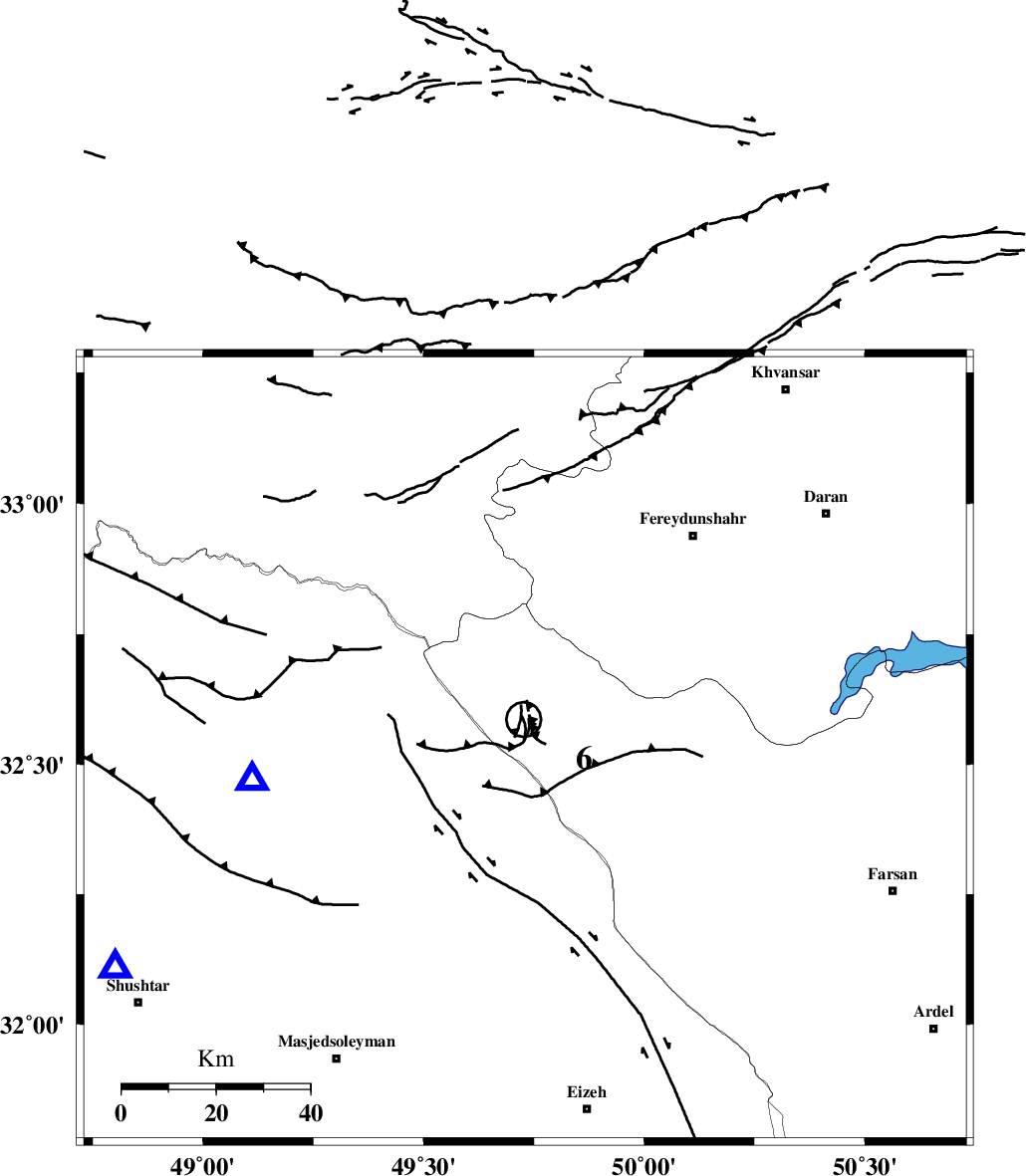
| Location | Lat:32.53 Lon: 49.73 |
| Region | 37 km West of Chelgard, Chaharmahal Bakhtiari Province |
Nearest Cities |
|
| 22 km South West of Durak, Chaharmahal Bakhtiari Province | |
| 31 km North East of Paabshalal, Khoozestan Province | |
| 37 km South West of Masir, Esfahan Province | |
| 37 km North West of Chelgard, Chaharmahal Bakhtiari Province | |
| 45 km North East of Qale-yekhvaju, Khoozestan Province | |
| Depth | 18 km |
| Agency | |
Faults within 150 km: |
|
| ZARDKUH_F (Length: 139 km) , Distance to epicenter: 12 km | |
| ARDAL_F (Length: 170 km) , Distance to epicenter: 20 km | |
| MAIN_ZAGROS_R_F (Length: 1106 km) , Distance to epicenter: 39 km | |
| Number of Phases | 5 |
| RMS | 0.1 |
| Number of Stations | 5 |
| Error in Latitude | >2.2 km |
| Error in Longitude | 2.6 km |
| Error in Depth | 3.8 km |
Download waveform in seisan format
to download seisan software Click here
to access information about IIEES stations Click here
Amplitude | ||||||||
| UID | Agency | Station | Component | Amplitude | Period | Arrival Time | Proccessing Time | Signal Clip |
| 36873 | IIEES | SHGR | N | 819.9 | 0.63 | 2006-12-07 17:23:10 | 2007-01-07 07:24:00 | n |
| 36874 | IIEES | ASAO | E | 87.9 | 0.95 | 2006-12-07 17:23:44 | 2007-01-07 07:24:00 | n |
| 36875 | IIEES | SNGE | N | 26.3 | 0.32 | 2006-12-07 17:24:23 | 2007-01-07 07:24:00 | n |
Phase | ||||||||||||
| Agency | Station | Component | Phase Type | Phase Quality | First Motion | Observed Arrival Time | Time Residual | Loc. Flag | Input Weight | Distance | Azimuth | |
| IIEES | SHGR | Z | Pg | E | 2006-12-07 17:22:48 | 0 | y | 99.4 | 242 | |||
| IIEES | ASAO | Z | Pg | E | 2006-12-07 17:23:08 | 0 | y | 225 | 7 | |||
| IIEES | NASN | Z | Pn | E | 2006-12-07 17:23:15 | 0 | y | 290 | 83 | |||
| IIEES | SNGE | Z | Pn | E | 2006-12-07 17:23:23 | -0.1 | y | 360 | 323 | |||
| IIEES | DAMV | Z | Pn | E | 2006-12-07 17:23:29 | 0.1 | y | 401 | 30 | |||