
Magnitude |
:2.7 |
| Date & Time (UTC) | 2006-11-17 12:43:35.7 |
| Date & Time (Local) | 1385/8/26 16:13:35.7 |
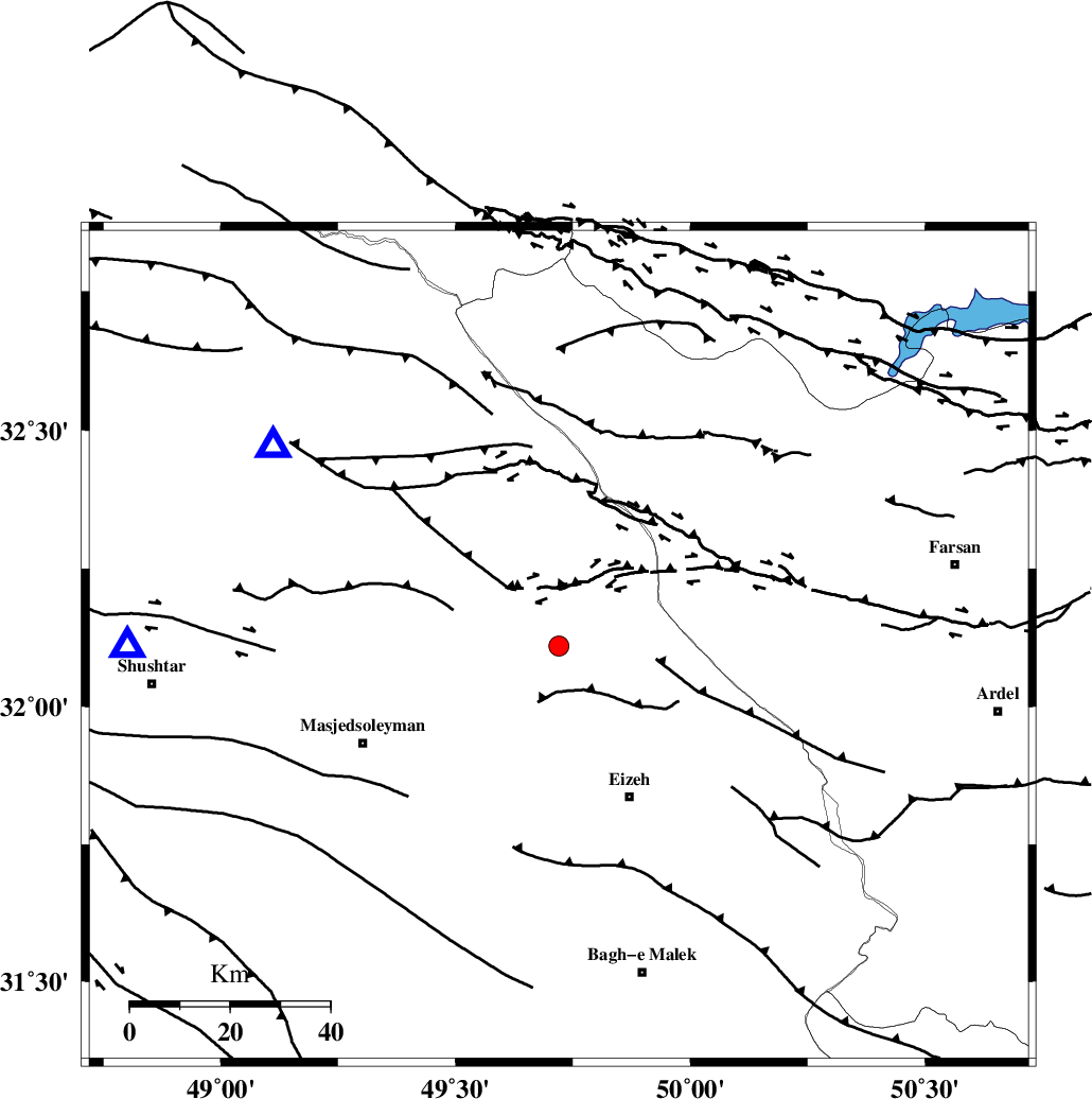
| Location | Lat:32.11 Lon: 49.72 |
| Region | 33 km North-West of Izeh, Khoozestan Province |
Nearest Cities |
|
| 16 km North West of Torshak, Khoozestan Province | |
| 25 km South East of Paabshalal, Khoozestan Province | |
| 28 km East of Qale-yekhvaju, Khoozestan Province | |
| 29 km North of Rasvand, Khoozestan Province | |
| 34 km North West of Izeh, Khoozestan Province | |
| Depth | 14 km |
| Agency | |
Faults within 150 km: |
|
| MFF2 (Length: 205 km) , Distance to epicenter: 9 km | |
| ZARDKUH_F (Length: 139 km) , Distance to epicenter: 39 km | |
| DEZFUL_EMBAYMENT (Length: 228 km) , Distance to epicenter: 48 km | |
| Number of Phases | 5 |
| RMS | 0.1 |
| Number of Stations | 3 |
| Error in Latitude | >2.5 km |
| Error in Longitude | 3.9 km |
| Error in Depth | 6.4 km |
Download waveform in seisan format
to download seisan software Click here
to access information about IIEES stations Click here
Amplitude | ||||||||
| UID | Agency | Station | Component | Amplitude | Period | Arrival Time | Proccessing Time | Signal Clip |
| 36711 | IIEES | SHGR | E | 308.8 | 0.44 | 2006-11-17 12:44:08 | 2007-01-07 07:24:00 | n |
| 36712 | IIEES | SHGR | N | 311.7 | 0.72 | 2006-11-17 12:44:09 | 2007-01-07 07:24:00 | n |
| 36713 | IIEES | ASAO | E | 34.9 | 0.6 | 2006-11-17 12:44:58 | 2007-01-07 07:24:00 | n |
| 36714 | IIEES | ASAO | N | 26.7 | 0.6 | 2006-11-17 12:45:02 | 2007-01-07 07:24:00 | n |
Phase | ||||||||||||
| Agency | Station | Component | Phase Type | Phase Quality | First Motion | Observed Arrival Time | Time Residual | Loc. Flag | Input Weight | Distance | Azimuth | |
| IIEES | SHGR | Z | Pg | E | 2006-11-17 12:43:50 | 0 | y | 86.6 | 270 | |||
| IIEES | ASAO | Z | Pn | E | 2006-11-17 12:44:17 | 0.1 | y | 272 | 6 | |||
| IIEES | ASAO | E | Sg | E | 2006-11-17 12:44:52 | 0 | y | 272 | 6 | |||
| IIEES | NASN | Z | Pn | E | 2006-11-17 12:44:20 | 0 | y | 301 | 74 | |||
| IIEES | NASN | N | Sn | 2006-11-17 12:44:54 | 0 | y | 301 | 74 | ||||