
Magnitude |
:3.1 |
| Date & Time (UTC) | 2006-10-28 12:33:52.4 |
| Date & Time (Local) | 1385/8/6 16:03:52.4 |
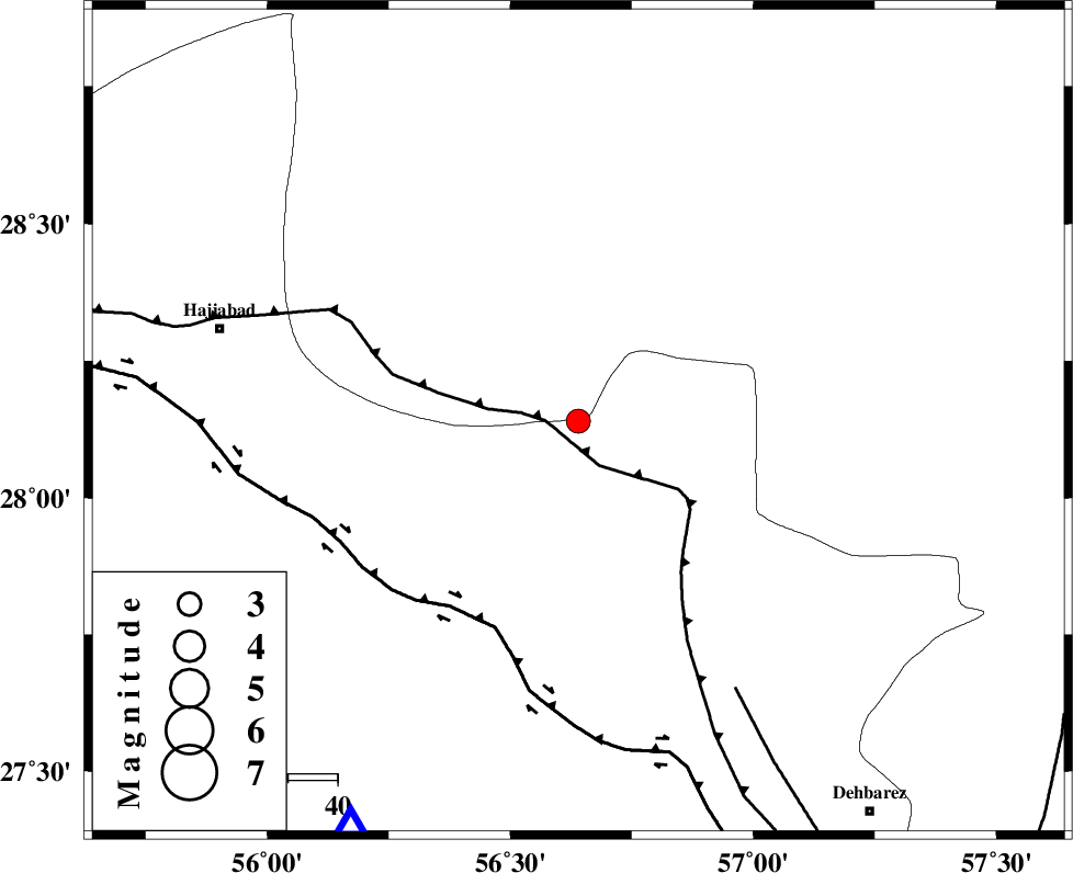
| Location | Lat:28.14 Lon: 56.64 |
| Region | 74 km South-East of Hajiabad, Hormozgan Province |
Nearest Cities |
|
| 32 km South West of Sarkhan, Kerman Province | |
| 42 km North East of Fareqan, Hormozgan Province | |
| 43 km South East of Arzuieeh, Kerman Province | |
| 43 km South East of Shahmaran, Kerman Province | |
| 62 km North West of Faryab, Kerman Province | |
| Depth | 15 km |
| Agency | |
Faults within 150 km: |
|
| MAIN_ZAGROS_R_F (Length: 1106 km) , Distance to epicenter: 5 km | |
| HZF2 (Length: 437 km) , Distance to epicenter: 45 km | |
| ZENDAN_MINAB_F_Z1 (Length: 183 km) , Distance to epicenter: 63 km | |
| Number of Phases | 3 |
| RMS | 0 |
| Number of Stations | 3 |
| Error in Latitude | >1.8 km |
| Error in Longitude | 3.3 km |
| Error in Depth | 0 km |
Download waveform in seisan format
to download seisan software Click here
to access information about IIEES stations Click here
Amplitude | ||||||||
| UID | Agency | Station | Component | Amplitude | Period | Arrival Time | Proccessing Time | Signal Clip |
| 36463 | IIEES | BNDS | N | 917.4 | 0.51 | 2006-10-28 12:34:25 | 2007-01-07 07:24:00 | n |
| 36464 | IIEES | BNDS | E | 639 | 0.49 | 2006-10-28 12:34:28 | 2007-01-07 07:24:00 | n |
| 36465 | IIEES | KRBR | N | 144.6 | 0.5 | 2006-10-28 12:34:55 | 2007-01-07 07:24:00 | n |
Phase | ||||||||||||
| Agency | Station | Component | Phase Type | Phase Quality | First Motion | Observed Arrival Time | Time Residual | Loc. Flag | Input Weight | Distance | Azimuth | |
| IIEES | BNDS | Z | Pg | E | 2006-10-28 12:34:08 | 0 | y | 93.9 | 209 | |||
| IIEES | KRBR | Z | Pg | E | 2006-10-28 12:34:26 | 0 | y | 205 | 3 | |||
| IIEES | ZHSF | Z | Pn | E | 2006-10-28 12:34:54 | 0 | y | 436 | 67 | |||