
Magnitude |
:3 |
| Date & Time (UTC) | 2006-10-26 22:26:38.4 |
| Date & Time (Local) | 1385/8/5 01:56:38.4 |
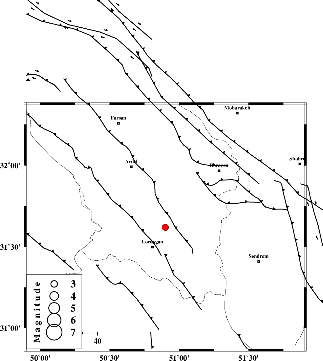
| Location | Lat:31.62 Lon: 50.9 |
| Region | 15 km North of Lordegan, Chaharmahal Bakhtiari Province |
Nearest Cities |
|
| 10 km East of Armand-e olia, Chaharmahal Bakhtiari Province | |
| 16 km North of Lordegan, Chaharmahal Bakhtiari Province | |
| 17 km North West of Aluni, Chaharmahal Bakhtiari Province | |
| 28 km North of Sardasht, Chaharmahal Bakhtiari Province | |
| 36 km South East of Sarkhun, Chaharmahal Bakhtiari Province | |
| Depth | 18 km |
| Agency | |
Faults within 150 km: |
|
| DOPOLAN_F (Length: 107 km) , Distance to epicenter: 9 km | |
| SABZKUH_F (Length: 67 km) , Distance to epicenter: 13 km | |
| DENA_F (Length: 137 km) , Distance to epicenter: 27 km | |
| Number of Phases | 5 |
| RMS | 0.1 |
| Number of Stations | 3 |
| Error in Latitude | >2.3 km |
| Error in Longitude | 1.5 km |
| Error in Depth | 4.3 km |
Download waveform in seisan format
to download seisan software Click here
to access information about IIEES stations Click here
Amplitude | ||||||||
| UID | Agency | Station | Component | Amplitude | Period | Arrival Time | Proccessing Time | Signal Clip |
| 36451 | IIEES | SHGR | E | 173.8 | 0.56 | 2006-10-26 22:27:51 | 2007-01-07 07:24:00 | n |
| 36452 | IIEES | SHGR | N | 144.8 | 0.6 | 2006-10-26 22:27:51 | 2007-01-07 07:24:00 | n |
| 36453 | IIEES | ASAO | N | 37.4 | 0.72 | 2006-10-26 22:28:18 | 2007-01-07 07:24:00 | n |
| 36454 | IIEES | ASAO | E | 27.6 | 0.6 | 2006-10-26 22:28:19 | 2007-01-07 07:24:00 | n |
Phase | ||||||||||||
| Agency | Station | Component | Phase Type | Phase Quality | First Motion | Observed Arrival Time | Time Residual | Loc. Flag | Input Weight | Distance | Azimuth | |
| IIEES | SHGR | Z | Pg | E | 2006-10-26 22:27:12 | 0.1 | y | 206 | 286 | |||
| IIEES | NASN | Z | Pg | E | 2006-10-26 22:27:14 | -0.1 | y | 223 | 53 | |||
| IIEES | NASN | E | Sg | E | 2006-10-26 22:27:41 | 0.1 | y | 223 | 53 | |||
| IIEES | ASAO | Z | Pn | E | 2006-10-26 22:27:27 | 0 | y | 335 | 346 | |||
| IIEES | ASAO | E | Sg | E | 2006-10-26 22:28:12 | 0 | y | 335 | 346 | |||