
Magnitude |
:4.1 |
| Date & Time (UTC) | 2006-09-19 20:57:24.7 |
| Date & Time (Local) | 1385/6/29 00:27:24.7 |
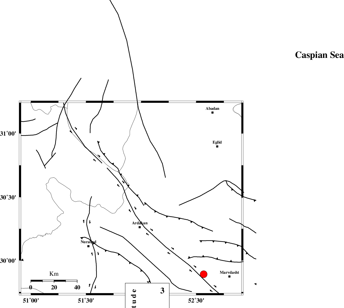
| Location | Lat:30.49 Lon: 51.91 |
| Region | 26 km North of Ardakan, Fars Province |
Nearest Cities |
|
| 6 km North of Kamhar, Fars Province | |
| 26 km North of Ardakan, Fars Province | |
| 32 km North West of Bahrghan, Fars Province | |
| 34 km South East of Tal-e khosro, Kohkiluieh va boyerahmad Province | |
| 34 km South West of Sedeh, Fars Province | |
| Depth | 15 km |
| Agency | |
Faults within 150 km: |
|
| HZF3 (Length: 197 km) , Distance to epicenter: 4 km | |
| KAZERUN_F (Length: 96 km) , Distance to epicenter: 34 km | |
| DENA_F (Length: 137 km) , Distance to epicenter: 40 km | |
| Number of Phases | 8 |
| RMS | 0.2 |
| Number of Stations | 8 |
| Error in Latitude | >5.7 km |
| Error in Longitude | 2.3 km |
| Error in Depth | 0 km |
Download waveform in seisan format
to download seisan software Click here
to access information about IIEES stations Click here
Amplitude | ||||||||
| UID | Agency | Station | Component | Amplitude | Period | Arrival Time | Proccessing Time | Signal Clip |
| 35854 | IIEES | SHGR | N | 543.6 | 0.6 | 2006-09-19 20:59:15 | 2006-10-17 03:59:00 | n |
| 35855 | IIEES | SHGR | E | 465.8 | 0.6 | 2006-09-19 20:59:16 | 2006-10-17 03:59:00 | n |
| 35856 | IIEES | KRBR | N | 223.8 | 0.68 | 2006-09-19 20:59:53 | 2006-10-17 03:59:00 | n |
| 35857 | IIEES | KRBR | E | 186.8 | 0.64 | 2006-09-19 21:00:08 | 2006-10-17 03:59:00 | n |
Phase | ||||||||||||
| Agency | Station | Component | Phase Type | Phase Quality | First Motion | Observed Arrival Time | Time Residual | Loc. Flag | Input Weight | Distance | Azimuth | |
| IIEES | NASN | Z | PN | E | 2006-09-19 20:58:05 | -0.1 | y | 270 | 18 | |||
| IIEES | SHGR | Z | PN | E | 2006-09-19 20:58:15 | -0.2 | y | 346 | 302 | |||
| IIEES | KRBR | Z | PN | E | 2006-09-19 20:58:30 | 0 | y | 470 | 96 | |||
| IIEES | ASAO | Z | PN | E | 2006-09-19 20:58:32 | 0.4 | y | 484 | 339 | |||
| IIEES | DAMV | Z | PN | E | 2006-09-19 20:58:42 | -0.4 | y | 570 | 1 | |||
| IIEES | CHTH | Z | PN | E | 2006-09-19 20:58:47 | 0.2 | y | 606 | 353 | |||
| IIEES | SNGE | Z | PN | E | 2006-09-19 20:58:55 | 0.2 | y | 666 | 321 | |||
| IIEES | MRVT | Z | Pn | E | 2006-09-19 20:59:22 | 0.3 | y | 884 | 25 | |||