
Magnitude |
:3.4 |
| Date & Time (UTC) | 2006-09-18 22:59:29.2 |
| Date & Time (Local) | 1385/6/28 02:29:29.2 |
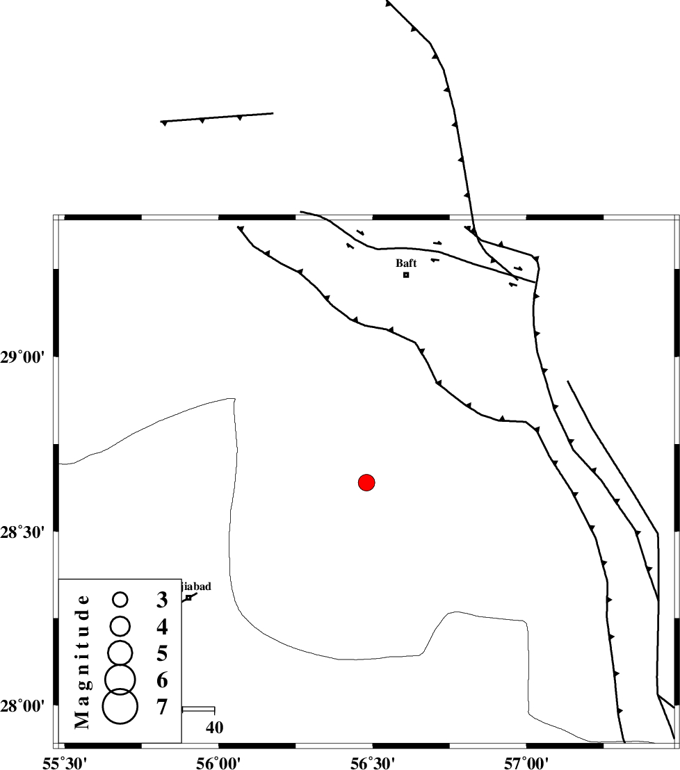
| Location | Lat:28.64 Lon: 56.48 |
| Region | 67 km North-East of Hajiabad, Hormozgan Province |
Nearest Cities |
|
| 22 km North of Shahmaran, Kerman Province | |
| 25 km North East of Arzuieeh, Kerman Province | |
| 38 km South West of Kashkueyeh, Kerman Province | |
| 51 km North West of Sarkhan, Kerman Province | |
| 59 km West of Dolatabad, Kerman Province | |
| Depth | 15 km |
| Agency | |
Faults within 150 km: |
|
| MAIN_ZAGROS_R_F (Length: 1106 km) , Distance to epicenter: 46 km | |
| HZF2 (Length: 437 km) , Distance to epicenter: 83 km | |
| LALEHZAR_F (Length: 52 km) , Distance to epicenter: 93 km | |
| Number of Phases | 3 |
| RMS | 0 |
| Number of Stations | 3 |
| Error in Latitude | >1.5 km |
| Error in Longitude | 3.7 km |
| Error in Depth | 0 km |
Download waveform in seisan format
to download seisan software Click here
to access information about IIEES stations Click here
Amplitude | ||||||||
| UID | Agency | Station | Component | Amplitude | Period | Arrival Time | Proccessing Time | Signal Clip |
| 35815 | IIEES | BNDS | E | 721.3 | 0.19 | 2006-09-18 23:00:16 | 2006-10-17 03:59:00 | n |
| 35816 | IIEES | BNDS | N | 779.1 | 0.57 | 2006-09-18 23:00:17 | 2006-10-17 03:59:00 | n |
| 35817 | IIEES | KRBR | N | 620.1 | 0.95 | 2006-09-18 23:00:17 | 2006-10-17 03:59:00 | n |
| 35818 | IIEES | KRBR | E | 469.7 | 0.42 | 2006-09-18 23:00:18 | 2006-10-17 03:59:00 | n |
| 35819 | IIEES | GHIR | N | 64.9 | 0.17 | 2006-09-18 23:01:06 | 2006-10-17 03:59:00 | n |
Phase | ||||||||||||
| Agency | Station | Component | Phase Type | Phase Quality | First Motion | Observed Arrival Time | Time Residual | Loc. Flag | Input Weight | Distance | Azimuth | |
| IIEES | BNDS | Z | PG | E | 2006-09-18 22:59:52 | 0 | y | 141 | 193 | |||
| IIEES | KRBR | Z | PG | E | 2006-09-18 22:59:54 | 0 | y | 151 | 10 | |||
| IIEES | GHIR | Z | Pn | E | 2006-09-18 23:00:19 | 0 | y | 344 | 264 | |||