
Magnitude |
:3.1 |
| Date & Time (UTC) | 2026-06-30 01:04:50.3 |
| Date & Time (Local) | 1405/4/9 04:34:50.3 |
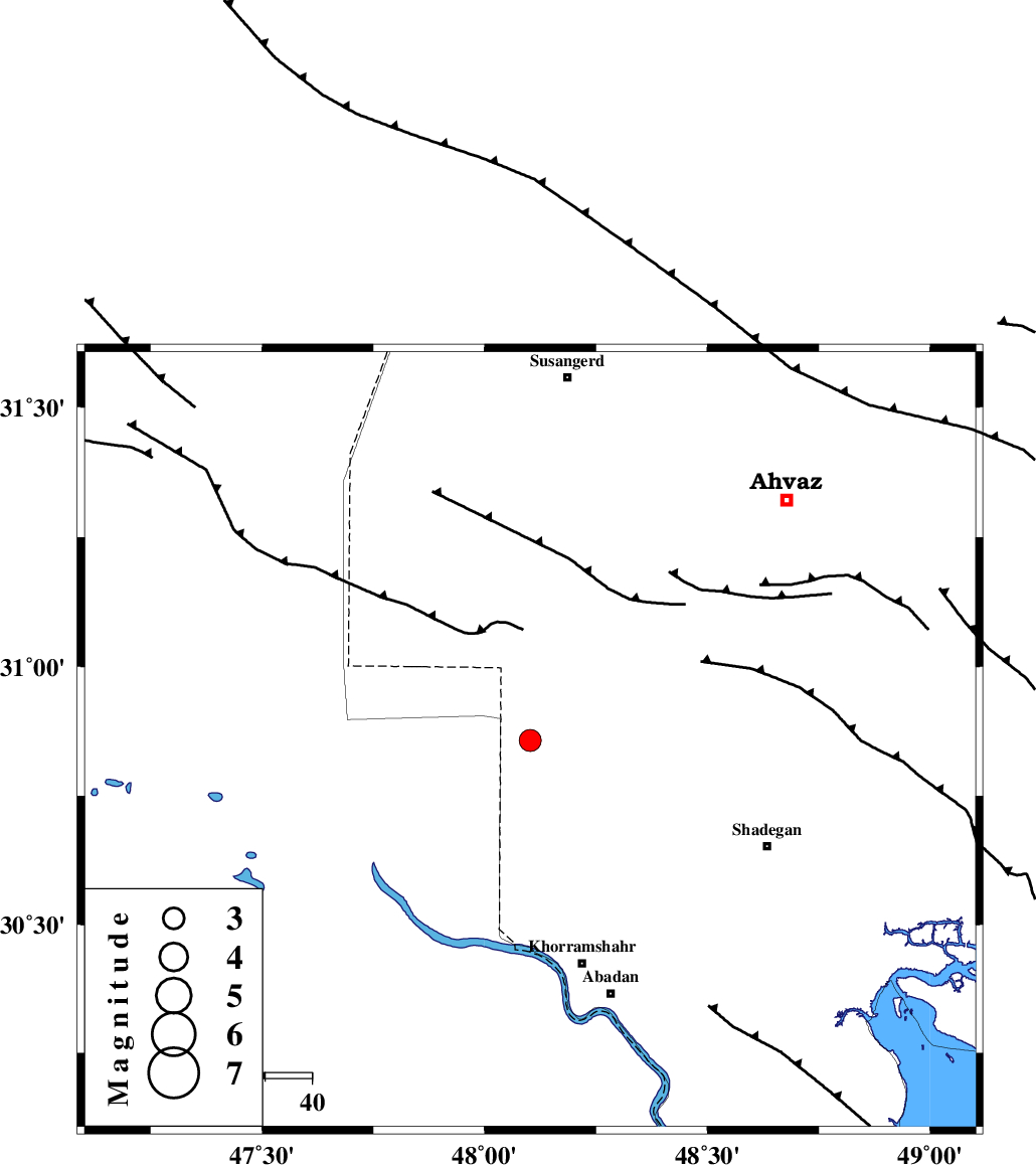
| Location | Lat:30.857 Lon: 48.102 |
| Region | Khoozestan Province, 49 km North-West of Khorramshahr |
Nearest Cities |
|
| 34 km North West of Darkhovin, Khoozestan Province | |
| 43 km North of Polno, Khoozestan Province | |
| 47 km North East of Al Basrah, Iraq Province | |
| 49 km North West of Khorramshahr, Khoozestan Province | |
| 55 km South West of Bahr, Khoozestan Province | |
| Depth | 12 km |
| Agency | |
Faults within 150 km: |
|
| AHVAZ_F (Length: 99 km) , Distance to epicenter: 79 km | |
| AGHAJARI_F (Length: 88 km) , Distance to epicenter: 114 km | |
| Number of Phases | 9 |
| RMS | 0.3 |
| Number of Stations | 9 |
| Error in Latitude | >1.8 km |
| Error in Longitude | 1.8 km |
| Error in Depth | 6.2 km |
Download waveform in seisan format
to download seisan software Click here
to access information about IIEES stations Click here
Amplitude | ||||||||
| UID | Agency | Station | Component | Amplitude | Period | Arrival Time | Proccessing Time | Signal Clip |
| 201997 | IIEES SC | ABH1 | Z | 0.4 | 1 | 2026-06-30 01:05:24 | 2026-06-30 07:11:00 | n |
| 201998 | IIEES SC | ASAO | Z | 0.03 | 1 | 2026-06-30 01:05:54 | 2026-06-30 07:11:00 | n |
| 201999 | IIEES SC | SFB | Z | 0.02 | 1 | 2026-06-30 01:06:06 | 2026-06-30 07:11:00 | n |
Phase | ||||||||||||
| Agency | Station | Component | Phase Type | Phase Quality | First Motion | Observed Arrival Time | Time Residual | Loc. Flag | Input Weight | Distance | Azimuth | |
| IIEES SC | BSR2 | Z | EPg | E | 2026-06-30 01:05:03 | 0.2 | y | 0 | 78 | 217 | ||
| IIEES SC | ABH1 | Z | EPn | E | 2026-06-30 01:05:24 | 0.2 | y | 0 | 208 | 98 | ||
| IIEES SC | BRJ | Z | EPn | E | 2026-06-30 01:05:39 | 0.5 | y | 0 | 322 | 69 | ||
| IIEES SC | DOB | Z | EPn | E | 2026-06-30 01:05:38 | -0.1 | y | 0 | 325 | 1 | ||
| IIEES SC | ASAO | Z | EPn | E | 2026-06-30 01:05:54 | 0.7 | y | 0 | 447 | 24 | ||
| IIEES SC | NASN | Z | EPn | E | 2026-06-30 01:05:55 | -4.5 | n | 4 | 495 | 64 | ||
| IIEES SC | SFB | Z | EPn | E | 2026-06-30 01:06:06 | -0.3 | y | 0 | 549 | 45 | ||
| IIEES SC | YZKH | Z | EPn | E | 2026-06-30 01:06:17 | -0.7 | y | 0 | 639 | 75 | ||
| IIEES SC | RAYN | Z | EPn | E | 2026-06-30 01:06:43 | -0.4 | y | 0 | 852 | 198 | ||