
Magnitude |
:3.2 |
| Date & Time (UTC) | 2026-02-13 00:57:48.4 |
| Date & Time (Local) | 1404/11/24 04:27:48.4 |
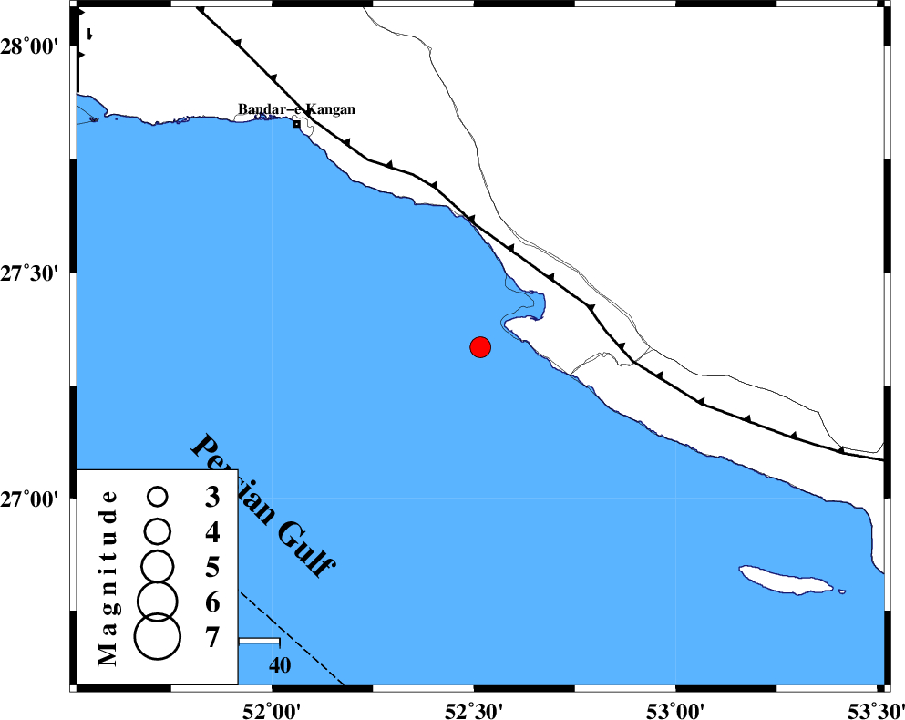
| Location | Lat:27.335 Lon: 52.516 |
| Region | Persian Gulf, 44 km South-West of Mehr |
Nearest Cities |
|
| 18 km South of Bandar-e asaluyeh, Bushehr Province | |
| 27 km West of Chah-e mobarak, Bushehr Province | |
| 39 km South West of Gallehdar, Fars Province | |
| 40 km South West of Ardavan-e olia, Fars Province | |
| 41 km South East of Bandar-e taheri, Bushehr Province | |
| Depth | 12 km |
| Agency | |
Faults within 150 km: |
|
| MFF3 (Length: 292 km) , Distance to epicenter: 28 km | |
| BORAZJAN_F (Length: 168 km) , Distance to epicenter: 116 km | |
| QIR_F (Length: 130 km) , Distance to epicenter: 126 km | |
| Number of Phases | 9 |
| RMS | 0.4 |
| Number of Stations | 9 |
| Error in Latitude | >4.2 km |
| Error in Longitude | 4.2 km |
| Error in Depth | 543 km |
Download waveform in seisan format
to download seisan software Click here
to access information about IIEES stations Click here
Amplitude | ||||||||
| UID | Agency | Station | Component | Amplitude | Period | Arrival Time | Proccessing Time | Signal Clip |
| 201616 | IIEES SC | UOSS | Z | 0.03 | 1 | 2026-02-13 00:58:52 | 2026-02-18 06:18:00 | n |
| 201617 | IIEES SC | KRVR | Z | 0.02 | 1 | 2026-02-13 00:59:16 | 2026-02-18 06:18:00 | n |
| 201618 | IIEES SC | SFB | Z | 0.01 | 1 | 2026-02-13 00:59:32 | 2026-02-18 06:18:00 | n |
| 201619 | IIEES SC | IRSR | Z | 0.005 | 1 | 2026-02-13 00:59:39 | 2026-02-18 06:18:00 | n |
Phase | ||||||||||||
| Agency | Station | Component | Phase Type | Phase Quality | First Motion | Observed Arrival Time | Time Residual | Loc. Flag | Input Weight | Distance | Azimuth | |
| IIEES SC | GENO | Z | EPn | E | 2026-02-13 00:58:41 | 0.2 | y | 0 | 362 | 89 | ||
| IIEES SC | UOSS | Z | EPn | E | 2026-02-13 00:58:52 | 0 | y | 0 | 454 | 126 | ||
| IIEES SC | BRJ | Z | EPn | E | 2026-02-13 00:59:01 | -0.3 | y | 0 | 521 | 347 | ||
| IIEES SC | AMS1 | Z | EPn | E | 2026-02-13 00:59:11 | 0.5 | y | 0 | 604 | 330 | ||
| IIEES SC | KRVR | Z | EPn | E | 2026-02-13 00:59:16 | 0.9 | y | 0 | 637 | 41 | ||
| IIEES SC | SFB | Z | EPn | E | 2026-02-13 00:59:32 | -0.4 | y | 0 | 778 | 358 | ||
| IIEES SC | IRSR | Z | EPn | E | 2026-02-13 00:59:39 | -0.2 | y | 0 | 828 | 93 | ||
| IIEES SC | HNVD | Z | EPn | E | 2026-02-13 00:59:44 | -0.2 | y | 0 | 874 | 332 | ||
| IIEES SC | SRVN | Z | EPn | E | 2026-02-13 00:59:57 | -0.6 | y | 0 | 978 | 90 | ||